Colonia Bosque de Chapultepec I Sección in Ciudad de México, Mexico — The Valley of Mexico (The Central Highlands)
Springs and Water Tanks
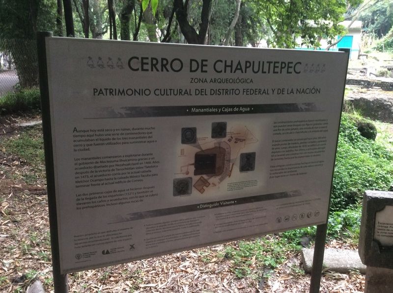
Cerro de Chapultepec
Zona Arqueológica
Patrimonio Cultural del Distrito Federal y de la Nación
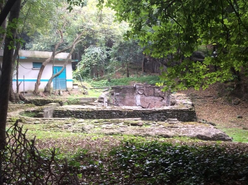
Aunque hoy está seco y en ruinas, durante mucho tiempo aquí hubo una serie de contenedores que acumulaban el líquido de los tres manantiales del cerro y que fueron utilizados para suministrar agua a la ciudad.
Los manantiales comenzaron a explotarse durante el gobierno de Moctezuma Ilhuicamina gracias a un acueducto diseñado por Nezahualcóyotl en 1466. Años después de la victoria de Tenochtitlán sobre Tlatelolco en 1473, el acueducto corría por la actual calzada Melchor Ocampo hasta la calzada México Tacuba para terminar frente al actual edificio de Correos.
Las dos primeras cajas de agua se hicieron después de la llegada de los españoles (1521) y también se elevaron los caños y acueductos, con lo que se cubrió los prehispánicos, incluso algunas rocas de las construcciones prehispánicas fueron reutilizadas y aún pueden verse bloques con figuras grabadas, como una flor de ocho pétalos, una estrella de mar o caracol cortado, un circulo o chalchihuite y el símbolo de agua.
El tercer contenedor se construyó hace unos 300 años, usando postes de madera, piedras cortadas y aplanado de yeso. Luego, alrededor de 1870, se edificó un cuarto depósito con ladrillos. Por último, a principios del siglo XX se levantó una construcción con muros recubiertos de cemento, hasta que los manantiales se secaron.
Estas antiguas construcciones hechas en torno al agua nos recuerdan la importancia de este valioso recurso y lo vulnerable del ambiente.
¡Este lugar tiene un chorro de historia!
Recomendaciones para el visitante
Springs and Water Tanks
Chapultepec Hill Archaeological Zone
Cultural Heritage of the Federal District and the Nation
Although today it is dry and in ruins, for a long time there were a series of tanks here that accumulated water from the hill’s three springs and were used to supply water to the city.
The springs began to be used during the government of Moctezuma Ilhuicamina thanks to an aqueduct designed by Nezahualcóyotl in 1466. Years after Tenochtitlán's victory over Tlatelolco in 1473, the aqueduct ran along the current Melchor Ocampo Road to the Mexico-Tacuba Road and finally ending in front of the current Post Office Building.
The first two water tanks were made after the arrival of the Spanish (1521) and the first

Photographed By J. Makali Bruton, September 10, 2019
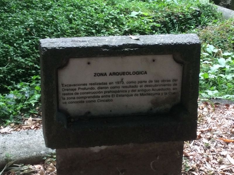
2. An additional nearby marker related to the archaeological area of Chapultepec's water system
Excavaciones realizadas en 1973, como parte de las obras del Drenaje Profundo, dieron como resultado el descubrimiento de restos de construccion prehispanica y del antiguo Acueducto, en la zona comprendida entre El Estanque de Moctezuma y la Cueva conocida como Cincalco.
Archaeological Zone
Excavations carried out in 1973, as part of the Deep Drainage works, resulted in the discovery of the remains of pre-Hispanic construction and the old Aqueduct, in the area between Moctezuma’s Baths and the cave known as Cincalco.
The third container was built about 300 years ago, using wooden posts, cut stones and plaster. Then, around 1870, a fourth water tank was built with bricks. Finally, at the beginning of the 20th century, a construction with cement-coated walls was erected, until the springs dried up.
These ancient constructions related to water remind us of the importance of this valuable resource and the vulnerability of the environment.
This place has a stream of history!
Recommendations for the visitor
Erected by Instituto Nacional de Antropología e Historia (INAH).
Topics. This historical marker is listed in these topic lists: Colonial Era • Industry & Commerce • Man-Made Features • Native Americans. A significant historical year for this entry is 1466.
Location. 19° 25.195′ N, 99° 10.817′ W. Marker is in Ciudad de México. It is in Colonia Bosque de Chapultepec I Sección. Marker is on Calzada de Rey just east of Avenida Acuario, on the left when traveling east. Touch for map. Marker is in this post office area: Ciudad de México 11100, Mexico. Touch for directions.
Other nearby markers. At least 8 other markers are within walking distance of this marker. Obelisk of the Children Heroes (within shouting distance of this marker); Monument to the Children Heroes of 1847 (within shouting distance of this marker); Juan Escutia, Child Hero of Mexico (within shouting distance of this marker); "The Sergeant" Ahuehuete (about 90 meters away, measured in a direct line); The Mexican Expeditionary Air Force and Squadron 201 (about 90 meters away); Chapultepec Hill (about 90 meters away); Temperance Fountain (about 90 meters away); The Heroic Cadets (about 90 meters away). Touch for a list and map of all markers in Ciudad de México.
Credits. This page was last revised on April 17, 2020. It was originally submitted on October 23, 2019, by J. Makali Bruton of Accra, Ghana. This page has been viewed 114 times since then and 18 times this year. Photos: 1. submitted on October 23, 2019, by J. Makali Bruton of Accra, Ghana. 2, 3, 4. submitted on October 24, 2019, by J. Makali Bruton of Accra, Ghana.


