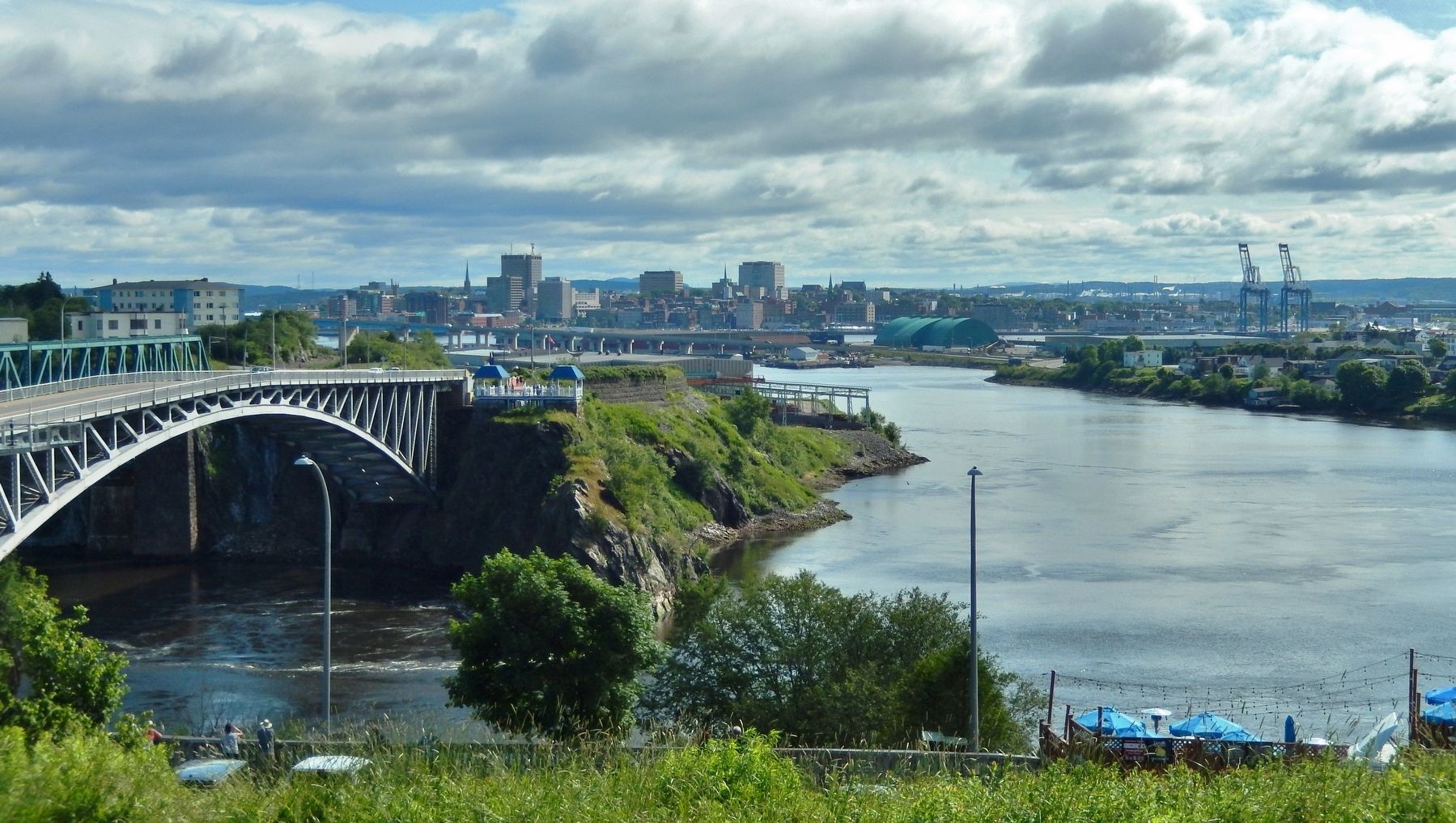
Saint John in Saint John County, New Brunswick — The Atlantic Provinces (North America)
Koluskap and Beaver
Koluskap et le castor
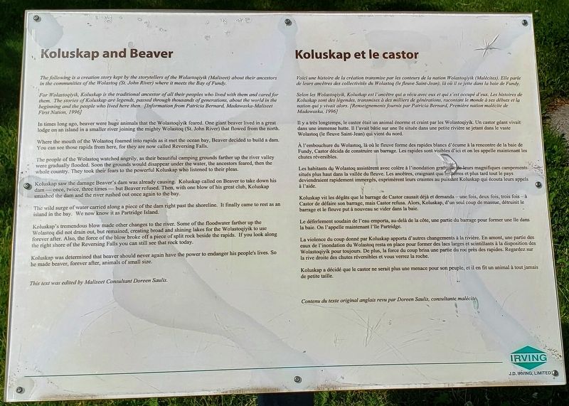
Koluskap and Beaver
The following is a creation story kept by the storytellers of the Wolastoqiyik (Maliseet) about their ancestors in the communities of the Wolastoq (St. John River) where it meets the Bay of Fundy.
For Wolastoqiyik, Koluskap is the traditional ancestor of all their peoples who lived with them and cared for them. The stories of Koluskap are legends, passed through thousands of generations, about the world in the beginning and the people who lived here then. [Information from Patricia Bernard, Madawaska-Maliseet First Nation, 1996]
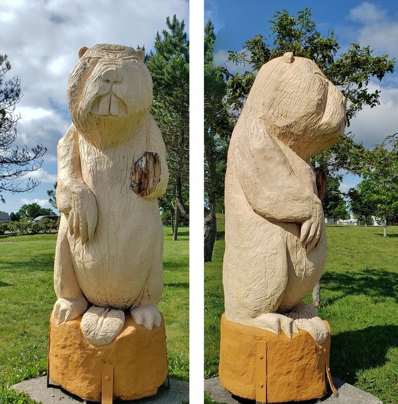
In times long ago, beaver were huge animals that the Wolastoqiyik feared. One giant beaver lived in a great lodge on an island in a smaller river joining the mighty Wolastoq (St. John River) that flowed from the north.
Where the mouth of the Wolastoq foamed into rapids as it met the ocean bay, Beaver decided to build a dam. You can see those rapids from here, for they are now called Reversing Falls.
The people of the Wolastoq watched angrily, as their beautiful camping grounds farther up the river valley were gradually flooded. Soon the grounds would disappear under the water, the ancestors feared, then the whole country. They took their fears to the powerful Koluskap who listened to their pleas.
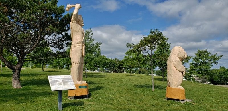
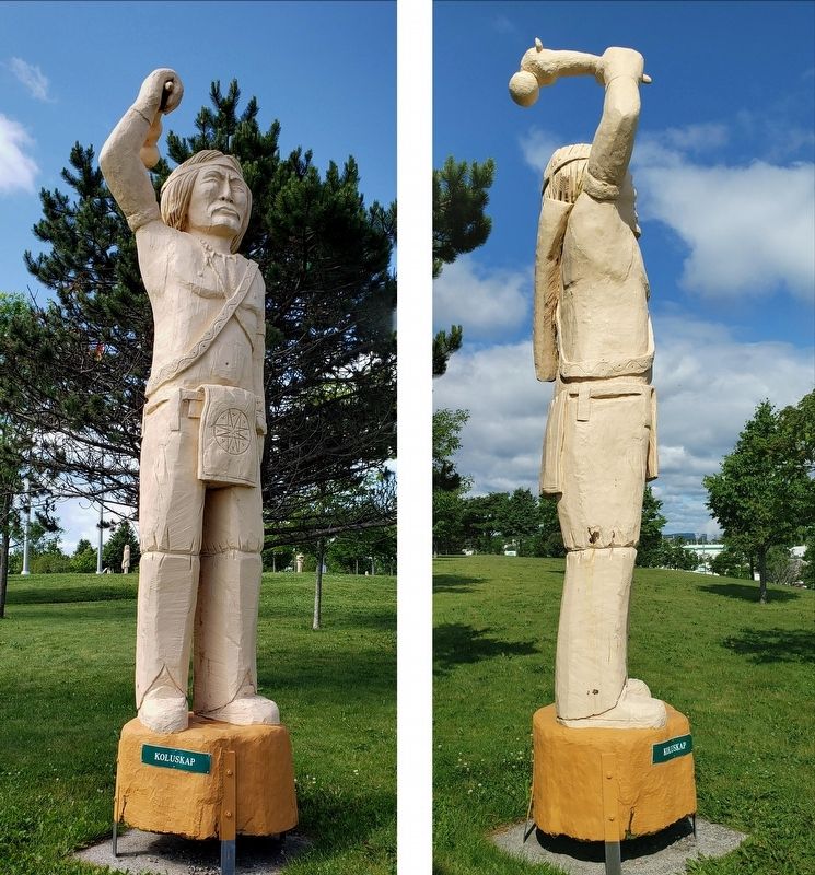
Koluskap saw the damage Beaver's dam was already causing. Koluskap called on Beaver to take down his dam — once, twice, three times — but Beaver refused. Then, with one blow of his great club, Koluskap smashed the dam and the river rushed out once again to the bay.
The wild surge of water carried along a piece of the dam right past the shoreline. It finally came to rest as an island in the bay. We now know it as Partridge Island.
Koluskap's tremendous blow made other changes to the river. Some of the floodwater farther up the Wolastoq did not drain out, but remained, creating broad and shining lakes for the Wolastoqiyik to use forever after. Also, the force of the blow broke off a piece of split rock beside the rapids. If you look along the right shore of the Reversing Falls you can still see that rock today.
Koluskap was determined that beaver should never again have the power to endanger his people's lives. So he made beaver, forever after, animals of small size.
This text was edited by Maliseet Consultant Doreen Saulis.
Koluskap et le castor
Voici une histoire de la création transmise par les conteurs de la nation Wolastogiyik (Malécites). Elle parle de leurs ancêtres des collectivités du Wolastoq (le fleuve Saint-Jean), là où il se jette dans la baie de Fundy.
Selon les Wolastoqiyik, Koluskap est l'ancêtre qui a vécu avec eux et qui s'est occupé d'eux. Les histoires de Koluskap sont des légendes, transmises à des milliers de générations, racontant le inonde à ses débuts et la nation qui y vivait alors. [Renseignements fournis par Patricia Bernard, Première nation malécite de Madawaska, 1996]
Il y a très longtemps, le castor était un animal énorme et craint par les Wolastoqiyik. Un castor géant vivait dans une immense hutte. Il l'avait bâtie sur une ile située dans une petite rivière se jetant dans le vaste Wolastoq (le fleuve Saint-Jean) qui vient du nord.
À l'embouchure du Wolastoq, là où le fleuve forme des rapides blancs d'écume à la rencontre de la baie de Fundy, Castor décida de construire un barrage. Les rapides sont visibles d'ici et on les appelle maintenant les chutes réversibles.
Les habitants du Wolastoq assistèrent avec colère à l'inondation graduelle de leurs magnifiques campements situés plus haut dans la vallée du fleuve. Les ancêtres, craignant que les terres et plus tard tout le pays deviendraient rapidement immergés, exprimèrent leurs craintes au puissant Koluskap qui écouta leurs appels à l'aide.
Koluskap vit les dégâts que le barrage de Castor causait déjà et demanda — une fois, deux fois, trois fois — à Castor de défaire son barrage, mais Castor refusa. Alors, Koluskap, d'un seul coup de massue, détruisit le barrage et le fleuve put à nouveau se vider dans la baie.
Le déferlement soudain de l'eau emporta, au-delà de la côte, une partie du barrage pour former une ile dans la baie. On l'appelle maintenant l'île Partridge.
La violence du coup donné par Koluskap apporta d'autres changements à la rivière. En amont, une partie des eaux de l'inondation du Wolastoq resta en place pour former des lacs larges et scintillants à la disposition des Wolastoqiyik pour toujours. De plus, la force du coup brisa une partie du roc près des rapides. Regardez sur la rive droite des chutes réversibles et vous verrez la roche.
Koluskap a décidé que le castor ne serait plus une menace pour son peuple, et il en fit un animal à tout jamais de petite taille.
Contenu du texte original anglais revu par Doreen Saulis, consultante malécite.
Erected by J.D. Irving, Limited.
Topics. This historical marker is listed in these topic lists: Animals • Native Americans • Waterways & Vessels.
Location. 45° 15.452′ N, 66° 5.359′ W. Marker is in Saint John, New Brunswick, in Saint John County. Marker can be reached from Lancaster Avenue, 0.2 kilometers Bridge Road (New Brunswick Route 100), on the left when traveling east. Marker is located along the walking path in Wolastoq Park, near the northeast corner of the park. Touch for map. Marker is at or near this postal address: 211 Lancaster Avenue, Saint John NB E2M 2K8, Canada. Touch for directions.
Other nearby markers. At least 8 other markers are within walking distance of this marker. Land of the Dawn (a few steps from this marker); Wolastoq Park (a few steps from this marker); Samuel de Champlain (within shouting distance of this marker); Françoise Marie Jacquelin (within shouting distance of this marker); Mills at Union Point (within shouting distance of this marker); The New Community of Saint John (within shouting distance of this marker); Rebels Attack (within shouting distance of this marker); Charles Gorman (within shouting distance of this marker). Touch for a list and map of all markers in Saint John.
Related markers. Click here for a list of markers that are related to this marker. Wolastoq Park
Credits. This page was last revised on November 2, 2022. It was originally submitted on October 29, 2019, by Cosmos Mariner of Cape Canaveral, Florida. This page has been viewed 346 times since then and 36 times this year. Photos: 1. submitted on October 29, 2019, by Cosmos Mariner of Cape Canaveral, Florida. 2, 3, 4, 5. submitted on October 30, 2019, by Cosmos Mariner of Cape Canaveral, Florida.
