The Urbanization of a Watershed
Changing the course of the River des Peres
| — | St. Vincent Greenway | — |
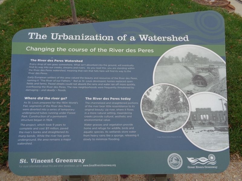
The River des Peres Watershed
Every drop of rain goes somewhere. What isn't absorbed into the ground, will eventually find its way into our creeks, streams and rivers. As you read this, you are standing within the River des Peres watershed, meaning that rain that falls here will find its way to the River des Peres.
Early European settlers of this area valued the beauty and resources of the River des Peres, name it "The River of our Fathers." But as St. Louis developed, homes replaced open fields and farms. Paved streets could not absorb the rains and water ran off more quickly, overflowing the River des Peres. The new neighborhoods were frequently threatened by damaging - and deadly - floods.
Where did the river go?
As St. Louis prepared for the 1904 World's Fair, segments of the River des Peres were diverted into a series of temporary underground tubes running under Forest Park. Construction of a permanent structure began in 1924.
The project, which took 9 years to complete and cost $11 million, paved the river's banks and straightened its many bends. While the river has gone underground, the area remains
this page online
The River des Peres today
The channelized and straightened portions of the river bear little resemblance to its original beauty. Up river, where it flows in a more natural setting, meandering creeks provide cultural, aesthetic and environmental value.
Water grasses and vegetation provide home and refuge for wildlife, birds and aquatic species. Its wetlands store water from heavy rains like a sponge, releasing slowly to minimize flooding.
Erected by Great Rivers Greenway.
Topics. This historical marker is listed in these topic lists: Parks & Recreational Areas • Waterways & Vessels.
Location. 38° 39.109′ N, 90° 17.08′ W. Marker is in St. Louis, Missouri. It is in Skinker DeBaliviere. It is on DeBaliviere Avenue, on the right when traveling north. Marker is in front of Crossroads College Preparatory School, at the Loop Trolley Stop station. Touch for map. Marker is at or near this postal address: 500 DeBaliviere Avenue, Saint Louis MO 63112, United States of America. Touch for directions.
Regionally, this marker is in the American Midwest, in
Other nearby markers. At least 8 other markers are within walking distance of this marker: Take a Ride, Stroll or Bike on the "DeBaliviere Strip" (a few steps from this marker); "The Knuckle" (about 700 feet away, measured in a direct line); People and Places That Shape Our Culture (approx. 0.2 miles away); "Clang! clang! clang! Goes the trolley!" (approx. ¼ mile away); Where Do We Place Our Public Assets? (approx. 0.4 miles away); Where Will Children Play? (approx. 0.4 miles away); How Do We Understand the Past? (approx. half a mile away); How Else Can a Park Serve Its Community? (approx. half a mile away). Touch for a list and map of all markers in St. Louis.
Another marker is no longer nearby. Ruth Porter Mall Park (was approx. 0.2 miles away but has been replaced with another marker now near it).
Credits. This page was last revised on January 30, 2023. It was originally submitted on October 30, 2019, by Jason Voigt of Glen Carbon, Illinois. This page has been viewed 463 times since then and 25 times this year. Photos: 1, 2. submitted on October 30, 2019, by Jason Voigt of Glen Carbon, Illinois. • Mark Hilton was the editor who published this page.
