Russellville in Pope County, Arkansas — The American South (West South Central)
Exploring the Arkansas
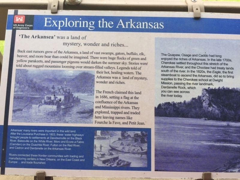
'The Arkansea' was a land of mystery, wonder and riches...
Back east rumors grew of the Arkansea, a land of vast swamps, gators, buffalo, elk, beaver, and more bear than could be imagined. There were huge flocks of green and yellow parakeets, and passenger pigeons would darken the summer sky. Stories were told about rugged mountains looming over stream-filled valleys. Legends told of their hot, healing waters. The Arkansea was a land of mystery, wonder and riches.
The French claimed this land in 1686, setting a flag at the confluence of the Arkansas and Mississippi rivers. They explored, trapped and traded here leaving names like Fourche la Fave, and Petit Jean.
(right inset)
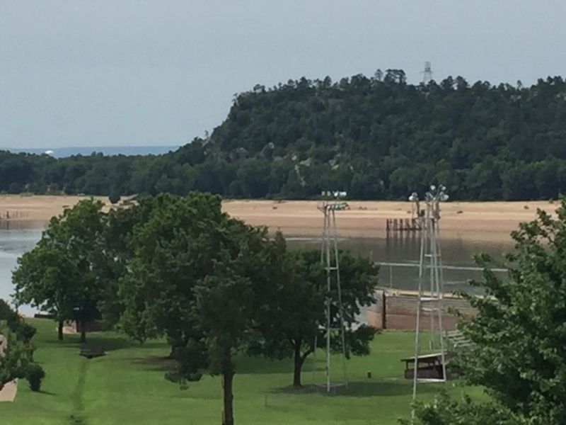
The Quapaw, Osage and Caddo had long enjoyed the riches of Arkansas. In the late 1700s, Cherokee settled throughout this stretch of the Arkansas River, and the Choctaw had treaty lands south of the river. In the 1820s, the Eagle, the first steamboat to ascend the Arkansas, did so to bring supplies to the Cherokee school at Dwight Mission, passing the river landmark Dardanelle Rock, which you can see across the river today.
(bottom inset)
Arkansas' many rivers were important in this wild land. After the Louisiana Purchase in 1803, these "water highways" brought people to settlements at Davidsonville on the Black River, Batesville on the White River, Moro and Ecore a Fabre (Camden) on the Ouachita River, Fulton on the Red River, and Cadron and Dardanelle on the Arkansas River.
Rivers connected these frontier communities with trading and manufacturing centers on New Orleans, on the East Coast and Europe ... and trade flourished.
Erected by US Army Corps of Engineers.
Topics. This historical marker is listed in these topic lists: Exploration • Native Americans • Waterways & Vessels. A significant historical year for this entry is 1686.
Location. 35° 15.147′ N, 93° 9.997′ W. Marker is in Russellville, Arkansas, in Pope County. Marker can be reached from Lock and Dam Road (Highway 7) just west of Sheppard Drive. Located at the Arkansas River Visitor Center. Touch for map. Marker is at or near this postal address: 1469 Lock and Dam Rd, Russellville AR 72802, United States of America. Touch for directions.
Other nearby markers. At least 8 other markers are within 2 miles of this marker, measured as the crow flies. Military Road Marker Stone (a few steps from this marker); Steamboats - Power on the River (within shouting distance of this marker); Washburn Cemetery (approx. 0.6 miles away); Action at Dardenelle (approx. 1.1 miles away); Old Brearley Cemetery (approx. 1˝ miles away); Council Oak (approx. 1.6 miles away); Dardanelle Confederate Monument (approx. 2.1 miles away); Yell County Council Oaks (approx. 2.1 miles away). Touch for a list and map of all markers in Russellville.
Credits. This page was last revised on October 31, 2019. It was originally submitted on October 31, 2019. This page has been viewed 211 times since then and 20 times this year. Photos: 1, 2. submitted on October 31, 2019.

