Wynne in Cross County, Arkansas — The American South (West South Central)
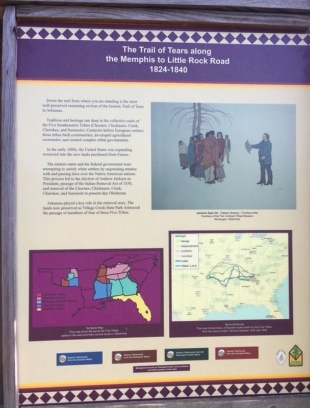
The Trail of Tears along the Memphis to Little Rock Road
1824-1840
Inscription.
Down the trail from where you are standing is the most well-preserved remaining section of the historic Trail of Tears in Arkansas.
Tradition and heritage run deep jn the collective souls of the Five Southeastern Tribes (Choctaw, Chickasaw, Creek, Cherokee, and Seminole). Centuries before European contact, these tribes built communities, developed agricultural economies, and created complex tribal governments.
In the early 1800s, the United States was expanding westward into the new lands purchased from France.
The eastern states and the federal eovernment were attempting to satisfy white settlers by negotiating treaties with and passing laws over the Native American nations. This process led to the election of Andrew Jackson as President, passage of the Indian Removal Act of 1830, and removal ofthe Choctaw, Chickasaw, Creek, Cherokee, and Seminole to present-day Oklahoma.
Arkansas played a key role in the removal story. The lands now presented as Village Creek State Park witnessed the passage of members of four of these Five Tribes.
Topics and series. This historical marker is listed in these topic lists: Native Americans • Roads & Vehicles. In addition, it is included in the Former U.S. Presidents: #07 Andrew Jackson series list. A significant historical year for this entry is 1824.
Location. 35° 9.163′ N, 90° 43.162′ W. Marker is in Wynne, Arkansas, in Cross County. Marker can be reached from County Highway 754. Located in Village Creek State Park. Touch for map. Marker is at or near this postal address: 201 Co Rd 754, Wynne AR 72396, United States of America. Touch for directions.
Other nearby markers. At least 8 other markers are within 11 miles of this marker, measured as the crow flies. Wittsburg in the Civil War (approx. 4.6 miles away); Old Military Road (approx. 5.4 miles away); Taylor's Creek and Mount Vernon (approx. 5.4 miles away); Cross County (approx. 6.2 miles away); Mt. Vernon Cemetery (approx. 9.6 miles away); Madison in the Civil War (approx. 9.6 miles away); Campbell House (approx. 10.4 miles away); St. Francis County Troops in the War Between the States (approx. 10.6 miles away).
Additional keywords. Forced removal
Credits. This page was last revised on August 4, 2020. It was originally submitted on October 31, 2019. This page has been viewed 402 times since then and 25 times this year. Photos: 1, 2, 3. submitted on October 31, 2019.


