Smiths Falls in Lanark County, Ontario — Central Canada (North America)
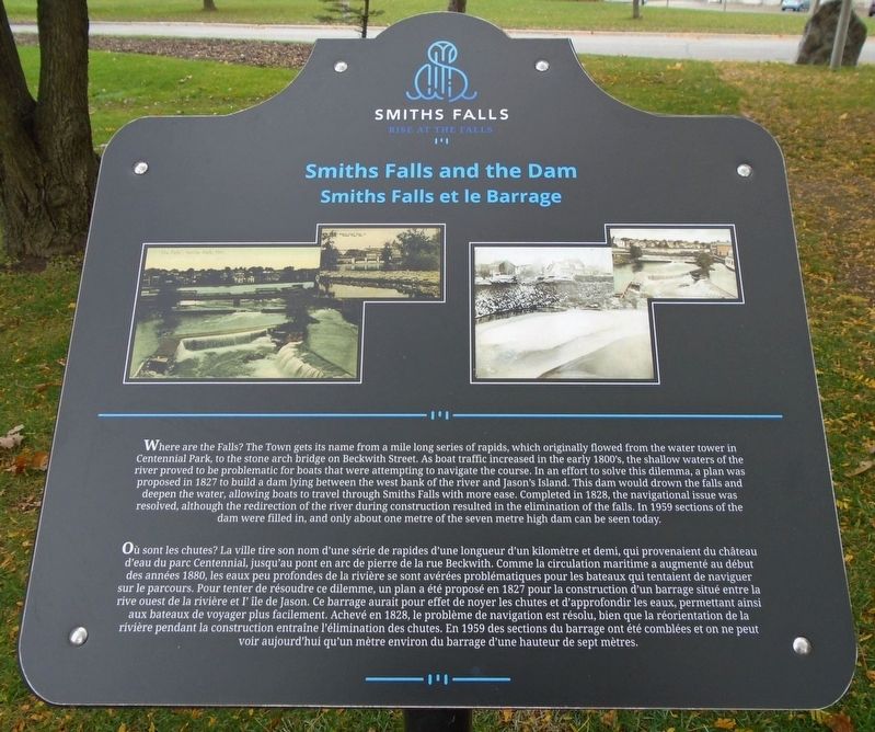
Smiths Falls and the Dam
⎯⎯⎯
Smiths Falls et le Barrage
Photographed by William Fischer, Jr., October 18, 2019
1. Smiths Falls and the Dam / Smiths Falls et le Barrage Marker

Where are the Falls? The Town gets its name from a mile long series of rapids, which originally flowed from the water tower in Centennial Park, to the stone arch bridge on Beckwith Street. As boat traffic increased in the early 1800's, the shallow waters of the river proved to be problematic for boats that were attempting to navigate the course. In an effort to solve this dilemma, a plan was proposed in 1827 to build a dam lying between the west bank of the river and Jason's Island. This dam would drown the falls and deepen the water, allowing boats to travel through Smiths Falls with more ease. Completed in 1828, the navigational issue was resolved, although the redirection of the river during construction resulted in the elimination of the falls. In 1959 sections of the dam were filled in, and only about one metre of the seven metre high dam can be seen today.
this page online
Erected by Town of Smiths Falls.
Topics. This historical marker is listed in these topic lists: Environment • Industry & Commerce • Waterways & Vessels. A significant historical year for this entry is 1827.
Location. 44° 53.823′ N, 76° 1.365′ W. Marker is in Smiths Falls, Ontario, in Lanark County. It is at the intersection of Confederation Drive and Old Mill Road, on the left
Photographed by William Fischer, Jr., October 18, 2019
2. Smiths Falls and the Dam / Smiths Falls et le Barrage Marker

Regionally, this marker is in the Haliburton Highlands to Ottawa Valley and in Eastern Ontario. It is also in Central Canada. Globally, it is in North America, the Western Hemisphere, the Western World, and the Anglosphere. Historically, it finds itself in what was once a British colony, the Viceroyalty of New France, the Haudenosaunee (Iroquois) Confederacy, and Rupert’s Land.
Other nearby markers. At least 8 other markers are within walking distance of this marker: Water Works / Station de Production d'Eau Potable (a few steps from this marker); Centennial Park (a few steps from this marker); The Rideau Waterway / Voie navigable du Canal Rideau (within shouting distance of this marker); HMCS/MHCS Smiths Falls (about 120 meters away, measured in a direct line); The Rideau Waterway (about 120 meters away); Welcome to Combined Locks (about 120 meters away); Crossroads of the Rideau / À la croisée des chemins (about 120 meters away); Grant Amy (about 120 meters away). Touch for a list and map of all markers in Smiths Falls.
Also see . . .
1. Smiths Fall, Ontario. Wikipedia entry (Submitted on November 4, 2019, by William Fischer, Jr. of Reynoldsburg, Ohio.)
2. Beautiful Smith Falls. Town website homepage (Submitted on August 31, 2022, by Larry Gertner of New York, New York.)
Credits. This page was last revised on March 21, 2025. It was originally submitted on November 4, 2019, by William Fischer, Jr. of Reynoldsburg, Ohio. This page has been viewed 605 times since then and 51 times this year. Photos: 1. submitted on November 4, 2019, by William Fischer, Jr. of Reynoldsburg, Ohio. 2. submitted on November 3, 2019, by William Fischer, Jr. of Reynoldsburg, Ohio.
