Merrickville in Leeds and Grenville United Counties, Ontario — Central Canada (North America)
Canal Twins
Canal Rideau Canal
⎯⎯⎯
Les canaux jumelés
Canal Caledonian Canal
Photographed by William Fischer, Jr., October 18, 2019
1. Canal Twins / Les canaux jumelés Marker

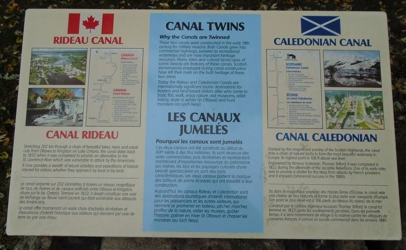
These two canals were constructed in the early 19th century for military reasons. Both Canals grew into commercial highways, survived as recreational waterways and are now important heritage resources. Rivers, lakes and cultural landscapes of scenic beauty are features of these canals. Scottish stonemasons employed during canal construction have left their mark on the built heritage of these two areas.
Today, the Rideau and Caledonian Canals are internationally significant tourist destinations for boaters and land-based visitors alike who come to boat, fish, walk, enjoy nature, visit museums, relish history, skate in winter (in Ottawa) and hunt monsters (on Loch Ness).
Stretching 202 km through a chain of beautiful lakes, rivers and canal cuts from Ottawa to Kingston on Lake Ontario, the canal dates back to 1832 when it was completed to provide an alternative to the St. Lawrence River which was vulnerable to attack by the Americans.
It now provides a wealth of leisure activities and expeditions of historic interest for visitors, whether they approach by boat or by land.
Flanked
this page online
Engineered by famous Scotsman, Thomas Telford, it was completed in 1822 during the aftermath of the Jacobite Rebellions. One of its early roles was to provide a shelter for the Navy from attacks by French privateers and it enjoyed commercial success in the 1880s.
Ces deux canaux ont été construits au début du XIXe siècle à des fins militaires. Ils sont devenus des voies commerciales, puis récréatives et représentent maintenant d'imporantes ressources du patrimoine. Les rivières, les lacs et les paysages culturels d'une beauté spectaculaire en sont des traits caractéristiques. Les deux canaux portent la marque des tailleurs de pierre écossais qui ont travaillé à leur construction.
Aujourd'hui, les canaux Rideau et Caledonian sont des destinations touristiques d'intérêt international pour les plaisanciers et les autres visiteurs, qui viennent se promener en bateau, pêcher, marcher, profiter
Photographed by William Fischer, Jr., October 18, 2019
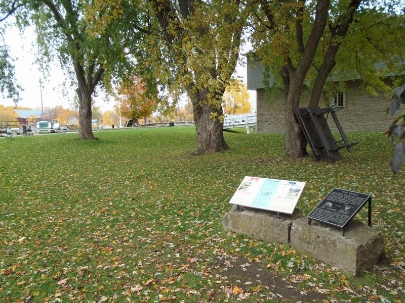
2. Canal Twins / Les canaux jumelés Marker
Le canal serpente sur 202 kilomètres à travers un réseau magnifique de lacs, de rivières et de canaux artificiels entre Ottawa et Kingston, située sur le lac Ontario. Terminé en 1832, il devait constituer une voie de rechange au fleuve Saint-Laurent qui était vulnérable aux attaques des Américains.
Le canal offre maintenant un vaste choix d'activités récréatives et d'excursions d'intérêt historique aux visiteurs qui viennent par voie de terre ou par voie d'eau.
Sis dans le magnifique paysage des Haute-Terres d'Écosse, le canal relie une chaîne de lacs naturels et forme la plus belle voie navigable d'Europe. Son point le plus élevé est à 106 pieds au-dessus du niveau de la mer.
Construit par le célèbre ingénieur écossais Thomas Telford, le canal fut terminé en 1822 après les soulèvements jacobites. Dans les premiers temps, il a servi notamment de refuge à la marine contre les attaques de corsaires français; il connut un succès commercial dans les années 1880
Topics. This historical marker is listed in these topic lists: Industry & Commerce • Parks & Recreational Areas • Waterways & Vessels. A significant historical year for this entry is 1832.
Location. 44° 54.981′ N, 75° 50.264′ W. Marker is in Merrickville, Ontario, in Leeds and Grenville United Counties. It is on Main Street just west of St. Lawrence Street (Provincial Highway 15), on the right when traveling west. Touch for map. Marker is at or near this postal address: 279 St Lawrence Street, Merrickville ON K0G 1N0, Canada. Touch for directions.

Regionally, this marker is in Eastern Ontario and specifically in Southeastern Ontario. It is also in Central Canada. Globally, it is in North America, the Western Hemisphere, the Western World, and the Anglosphere. Historically, it finds itself in what was once a British colony, the Viceroyalty of New France, the Haudenosaunee (Iroquois) Confederacy, and Rupert’s Land.
Other nearby markers. At least 8 other markers are within walking distance of this marker: Twin Canals / Les canaux jumelés (here, next to this marker); Dr. Jim Connor (here, next to this marker); Merrickville (a few steps from this marker); The Merrickville Blockhouse / Le blockhaus de Merrickville (within shouting distance of this marker); Blockhaus de Merrickville Blockhouse (within shouting distance of this marker); Merrickville Blockhouse 1832 (within shouting distance of this marker); 1st Merrickville Scout Group (within shouting distance of this marker); Merrickville United Church (within shouting distance of this marker). Touch for a list and map of all markers in Merrickville.
Also see . . .
1. Rideau Canal National Historic Site. (Submitted on November 7, 2019, by William Fischer, Jr. of Reynoldsburg, Ohio.)
2. Caledonian Canal. (Submitted on November 7, 2019, by William Fischer, Jr. of Reynoldsburg, Ohio.)
Credits. This page was last revised on March 23, 2025. It was originally submitted on November 7, 2019, by William Fischer, Jr. of Reynoldsburg, Ohio. This page has been viewed 388 times since then and 19 times this year. Photos: 1, 2. submitted on November 7, 2019, by William Fischer, Jr. of Reynoldsburg, Ohio.
