Miscouche in Prince County, Prince Edward Island — The Atlantic Provinces (North America)
Les Acadiens de la baie de Malpèque
The Acadians of Malpeque Bay
Inscription.
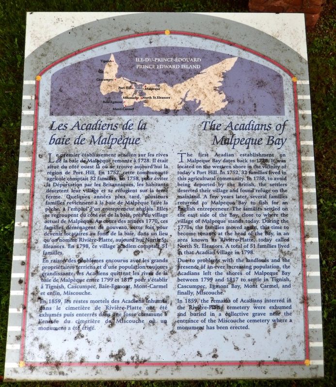
Le premier établissement acadien sur les rives de la baie de Malpèque remonte à 1728. Il était situé du côté ouest là où se trouve aujourd’hui la région de Port Hill. En 1752, cette communauté agricole comptait 32 familles. En 1758, pour éviter la Déportation par les Britanniques, les habitants désertent leur village et se réfugient sur la terre ferme. Quelques années plus tard, plusieurs familles reviennent à la baie de Malpèque faire la pêche, à l’emploi d’un entrepreneur anglais. Elles se regroupent du côté est de la baie, près du village actuel de Malpèque. Au cours des années 1770, ces familles déménagent de nouveau, cette fois pour devenir locataires au fond de la baie, dans un lieu qu’on nomme Rivière-Platte, aujourd’hui North St. Eleanors. En 1798, ce village acadien comptait 51 familles.
En raison des problèmes encourus avec les grands propriétaires terriens et d’une population toujours grandissante, les Acadiens quittent les rives de la baie de Malpèque entre 1799 et 1817 pour s’établir à Tignish, Cascumpec, Baie-Egmont, Mont-Carmel et enfin, Miscouche.
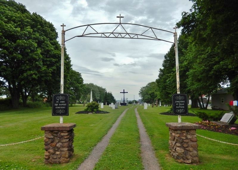
En 1859, les restes mortels des Acadiens inhumes dans le cimetière de Rivière-Platte ont été exhumés puis enterrés dans une fosse commune à l’entrée du cimetière de Miscouche ou un monument a été érigé.
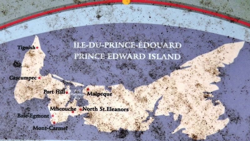
The first Acadian establishment on Malpeque Bay dates back to 1728. It was located on the western shore in the vicinity of today’s Port Hill. In 1752, 32 families lived in this agricultural community. In 1758, to avoid being deported by the British, the settlers deserted their village and found refuge on the mainland. A few years later, several families returned to Malpeque Bay to fish for an English entrepreneur. The families settled on the east side of the Bay, close to where the village of Malpeque stands today. During the 1770s the families moved again, this time to become tenants at the head of the Bay, in an area known as Rivière-Platte, today called North St. Eleanors. A total of 51 families lived in that Acadian village in 1798.
Due to problems with the landlords and the presence of an ever increasing population, the Acadians left the shores of Malpeque Bay between 1799 and 1817 to settle in Tignish, Cascumpec, Egmont Bay, Mont Carmel, and finally, Miscouche.
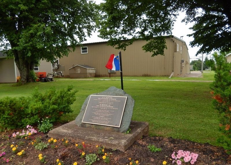
In 1859, the remains of Acadians interred in the Rivière-Platte cemetery were exhumed and buried in a collective grave near the entrance of the Miscouche cemetery where a monument has been erected.
Topics. This historical marker is listed in these topic lists: Cemeteries & Burial Sites • Colonial Era • Settlements & Settlers. A significant historical year for this entry is 1728.
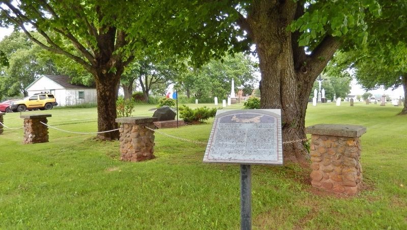
Location. 46° 25.976′ N, 63° 51.972′ W. Marker is in Miscouche, Prince Edward Island, in Prince County. Marker can be reached from Main Drive East (Veteran's Memorial Highway) (Prince Edward Island Route 2) 0.2 kilometers east of Lady Slipper Drive North (Prince Edward Island Route 12), on the left when traveling east. Marker is located between the Acadian Museum and Saint John the Baptist Catholic Church, overlooking the church cemetery. Touch for map. Marker is at or near this postal address: 23 Main Drive East, Miscouche PE C0B 1T0, Canada. Touch for directions.
Other nearby markers. At least 8 other markers are within walking distance of this marker. Le Couvent Saint-Joseph et les religieuses de la Congrégation de Notre-Dame (within shouting distance of this marker); La Convention nationale des Acadiens de 1884 (within shouting distance of this marker); La fondation de Miscouche (within shouting distance of this marker); Les Dix Conventions Nationales Acadiennes (within shouting distance of this marker); La Fanfare de Miscouche (about 90 meters away, measured in a direct line); L'Église Saint-Jean-Baptiste (about 90 meters
away); L'évolution du village de Miscouche (about 90 meters away); L'économie (about 90 meters away). Touch for a list and map of all markers in Miscouche.
Related markers. Click here for a list of markers that are related to this marker. The Village of Miscouche
Also see . . . Malpeque Bay, Prince Edward Island (Wikipedia). Acadian families arrived from Nova Scotia in 1728 and settled on the west shore of Malpeque Bay, north of present-day Miscouche, naming their settlement "Malpèque" after the Mi'kmaq name. By 1752, the settlement housed a population of more than 200. In 1758, the expulsion of the Acadians began after the fall of Louisbourg. According to local tradition, when the Malpèque settlers learned of the British arrival at Port-LaJoye, they stripped their church and buried the chapel bell to hide it from British capture. (Submitted on November 12, 2019, by Cosmos Mariner of Cape Canaveral, Florida.)
Photographed By Cosmos Mariner, July 17, 2019
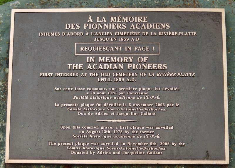
4. Acadian Pioneers Memorial Plaque
(located near marker)
(located near marker)
des Pionniers Acadiens
Inhumés d’abord à l’ancien cimetière de la Rivière-Platte
jusqu’en 1859 A.D.
Requiescant in Pace !
In Memory of
The Acadian Pioneers
First interred at the old cemetery of la Rivière-Platte
until 1859 A.D.
Sur cette fosse commune, une première plaque fut dévoilée
le 13 août 1978 par l'ancienne
Société historique acadienne de l’Î.-P.-É.
La présente plaque fut dévoilée le 5 novembre 2005 par le
Comité historique Soeur-Antoinette-DesRoches.
Don de Adrien et Jacqueline Gallant
Upon this common grave, a first plaque was unveiled
on August 13th, 1978 by the former
Société historique acadienne de l’Î.-P.-É.
The present plaque was unveiled on November 5th, 2005 by the
Comité historique Soeur-Antoinette-DesRoches.
Donated by Adrien and Jacqueline Gallant
Credits. This page was last revised on November 12, 2019. It was originally submitted on November 9, 2019, by Cosmos Mariner of Cape Canaveral, Florida. This page has been viewed 275 times since then and 12 times this year. Photos: 1, 2, 3, 4, 5, 6. submitted on November 12, 2019, by Cosmos Mariner of Cape Canaveral, Florida.
