Unionville in Farmington in Capitol Region, Connecticut — The American Northeast (New England)
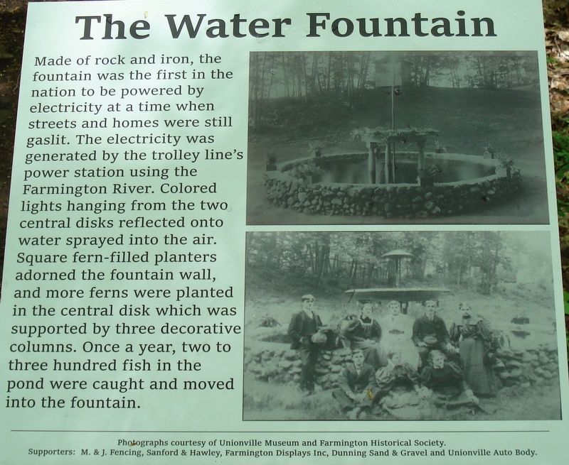
The Water Fountain
Photographed by Alan M. Perrie, May 20, 2019
1. The Water Fountain Marker
Erected 2019 by Eagle Scout project by Timothy Germano.
Topics. This historical marker is listed in these topic lists: Entertainment • Man-Made Features • Parks & Recreational Areas.
Location. 41° 45.551′ N, 72° 52.962′ W. Marker is in Farmington in Capitol Region, Connecticut. It is in Unionville. It can be reached from Farmington Avenue (Connecticut Route 4) 0.3 miles north of Park Pond Place, on the left when traveling east. The marker is located on the Suburban Park Trail to the Dance Pavilion. Start
this page online

Regionally, this marker is in the Connecticut River Valley, in Greater Hartford, and in the Knowledge Corridor. It is also in the American Northeast and in New England. Globally, it is in North America, the Western Hemisphere, the Western World, and the Anglosphere. Historically, it finds itself in what was once Hartford County and also one of the original Thirteen Colonies.
Other nearby markers. At least 8 other markers are within one mile of this marker, measured as the crow flies: Suburban Park 1895-1905 (about 700 feet away, measured in a direct line); Unionville (about 800 feet away); Unionville Veterans Monument (approx. ¼ mile away); Unionville Civil War Memorial (approx. ¼ mile away); Yodkins-Morin Memorial (approx. 0.4 miles away); Yodkins-Morin Memorial Park (approx. 0.4 miles away); Farmington (approx. 1.1 miles away); Farmington Veterans Memorial (approx. 1.1 miles away). Touch for a list and map
Photographed by Alan M. Perrie, May 20, 2019
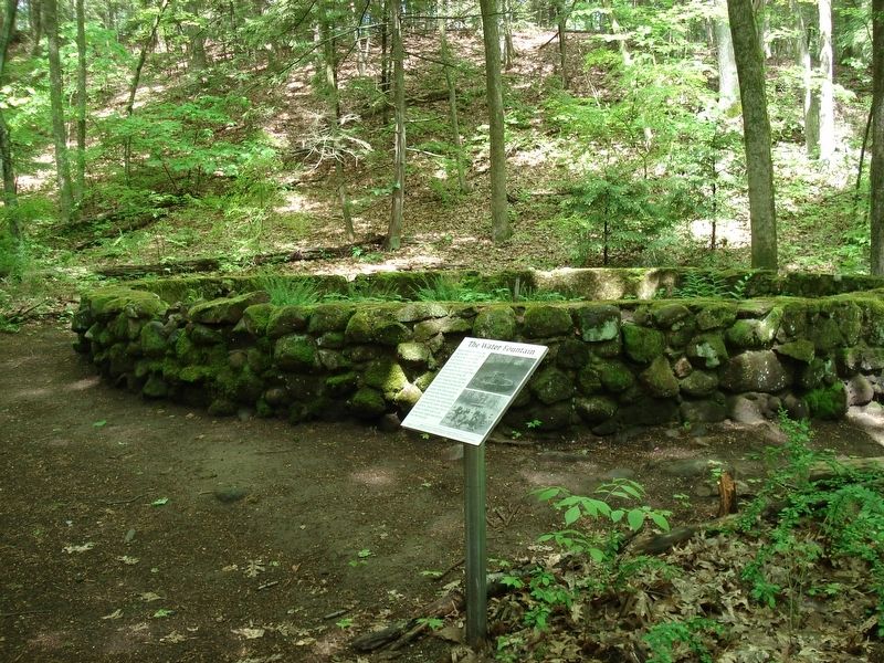
2. The Water Fountain and marker.
Also see . . .
1. The Unique Hike That Takes You Through An Abandoned Amusement Park In Connecticut. Only in Your State website entry (Submitted on November 11, 2019, by Alan M. Perrie of Unionville, Connecticut.)
2. Suburban Park video. (Submitted on November 11, 2019, by Alan M. Perrie of Unionville, Connecticut.)
3. History of Fountains. (Submitted on November 11, 2019, by Alan M. Perrie of Unionville, Connecticut.)

Photographed by Alan M. Perrie, May 20, 2019
3. Suburban Park Trailhead on Park Pond Place
Credits. This page was last revised on May 19, 2026. It was originally submitted on November 11, 2019, by Alan M. Perrie of Unionville, Connecticut. This page has been viewed 553 times since then and 24 times this year. Last updated on November 13, 2019, by Alan M. Perrie of Unionville, Connecticut. Photos: 1, 2, 3. submitted on November 11, 2019, by Alan M. Perrie of Unionville, Connecticut. • Michael Herrick was the editor who published this page.
