Torrey in Wayne County, Utah — The American Mountains (Southwest)
Building a Community
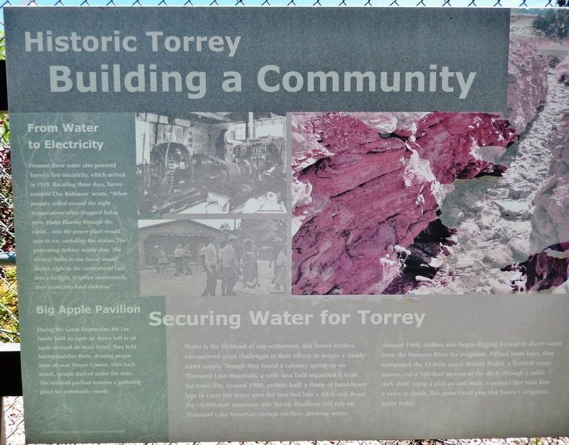
Historic Torrey
Inscription.
From Water to Electricity
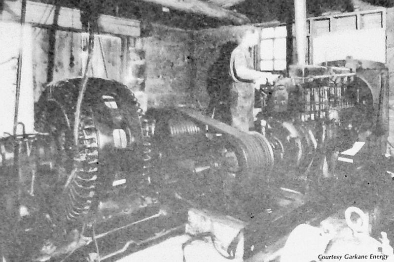
Fremont River water also powered Torrey's first electricity, which arrived in 1929. Recalling those days, Torrey resident Clay Robinson wrote, "When January rolled around the night temperatures often dropped below zero. Water flowing through the canal... into the power plant would turn to ice, curtailing the stream. The generating turbine would slow. The electric bulbs in our house would flicker. Light in the room would fade into a twilight, brighten momentarily, then zoom into total darkness."
Big Apple Pavilion
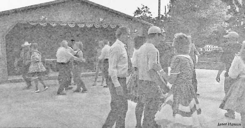
During the Great Depression, the Lee family built an open air dance hall in an apple orchard on Main Street. They held boxing matches there, drawing people from all over Wayne County. After each match, people danced under the stars. The restored pavilion remains a gathering place for community events.
Securing Water for Torrey
Water is the lifeblood of any settlement, and Torrey settlers encountered great challenges in their efforts to secure a steady water supply. Though they found a culinary spring up on Thousand Lake Mountain, a wide lava field separated it from the town site. Around 1900, settlers built a flume of hand-hewn logs to carry the water over the lava bed into a ditch and down the 10,000-foot mountain into Torrey. Residents still rely on Thousand Lake Mountain springs for their drinking water.
Around 1900, settlers also began digging a canal to divert water from the Fremont River for irrigation. Fifteen years later, they completed the 11-mile canal. Robert Peden, a Scottish stone mason, cut a 500-foot section of the ditch through a solid rock shelf, using a pick-ax and mule, a project that took him 6 years to finish. This same canal provides Torrey’s irrigation water today.
Topics. This historical marker is listed in these topic lists: Man-Made Features • Settlements & Settlers • Waterways & Vessels. A significant historical year for this entry is 1929.
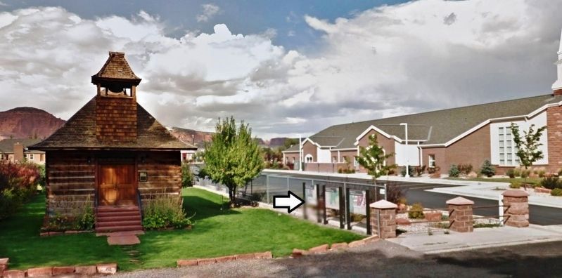
Location. 38° 17.952′ N, 111° 25.199′ W. Marker is in Torrey, Utah, in Wayne County. Marker is on East Main Street (Utah Route 24) 0.1 miles east of Center Street, on the left when traveling east. Marker is the left panel of a three-panel kiosk located near the sidewalk, in front of the old Torrey Church and Schoolhouse. Touch for map. Marker is at or near this postal address: 49 East Main Street, Torrey UT 84775, United States of America. Touch for directions.
Other nearby markers. At least 8 other markers are within 12 miles of this marker, measured as the crow flies. Torrey Log Church and Schoolhouse (a few steps from this marker); Torrey Log School and Church (a few steps from this marker); Tarlton Lewis (approx. 3.1 miles away); First Public Building (approx. 3.3 miles away); Nielsen Grist Mill (approx. 4.8 miles away); Relief Society Hall (approx. 7.4 miles away); A Community's Cornerstone (approx. 9.4 miles away); The First Grave (approx. 12 miles away). Touch for a list and map of all markers in Torrey.
Photographed By Cosmos Mariner, July 31, 2014
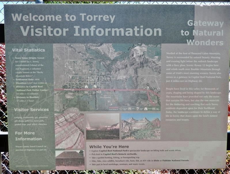
4. Welcome to Torrey • Visitor Information
(center panel of 3-panel kiosk)
(center panel of 3-panel kiosk)
Vital Statistics
• Town Name Origin: Named for Colonel Jay L. Torrey, commissioned Colonel of the 2nd Regiment, a volunteer cavalry known as the "Rocky Mountain Riders".
• Settlement Date: 1898
• Elevation: 6,837 feet (2,084 m)
• Distance to Capitol Reef National Park Visitor Center: 10 miles (~15 minutes)
• Distance to Boulder: 37 miles (~1 hour)
Gateway to Natural Wonders
Nestled at the foot of Thousand Lakes Mountain, Torrey is surrounded by natural beauty. Morning and evening light infuse the redrock landscape with a fiery glow. Scenic Byway 12 begins here and winds south over Boulder Mountain through some of Utah's most stunning scenery. Torrey also serves as a gateway to Capitol Reef National Park, just 4 miles east on Highway 24.
People have lived in this valley for thousands of years, shaping and being shaped by this landscape. The mountains have provided not only the water that sustains life here, but also the raw materials for the timbering and ranching that early Torrey residents depended upon for their livelihood. Today, the landscape continues to define a way of life in Torrey that draws upon the land's natural resources and beauty.
Photographed By Cosmos Mariner, July 31, 2014
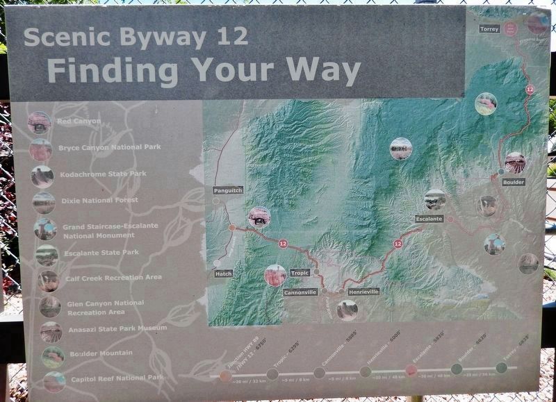
5. Scenic Byway 12 • Finding Your Way
(right panel of 3-panel kiosk)
(right panel of 3-panel kiosk)
• Bryce Canyon
• Bryce Canyon National Park
• Kodachrome State Park
• Dixie National Forest
• Grand Staircase-Escalante National Monument
• Escalante State Park
• Calf Creek Recreation Area
• Glen Canyon National Recreation Area
• Anasazi State Park Museum
• Boulder Mountain
• Capitol Reef National Park
• Bryce Canyon National Park
• Kodachrome State Park
• Dixie National Forest
• Grand Staircase-Escalante National Monument
• Escalante State Park
• Calf Creek Recreation Area
• Glen Canyon National Recreation Area
• Anasazi State Park Museum
• Boulder Mountain
• Capitol Reef National Park
Credits. This page was last revised on November 15, 2019. It was originally submitted on November 14, 2019, by Cosmos Mariner of Cape Canaveral, Florida. This page has been viewed 150 times since then and 17 times this year. Photos: 1. submitted on November 14, 2019, by Cosmos Mariner of Cape Canaveral, Florida. 2, 3, 4, 5, 6. submitted on November 15, 2019, by Cosmos Mariner of Cape Canaveral, Florida.
