Hunter Hills in Atlanta in Fulton County, Georgia — The American South (South Atlantic)
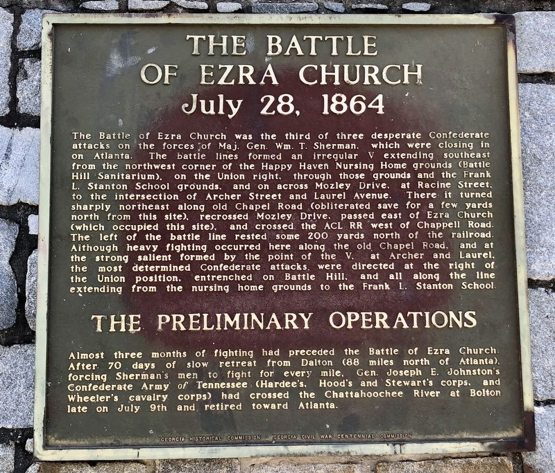
The Battle of Ezra Church
⎯⎯⎯
The Preliminary Operations
July 28, 1864
Photographed by Mark Hilton, November 10, 2019
1. The Battle of Ezra Church / The Preliminary Operations Marker
this page online
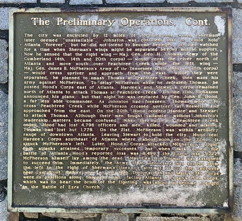
The city was encircled by 12 miles of fortifications which Sherman later deemed "unassailable". Johnston was confident that he could hold Atlanta “forever", but he did not intend to become besieged. He had watched for a time when Sherman's wings might be separated beyond mutual support. Now he sensed that the right wing – Maj. Gen. Geo. H. Thomas Army of the Cumberland (4th, 14th and 20th corps) – would cross the river north of Atlanta and move south over Peachtree Creek while the left wing Maj. Gen. James B. McPherson's Army of the Tennessee (15th 16th and 17th corps) – would cross
Photographed by Mark Hilton, November 10, 2019
2. The Preliminary Operations con't Marker
Photographed by Mark Hilton, November 10, 2019
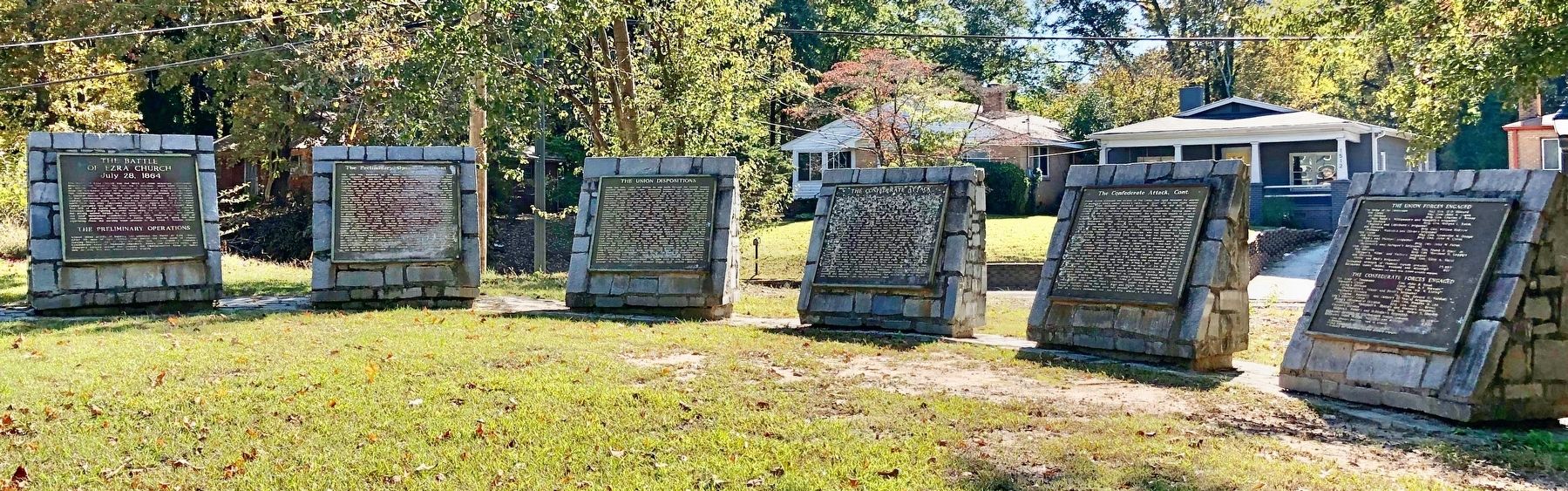
3. The Battle of Ezra Church / The Preliminary Operations Markers are the first two on left.
Erected by Georgia Historical Commission, Georgia Civil War Centennial Commission.
Topics and series. This historical marker is listed in this topic list: War, US Civil. In addition, it is included in the Georgia Historical Society series list. A significant day of the year for for this entry is July 9.
Location. 33° 45.202′ N, 84° 26.213′ W. Marker is in Atlanta, Georgia, in Fulton County. It is in Hunter Hills. It is on M.L.K. Jr Drive SW east of Wellington Street SW, on the left when traveling east. Located in Mozley Park. Touch for map.
Photographed by Mark Hilton, November 10, 2019
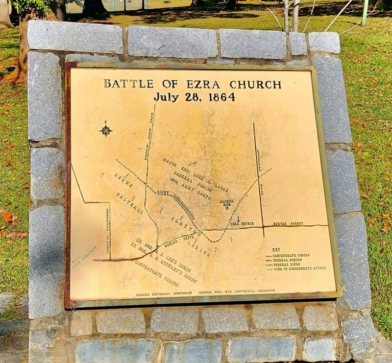
4. Nearby map of The Battle of Ezra Church marker.

Regionally, this marker is in Georgia’s Piedmont. It is also in the American South and specifically in the Deep South. Globally, it is in North America, the Western Hemisphere, the Western World, and the Anglosphere. Historically, it finds itself in what was once the territory of the Mississippian Culture, one of the original Thirteen Colonies, one of the Confederate States of America, and the Antebellum South.
Other nearby markers. At least 8 other markers are within walking distance of this marker: The Union Dispositions (here, next to this marker); The Confederate Attack (here, next to this marker); Battle of Ezra Church (a few steps from this marker); Clayton's Div., Lee's A.C. (approx. ¼ mile away); a different marker also named Clayton’s Div., Lee’s A.C. (approx. 0.3 miles away); a different marker also named Battle of Ezra Church (approx. 0.4 miles away); Battle of Ezra Ch. (approx. half a mile away); a different marker also named Battle of Ezra Ch. (approx. 0.6 miles away). Touch for a list and map of all markers in Atlanta.
Other markers no longer nearby. Battle Hill (was here, next to this marker but has been confirmed missing); Site of Ezra Church (was a few steps from this marker but has been confirmed missing); The Federal Salient (was approx. ¼ mile away but has been confirmed missing); a different marker also named Clayton's Div., Lee's A.C. (was approx. half a mile away but has been confirmed missing).
Also see . . . Wikipedia article on the Battle of Ezra Church. (Submitted on November 29, 2019, by Mark Hilton of Montgomery, Alabama.)
Credits. This page was last revised on February 8, 2023. It was originally submitted on November 29, 2019, by Mark Hilton of Montgomery, Alabama. This page has been viewed 982 times since then and 104 times this year. Photos: 1, 2, 3, 4. submitted on November 29, 2019, by Mark Hilton of Montgomery, Alabama.
