Mount Morris in Livingston County, New York — The American Northeast (Mid-Atlantic)
Mt. Morris Dam
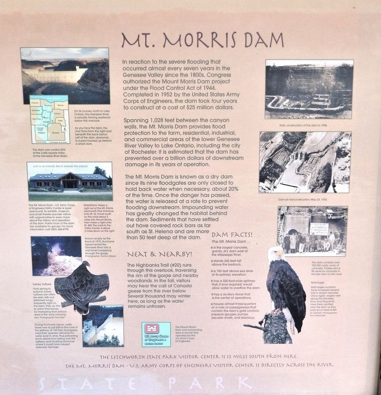
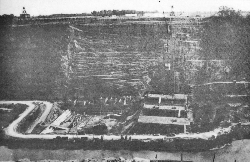
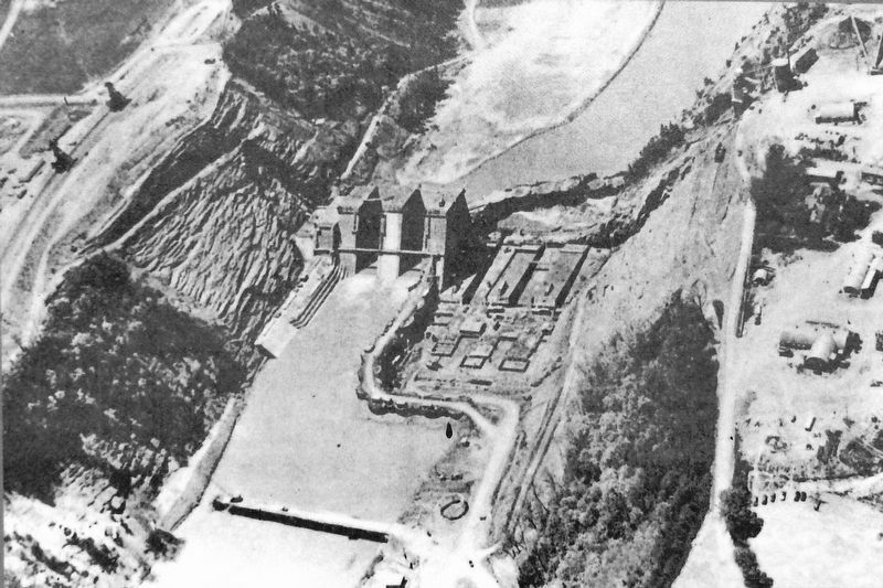
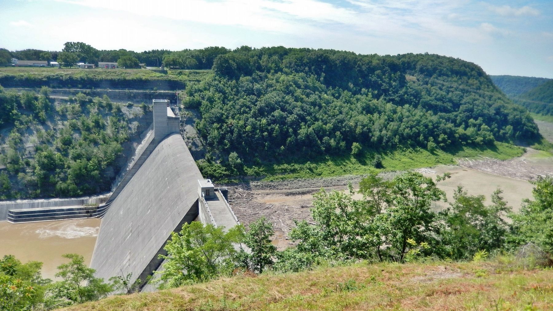
Spanning 1,028 feet between the canyon walls, the Mt. Morris Dam provides flood protection to the farm, residential, industrial, and commercial areas of the lower Genesee River Valley to Lake Ontario, including the city of Rochester. It is estimated that the dam has prevented over a billion dollars of downstream damage in its years of operation.
The Mt. Morris Dam is known as a dry dam since its nine floodgates are only closed to hold back water when necessary, about 20% of the time. Once the danger has passed, the water is released at a rate to prevent flooding downstream. Impounding water has greatly changed the habitat behind the dam. Sediments that have settled out have covered rock bars as far south as St. Helena and are more than 50 feet deep at the dam.
Neat & Nearby
The Highbanks Trail (#20) runs through this overlook, traversing the rim of the gorge and nearby woodlands. In the fall, visitors may hear the call of Canada geese from the river below. Several thousand may winter here, as long as the water remains unfrozen.
Dam Facts!
The Mt. Morris Dam ...
• is the largest concrete, gravity, dry dam east of the Mississippi River.
• stands 245 feet tall above the bedrock.
• is 760 feet above sea level at its spillway elevation.
• has a 550-foot-wide spillway that, if ever required, would allow water to overflow the dam.
• has a six-story tower that is the center of operations.
• houses almost three-quarters of a mile of passageways that contain the dam's gate controls, pressure gauges, pumps, elevator shafts, and stairways.
The Mount Morris Dam and surrounding area is owned and operated by the U.S. Army Corps of Engineers.
Erected by Letchworth State Park.
Topics. This historical marker is listed in these topic lists: Animals • Disasters • Man-Made Features • Waterways & Vessels. A significant historical year for this entry is 1952.
Location. 42° 44.104′ N, 77° 54.456′ W. Marker is in Mount Morris, New York, in Livingston County. Marker can be reached from Park Road, 1.4 miles west of Mt. Morris Road (State Route 36), on the left when traveling west. Marker is located at the southwest corner of the Mt. Morris Dam Overlook parking lot. Touch for map. Marker is in this post office area: Mount Morris NY 14510, United States of America. Touch for directions.
Other nearby markers.
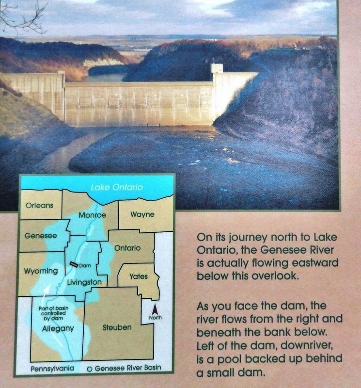
2. Marker detail: Genesee River flows to Lake Ontario
On its journey north to Lake Ontario, the Genesee River is actually flowing eastward below this overlook.
As you face the dam, the river flows from the right and beneath the bank below. Left of the dam, downriver, is a pool backed up behind a small dam.
The dam can control 43% of the 2,466 square miles of the Genesee River Basin.
As you face the dam, the river flows from the right and beneath the bank below. Left of the dam, downriver, is a pool backed up behind a small dam.
The dam can control 43% of the 2,466 square miles of the Genesee River Basin.
Related markers. Click here for a list of markers that are related to this marker. Mount Morris Dam

3. Marker detail: Mt. Morris Dam Visitor Center
The Mt. Morris Dam - U.S. Army Corps of Engineers Visitor Center is open year-round. Its exhibits, museum, and small theater provide visitors with opportunities to learn more about the history and operation of the dam. Public tours of the dam are available for groups. For more information call (585) 658-4790.
Directions: Make a right out of the Mt. Morris Letchworth Park Entrance onto Rt. 36. Travel south on this road about 2 miles into Mount Morris, then make a right onto Rt. 408. The road to the Visitor Center is about 2 miles down on the right.
Directions: Make a right out of the Mt. Morris Letchworth Park Entrance onto Rt. 36. Travel south on this road about 2 miles into Mount Morris, then make a right onto Rt. 408. The road to the Visitor Center is about 2 miles down on the right.
Photographed By Norma Gibson & Paul Wolf
6. Marker detail: Hurricane Agnes (1972)
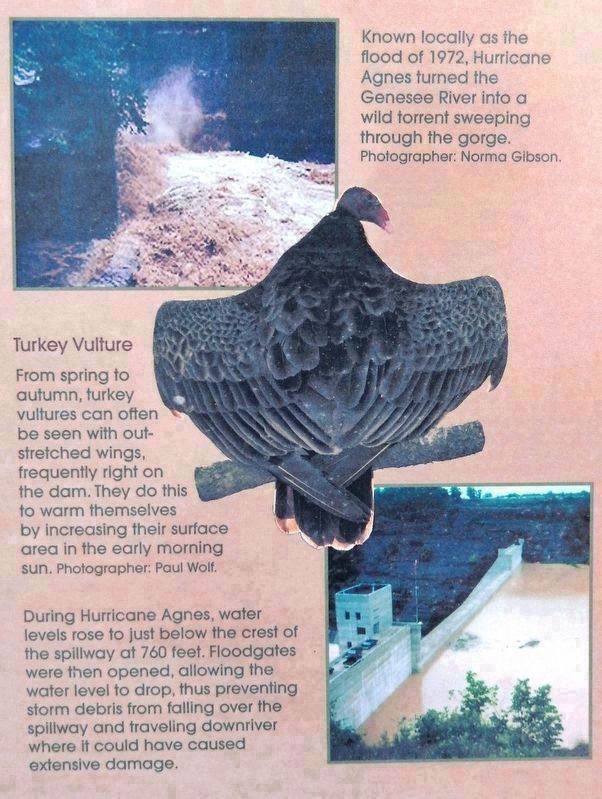
Known locally as the flood of 1972, Hurricane Agnes turned the Genesee River into a wild torrent sweeping through the gorge.
During Hurricane Agnes, water levels rose to just below the crest of the spillway at 760 feet. Floodgates were then opened, allowing the water level to drop, thus preventing storm debris from falling over the spillway and traveling downriver where it could have caused extensive damage.
Turkey Vulture
From spring to autumn, turkey vultures can often be seen with outstretched wings, frequently right on the dam. They do this to warm themselves by increasing their surface area in the morning sun.
Photographed By Terry Alexander
7. Marker detail: The Last Bucket of Concrete
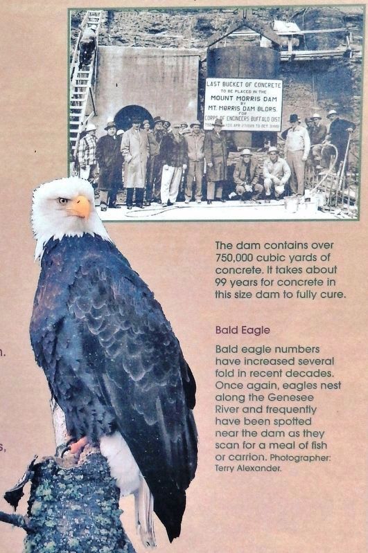
The dam contains over 750,000 cubic yards of concrete. It takes about 99 years for concrete in this size dam to fully cure.
Bald Eagle
Bald eagle numbers have increased several fold in recent decades. Once again, eagles nest along the Genesee River and frequently have been spotted near the dam as they scan for a meal of fish or carrion.
Bald Eagle
Bald eagle numbers have increased several fold in recent decades. Once again, eagles nest along the Genesee River and frequently have been spotted near the dam as they scan for a meal of fish or carrion.
Credits. This page was last revised on December 8, 2019. It was originally submitted on December 7, 2019, by Cosmos Mariner of Cape Canaveral, Florida. This page has been viewed 425 times since then and 43 times this year. Photos: 1, 2, 3, 4. submitted on December 7, 2019, by Cosmos Mariner of Cape Canaveral, Florida. 5. submitted on December 8, 2019, by Cosmos Mariner of Cape Canaveral, Florida. 6. submitted on December 7, 2019, by Cosmos Mariner of Cape Canaveral, Florida. 7. submitted on December 8, 2019, by Cosmos Mariner of Cape Canaveral, Florida. 8. submitted on December 7, 2019, by Cosmos Mariner of Cape Canaveral, Florida. 9. submitted on December 8, 2019, by Cosmos Mariner of Cape Canaveral, Florida.
