Near Hamilton City in Glenn County, California — The American West (Pacific Coastal)
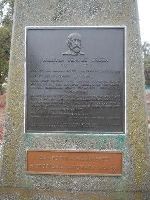
William Semple Green
1832 – 1905
Photographed by Barry Swackhamer, November 17, 2012
1. William Semple Green Marker
Ferry boat captain, mail carrier, surveyor, editor, writer, legislator, Surveyor General of the United States, California State Treasurer, irrigationist, friend of man.
On Dec. 18, 1880 posted the first water notice on an oak tree on the west bank of the Sacramento River immediately east of this spot for the diversion of 500,000 miner’s inches of water for the irrigation of lands on the west side of the Sacramento Valley.
Dedicated by Colusi County Historical Society Donated and erected by Glenn-Colusa Irrigation District, May 15, 1954
“......thou shalt take of the water of the river and pour it upon the dry land.” Exodus 4:9
California Registered Historical Landmark No. 831
Erected 1954 by Colusi County Historical Society. (Marker Number 831.)
Topics and series. This historical marker is listed in these topic lists: Agriculture • Industry & Commerce • Settlements & Settlers • Waterways & Vessels. In addition, it is included in the California Historical Landmarks series list. A significant historical date for this entry is May 15, 1864.
Location. 39° 47.378′ N,
this page online

Regionally, this marker is in California’s Sacramento Valley, specifically in the Central Valley, and on the Coast Ranges. It is also on the American Pacific Coast. Globally, it is in North America, on the Ring of Fire, in the Pacific Rim, in the Western Hemisphere, in the Western World, and in the Anglosphere. Historically, it finds itself in what was once New Spain and also Mexico’s Alta California.
Other nearby markers. At least 8 other markers are within 11 miles of this marker, measured as the crow flies: Pioneer Homesite (approx. half a mile away); Gianella Bridge (approx. 4.1 miles away); The Swift Adobe (approx. 7.9 miles away); Orland’s Cannons (approx. 7.9 miles away); Papst Flour Mill Site (approx. 8.1 miles away); William B. Ide’s Public Service
Photographed by Barry Swackhamer, November 17, 2012
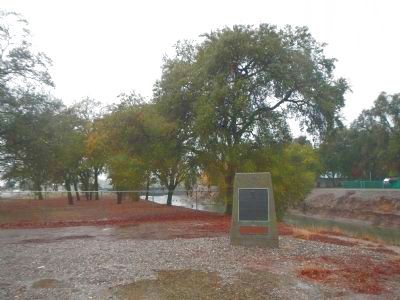
2. William Semple Green Marker
Credits. This page was last revised on December 8, 2024. It was originally submitted on December 12, 2012, by Barry Swackhamer of Brentwood, California. This page has been viewed 956 times since then and 29 times this year. Last updated on December 11, 2019, by Craig Baker of Sylmar, California. Photos: 1, 2. submitted on December 12, 2012, by Barry Swackhamer of Brentwood, California. • J. Makali Bruton was the editor who published this page.
