Sunbury in Northumberland County, Pennsylvania — The American Northeast (Mid-Atlantic)
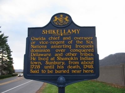
Shikellamy
Erected 1947 by Pennsylvania Historical and Museum Commission.
Topics and series. This historical marker is listed in these topic lists: Colonial Era • Native Americans. In addition, it is included in the Pennsylvania Historical and Museum Commission series list. A significant historical year for this entry is 1728.
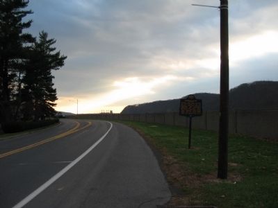
Location. 40° 52.558′ N, 76° 47.532′ W. Marker is in Sunbury, Pennsylvania, in Northumberland County. Marker is on North Front Street (State Highway 147), on the right when traveling south. Touch for map. Marker is in this post office area: Sunbury PA 17801, United States of America. Touch for directions.
Other nearby markers. At least 8 other markers are within walking distance of this marker. The Sullivan Expedition (a few steps from this marker); Thompson's Rifle Battalion: (within shouting distance of this marker); Fort Augusta (within shouting distance of this marker); Shikellamy's Profile (about 600 feet away, measured in a direct line); a different marker also named Shikellamy (about 800 feet away); The Bloody Spring (approx. 0.7 miles away); Pennsylvania Canal (approx. 0.7 miles away); William Maclay (approx. 0.8 miles away). Touch for a list and map of all markers in Sunbury.
Also see . . .
1. Shikellamy. A biography of the Oneida chief. (Submitted on December 11, 2008, by Craig Swain of Leesburg, Virginia.)
2. Shikellamy - Behind the Marker. ExplorePAHistory.com (Submitted on July 20, 2011, by Mike Wintermantel of Pittsburgh, Pennsylvania.)
Credits. This page was last revised on June 16, 2016. It was originally submitted on December 11, 2008, by Craig Swain of Leesburg, Virginia. This page has been viewed 1,082 times since then and 24 times this year. Photos: 1, 2. submitted on December 11, 2008, by Craig Swain of Leesburg, Virginia.

