Near Port Gibson in Claiborne County, Mississippi — The American South (East South Central)
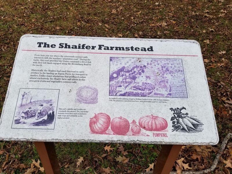
The Shaifer Farmstead
From here you see where the nineteenth century path intersects with the auxiliary "plantation road." During the battle, this road provided the Union command a direct link with their left flank engaged along the Bruinsburg Road to the north.
Historically, the Shaifers had used this road to carry produce to the landing on Bayou Pierre for transport to market. Unlike many plantations that produced cotton almost exclusively, the Shaifer farm and others in this area grew fruits and vegetables commercially.
Photo captions
Left: This soil's stability and fertility are constantly threatened. The canebrake bottoms were best used as pastures with crops and orchards on the higher ground.
Right: As implied in this painting detail by William Duffner of the 24th Indiana Infantry, USA, the plantation extended from here, with residential quarters and barns.
Topics. This historical marker is listed in these topic lists: Agriculture • Roads & Vehicles • Settlements & Settlers • War, US Civil.
Location. 31° 56.902′ N, 91° 2.164′ W. Marker is near Port Gibson, Mississippi, in Claiborne County. Marker can be reached from Shaifer Road, 1˝ miles west of Bessie Weathers Road, on the right when
Other nearby markers. At least 8 other markers are within walking distance of this marker. The Quandary of Freedom (a few steps from this marker); At the Center of the Battle (a few steps from this marker); Field Surgery on the Porch (a few steps from this marker); Reconciliation and Reunions (within shouting distance of this marker); From This Site (within shouting distance of this marker); Battle of Port Gibson (about 300 feet away, measured in a direct line); A Fight at Midnight (about 300 feet away); Magnolia Church and the Battle along the Rodney Road (approx. 0.4 miles away). Touch for a list and map of all markers in Port Gibson.
Credits. This page was last revised on February 2, 2020. It was originally submitted on December 21, 2019, by Cajun Scrambler of Assumption, Louisiana. This page has been viewed 241 times since then and 14 times this year. Photos: 1, 2. submitted on December 21, 2019, by Cajun Scrambler of Assumption, Louisiana.

