Buckhead in Atlanta in Fulton County, Georgia — The American South (South Atlantic)
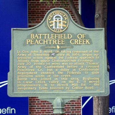
Battlefield of Peachtree Creek
Photographed by David Seibert, June 15, 2008
1. Battlefield of Peachtree Creek Marker
July 20. Hood’s 1st move was to attack Thomas’ Army of the Cumberland before it crossed Peachtree Cr., but a delay in Confederate deployment enabled the Federals to gain positions south of the creek.
Battle was joined in this area. Beginning in Clear Creek valley on the E., it moved progressively W. to Howell Mill Rd. - the sanguinary fields bisected by Collier Rd.
Erected 1955 by Georgia Historical Commission. (Marker Number 060-31.)
Topics and series. This historical marker is listed in this topic list: War, US Civil. In addition, it is included in the Battlefield Trails - Civil War, and the Georgia Historical Society series lists. A significant historical date for this entry is July 18, 1864.
Location. 33° 48.292′ N, 84° 23.601′ W. Marker is in Atlanta, Georgia, in Fulton County. It is in Buckhead. It is on Palisades Road 0 miles east of Peachtree Road NE (U.S. 19), in the median. Touch for map. Marker is in this post office area: Atlanta
this page online

Regionally, this marker is in the Piedmont. It is also in the American South and specifically in the Deep South. Globally, it is in North America, the Western Hemisphere, the Western World, and the Anglosphere. Historically, it finds itself in what was once the territory of the Mississippian Culture, one of the original Thirteen Colonies, one of the Confederate States of America, and the Antebellum South.
Other nearby markers. At least 8 other markers are within walking distance of this marker: The Indian Trail Echota (a few steps from this marker); Hardee’s Attack (within shouting distance of this marker); Old Montgomery Fy. Rd. (about 800 feet away, measured in a direct line); Newton’s Division (approx. ¼ mile away); Hardee at Peachtree Creek (approx. ¼ mile away); Featherston’s Brigade (approx. 0.3 miles away); Coburn's Brigade (approx. 0.3 miles away); Wood's Brigade (approx. 0.4 miles away). Touch for a list and map of all markers in Atlanta.
Related markers. Click here for a list of markers that are related to this marker. Battle of Peachtree Creek
Photographed by Felch Dumas, August 14, 2008
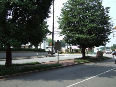
2. Battlefield of Peachtree Creek Marker facing Peachtree Street from Palisades Road
Credits. This page was last revised on October 29, 2024. It was originally submitted on December 14, 2008, by David Seibert of Sandy Springs, Georgia. This page has been viewed 5,484 times since then and 108 times this year. Photos: 1. submitted on December 14, 2008, by David Seibert of Sandy Springs, Georgia. 2. submitted on March 23, 2009, by Felch Dumas of Decatur, Georgia. • Craig Swain was the editor who published this page.
