Near North Riverfront in St. Louis, Missouri — The American Midwest (Upper Plains)
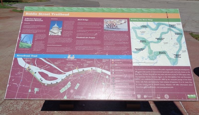
Biddle Street Trailhead
Gateway Arch
The Gateway Arch is a 630 feet tall stainless steel structure designed by famous architect Eero Saarinen. It symbolizes St. Louis's role as the gateway to the west.
A tram takes visitors up the 63-story tall structure to a small observation deck with 16 windows at the top of the Arch. The viewing area can hold up to 160 people.
The Arch cost $13 million to build. Construction began February 12, 1963 and was completed October 28, 1965.
The arch is flexible and is designed to be able to withstand an earthquake or sway as much as 18 inches. It is perfectly grounded and insulated from the hundreds of lightening strikes it receives each year.
Old Courthouse
The land on which the Old Courthouse stands was given to St. Louis County in 1816 by Auguste Chouteau and Judge John B.C. Lucas on condition that it be used as the site of the Courthouse of the County of St. Louis.
The original courthouse was built in 1828 and saw a series of additions and remodeling in later years, beginning in 1839.
In 1861 a cast iron, Italian Renaissance style dome patterned after the dome in St. Peter's Basilica in Rome was installed on top of the Courthouse. Some critics said the dome with the copper exterior would be too heavy for the building to support, but it proved to be sound.
Museum of Westward Expansion
Underneath the Gateway Arch, the Museum of Westward Expansion contains artifacts and exhibits that tell about Lewis and Clark and the Corps of Discovery, the pioneers and Native American cultures living in the American West.
MLK Bridge
Originally named the Veterans Memorial Bridge when it opened in 1951, this is the 6th largest and longest cantilevered truss bridge in the United States, and the largest one over the Mississippi.
From 1955 until 1967, US-40 and US-66 crossed the Mississippi over this bridge.
In 1968, the Veterans Memorial Bridge was renamed in honor of Dr. Martin Luther King, Jr.
The bridge began to fall into disrepair. The St. Louis Port Authority took it over and rebuilt it in the late 1980s.
Floodwall Art Project
This seven foot tall, 150 foot long tile mural was designed by ceramic artist Catherine Magel and created with the assistance of approximately 1500 youth and adults from at least six North St. Louis communities.
The ceramic mural displays the history of the natural world. It begins with microscopic life forms, moves into sea life, graduates to earth creatures and ends with migrating birds.
Children going through the grieving process helped create the migrating birds with artist Catherine Magel. Each child wrote a message to the person they lost, and that paper was imbedded in a bird. When the ceramic birds were fired, the paper burned away, so the message could not be read by anyone else. The migrating birds serve as a metaphor for letting go and moving on to other places.
Community involvement in the art project has created a sense of ownership and pride. The community helps keep the area around the mural tidy and litter free.
Several groups worked together to provide funding and labor for the mural wall, including Americorps, Confluence Greenway, Missouri Arts Council and a number of other corporations.
The Great Rivers Greenway District is the public organization leading the development of a region-wide system of interconnected greenways, parks and trails, known as the River Ring. The River Ring will join two states and cover an area of 1,216 square miles. The Greenway District, formerly known as the Metropolitan Park and Recreation District, was established in November 2000 by the successful passage of the Clean Water, Safe Parks and Community Trails Initiative (Proposition C) in St. Louis City, St. Louis County and St. Charles County, Missouri. For more information about Great Rivers Greenway District, visit www.greatrivers.info.
Erected by Great Rivers Greenway.
Topics and series. This historical marker is listed in these topic lists: African Americans • Architecture • Arts, Letters, Music • Bridges & Viaducts • Civil Rights • Education • Exploration • Native Americans • Parks & Recreational Areas. In addition, it is included in the Lewis & Clark Expedition series list.
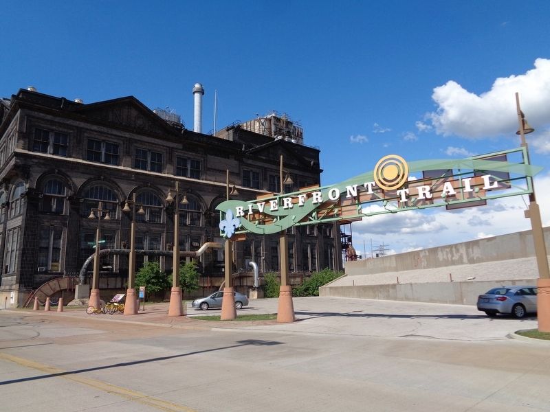
Location. 38° 38.111′ N, 90° 10.881′ W. Marker is in St. Louis, Missouri. It is in Near North Riverfront. Marker is at the intersection of North Leonor K Sullivan Boulevard and Biddle Street, on the right when traveling north on North Leonor K Sullivan Boulevard. Marker is located at the Riverfront Trail parking lot, which is next to the Ashley Street Power House. Touch for map. Marker is at or near this postal address: 699 N Leonor K Sullivan Boulevard, Saint Louis MO 63102, United States of America. Touch for directions.
Other nearby markers. At least 8 other markers are within walking distance of this marker. La Grande Rue (approx. 0.3 miles away); Old Missouri Hotel (approx. 0.3 miles away); Rue de lEglise (approx. 0.3 miles away); Rue Royale (approx. 0.4 miles away); Robert J. Baer Plaza (approx. 0.4 miles away); 1994 (approx. 0.4 miles away); 1993 (approx. 0.4 miles away); 1992 (approx. 0.4 miles away). Touch for a list and map of all markers in St. Louis.
Also see . . . Mississippi Greenway. From the Great Rivers Greenway website, there is some information about the 15-mile trail that starts at the Riverfront Trail lot (at Biddle and Leonor K Sullivan) and goes to North Riverfront Park (near the Old Chain of Rocks Bridge). (Submitted on January 8, 2020, by Jason Voigt of Glen Carbon, Illinois.)
Credits. This page was last revised on January 30, 2023. It was originally submitted on January 8, 2020, by Jason Voigt of Glen Carbon, Illinois. This page has been viewed 280 times since then and 36 times this year. Photos: 1, 2. submitted on January 8, 2020, by Jason Voigt of Glen Carbon, Illinois. • Devry Becker Jones was the editor who published this page.

