
Colonia Polanco in Ciudad de México, Mexico — The Valley of Mexico (The Central Highlands)
Ek Balam Building 1
Photographed by J. Makali Bruton, November 30, 2019
1. Ek Balam Building 1 Marker

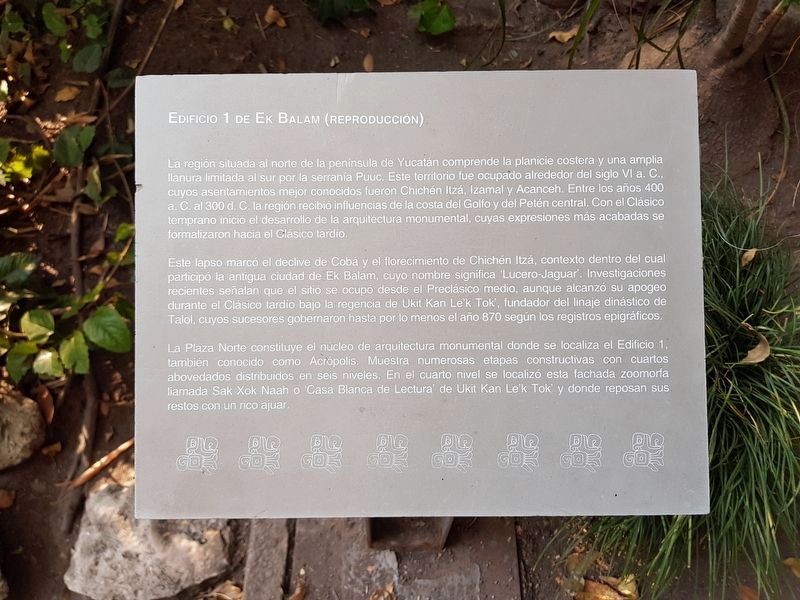
La región situada al norte de la península de Yucatan comprende la planicie costera y una amplia llanura limitada al sur por la serranía Puuc. Este territorio fue ocupado alrededor del siglo VI a.C., cuyos asentamientos mejor conocidos fueron Chichén Itzá, Izamal y Acanceh. Entre los años 400 a.C. al 300 d.C. la región recibió influencias de la costa del Golfo y del Petén central. Con el Clásico temprano inició el desarrollo de la arquitectura monumental, cuyas expresiones más acabadas se formalizaron hacia el Clásico tardío.
Este lapso marcó el declive de Cobá y el florecimiento de Chichén Itzá, contexto dentro del cual participó la antigua ciudad de Ek Balam, cuyo nombre significa “Lucero-Jaguar”. Investigaciones recientes señalan que el sitio se ocupoó desde el Preclásico medio, aunque alcanzó su apogeo durante el Clásico tardío bajo la regencia de Ukit Kan Le’k Tok’, fundador del linaje dinástico de Talol, cuyos sucesores gobernaron hasta por lo menos el año 870 según los registros epigráficos.
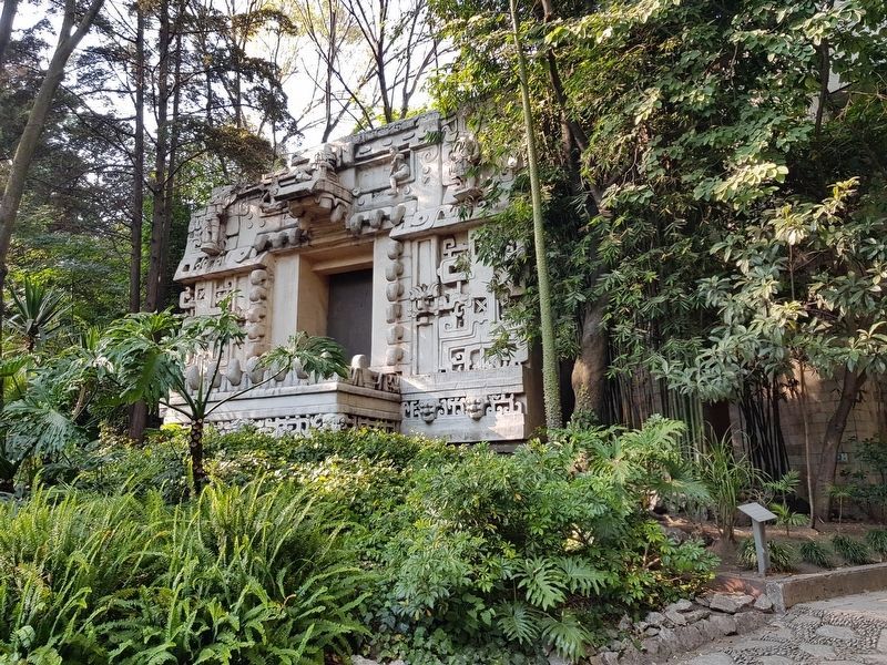
La Plaza Norte constituye el núcleo de arquitectura monumental donde se localiza el Edificio 1, también conocido como Acrópolis. Muestra numerosas etapas constructivas con cuartos abovedados distribuidos en seis niveles. En el cuarto nivel se localizó esta fachada zoomorfa llamada Sak Xok Naah o “Casa Blanca de Lectura” de Ukit Kan Le’k Tok’ y donde resposan sus restos con un rico ajuar.
Ek Balam Building 1 (reproduction)
The region located north of the Yucatan Peninsula comprises the coastal area and a wide plain bounded to the south by the Puuc Mountain range. This territory was occupied around the 6th century B.C. Its best-known settlements were Chichén Itzá, Izamal and Acanceh. Between the years 400 B.C. to 300 A.D., the region was influenced by the Gulf Coast and the Central Petén societies. In the Early Classic Period began the development of monumental architecture, whose most complete expressions were formalized towards the Late Classic Period.
This period marked the decline of Cobá and the flowering of Chichén Itzá and it was in this context within which the ancient city of Ek Balam participated, whose name means "Bright Star-Jaguar". Recent research indicates that the site was occupied from the Middle Preclassic, although it reached its peak during the Late Classic under the regency of Ukit Kan Le'k Tok', founder of the dynastic lineage of Talol, whose successors ruled until at least 870 according to epigraphic records.
The North Plaza constitutes the core of monumental architecture at the site, where Building 1, also known as the Acropolis, is located. It shows numerous construction stages with vaulted rooms distributed in six levels. On the fourth level, this zoomorphic facade called Sak Xok Naah or “White House of Reading” of Ukit Kan Le’k Tok’ was located. This is where his remains were entombed with a rich burial offering.
Topics.
this page online
Location. 19° 25.526′ N, 99° 11.2′ W. Marker is in Ciudad de México. It is in Colonia Polanco. It can be reached from Avenida Paseo de la Reforma, on the left. The marker and reproduction of the building are on the grounds of the National Anthropological Museum of Mexico, south of the main building of the museum. The marker can only be seen by entering the museum grounds. Touch for map. Marker is in this post office area: Ciudad de México 11100, Mexico. Touch for directions.

Regionally, this marker is in Central Mexico and specifically in Mexico City Metropolitan Area. Globally, it is in North America, specifically in Mesoamerica, on the Ring of Fire, and in the Western Hemisphere. Historically, it finds itself in what was once New Spain, a Spanish colony, and the Aztec Empire.
Other nearby markers. At least 8 other markers are within walking distance of this marker: Hochob Building 2 (a few steps from this marker); Stela 6 of Piedras Negras
Photographed by J. Makali Bruton, November 30, 2019
2. Ek Balam Building 1 and Marker
Credits. This page was last revised on January 4, 2023. It was originally submitted on January 12, 2020, by J. Makali Bruton of Washington, District of Columbia. This page has been viewed 226 times since then and 8 times this year. Photos: 1, 2. submitted on January 12, 2020, by J. Makali Bruton of Washington, District of Columbia.
