Near Thalmann in Glynn County, Georgia — The American South (South Atlantic)
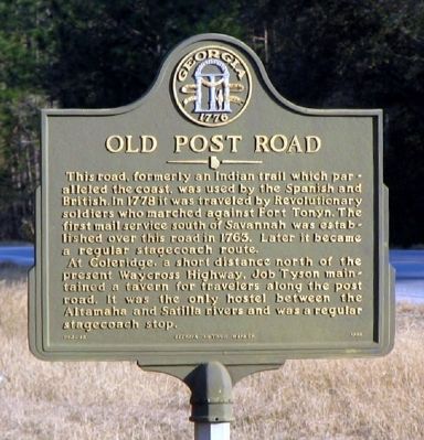
Old Post Road
This road, formerly an Indian trail which paralleled the coast, was used by the Spanish and British. In 1778 it was traveled by Revolutionary soldiers who marched against Fort Tonyn. The first mail service south of Savannah was established over this road in 1763. Later it became a regular stagecoach route.
At Coleridge, a short distance north of the present Waycross Highway, Job Tyson maintained a tavern for travelers along the post road. It was the only hostel between the Altamaha and Satilla rivers and was a regular stagecoach stop.
Erected 1996 by Georgia Department of Natural Resources. (Marker Number 063-4B.)
Topics and series. This historical marker is listed in these topic lists: Colonial Era • Native Americans • Roads & Vehicles • War, US Revolutionary. In addition, it is included in the Georgia Historical Society, and the Postal Mail and Philately series lists. A significant historical year for this entry is 1778.
Location. 31° 18.677′ N, 81° 43.962′ W. Marker is near Thalmann, Georgia, in Glynn County. Marker is at the intersection of Harrell Highway (Georgia Route 32) and Post Road, on the right when traveling west on Harrell Highway. The marker stands at the Glynn-Brantley County line. Touch for map. Marker is in this post office area: Brunswick GA 31523, United States of America. Touch for directions.
Other nearby markers. At least 3 other markers are within 13 miles of this marker, measured as the crow flies. Confederate Soldiers Memorial (approx. 6.3 miles away); Union School (approx. 12.1 miles away); Emanuel United Methodist Church (approx. 12˝ miles away).
Credits. This page was last revised on November 25, 2020. It was originally submitted on December 15, 2008, by David Seibert of Sandy Springs, Georgia. This page has been viewed 1,385 times since then and 73 times this year. Photo 1. submitted on December 15, 2008, by David Seibert of Sandy Springs, Georgia. • Bill Pfingsten was the editor who published this page.
Editor’s want-list for this marker. A wide shot of the marker and its surroundings. • Can you help?
