
Bayside in Saint Andrews, New Brunswick — The Atlantic Provinces (North America)
In Champlain’s Footsteps
⎯⎯⎯
Sur les traces de Champlain
Photographed by Cosmos Mariner, July 13, 2019
1. In Champlain’s Footsteps /
Sur les traces de Champlain Marker
Sur les traces de Champlain Marker

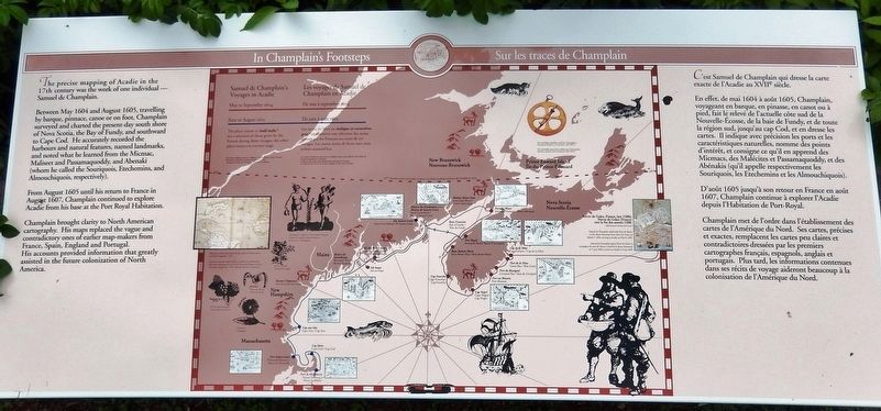
The precise mapping of Acadie in the 17th century was the work of one individual — Samuel de Champlain.
Between May 1604 and August 1605, travelling by barque, pinnace, canoe or on foot, Champlain surveyed and charted the present-day south shore of Nova Scotia, the Bay of Fundy, and southward to Cape Cod. He accurately recorded the harbours and natural features, named landmarks, and noted what he learned from the Micmac, Maliseet and Passamaquoddy, and Abenaki (whom he called the Souriquois, Etechemins, and Almouchiquois, respectively).
From August 1605 until his return to France in August 1607, Champlain continued to explore Acadie from his base at the Port Royal Habitation.
Champlain brought clarity to North American cartography. His maps replaced the vague and contradictory ones of earlier map-makers from France, Spain, England and Portugal. His accounts provided information that greatly assisted in the future colonization of North America.
C'est Samuel de Champlain qui dresse la carte exacte de l'Acadie au XVIIe siècle.
En effet, de mai 1604 à août 1605, Champlain, voyageant
this page online
D'août 1605 jusqu'à son retour en France en août 1607, Champlain continue à explorer l'Acadie depuis l'Habitation de Port-Royal.
Champlain met de l'ordre dans l'établissement des cartes de l'Amérique du Nord. Ses cartes, précises et exactes, remplacent les cartes peu claires et contradictoires-dressées par les premiers cartographes français, espagnols, anglais et portugais. Plus tard, les informations contenues dans ses récits de voyage aideront beaucoup à la colonisation de l'Amérique du Nord.
Erected by Parks Canada / Parcs Canada.
Topics and series. This historical marker is listed in these topic lists: Colonial Era • Exploration • Waterways & Vessels.
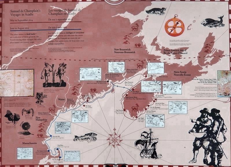
2. Marker detail: Samuel Champlain's Voyages in Acadie
Les voyages de Samuel de Champlain en Acadie
Les voyages de Samuel de Champlain en Acadie
Location. 45° 8.091′ N, 67° 6.779′ W. Marker is in Bayside, New Brunswick, in Saint Andrews. It can be reached from New Brunswick Highway 127 (New Brunswick Route 127) 9 kilometers south of Route 1, on the right when traveling south. Marker is located at the Saint Croix Island National Historic Site, along the interpretive trail. Touch for map. Marker is at or near this postal address: 3509 New Brunswick Highway 127, Bayside NB E5B 2V2, Canada. Touch for directions.

Regionally, this marker is in Charlotte County and the Fundy Isles. It is also in the Maritimes and in Atlantic Canada. Globally, it is in the North Atlantic Region, North America, the Western Hemisphere, the Western World, and the Anglosphere. Historically, it finds itself in what was once a British colony, the Viceroyalty of New France, and Acadia.
Other nearby markers. At least 8 other markers are within walking distance of this marker: A Checkered History / Une historie mouvementée (a few steps from this marker); Moving on / Le déménagement
Photographed by Cosmos Mariner, July 13, 2019
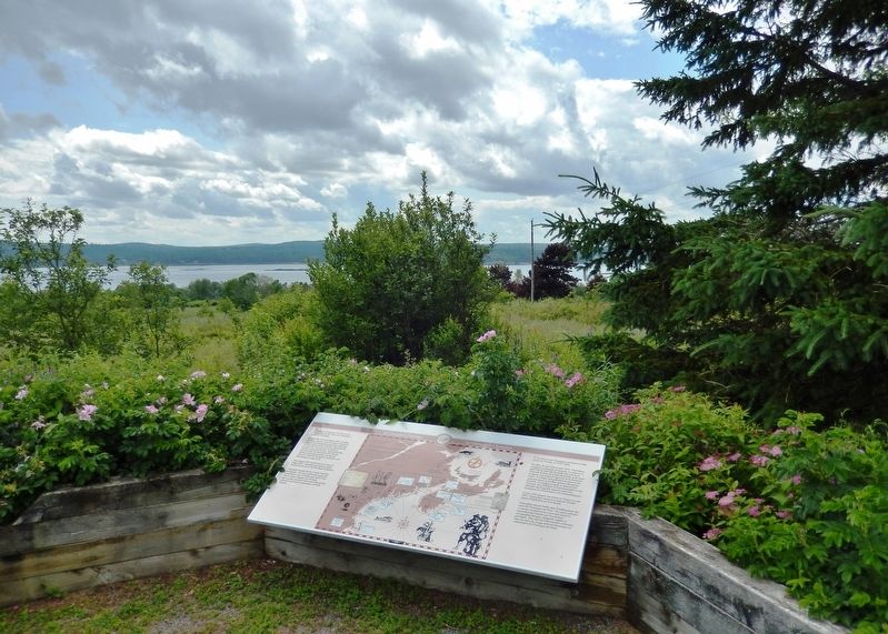
3. In Champlain’s Footsteps Marker (wide view)
Related markers. Click here for a list of markers that are related to this marker. Saint Croix Island International Historic Site / Île Sainte-Croix Lieu historique international
Also see . . . Samuel de Champlain. French explorer, acknowledged founder of the city of Quebec, and consolidator of the French colonies in the New World. Champlain spent three winters in Acadia — the first on an island in the St. Croix River, where scurvy killed nearly half the party, and the second and third, which claimed the lives of fewer men, at Annapolis Basin. During the summers he searched for an ideal site for colonization. His explorations led him down the Atlantic coast southward to Massachusetts Bay and beyond, mapping in detail the harbours that his English rivals had only touched. (Submitted on January 16, 2020, by Cosmos Mariner of Cape Canaveral, Florida.)
Credits. This page was last revised on January 19, 2020. It was originally submitted on January 15, 2020, by Cosmos Mariner of Cape Canaveral, Florida. This page has been viewed 389 times since then and 30 times this year. Photos: 1. submitted on January 15, 2020, by Cosmos Mariner of Cape Canaveral, Florida. 2, 3. submitted on January 16, 2020, by Cosmos Mariner of Cape Canaveral, Florida.
