Swope Parkway - Elmwood in Kansas City in Jackson County, Missouri — The American Midwest (Upper Plains)
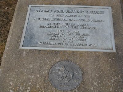
Byram's Ford Historic District
has been placed on the
National Register of Historic Places
by the United States
Department of the Interior
Site of the
Battle of the Big Blue
October 22 and 23, 1864
and the
Independence to Westport Road
text of small seal:
Howard N. Monnett Memorial
Civil War Round Table - KC
Battle of Westport
Erected by Civil War Roundtable of KC.
Topics and series. This historical marker is listed in these topic lists: Roads & Vehicles • War, US Civil. In addition, it is included in the National Historic Landmarks series list. A significant historical date for this entry is October 22, 1909.
Location. 39° 0.985′ N, 94° 31.308′ W. Marker is in Kansas City, Missouri, in Jackson County. It is in Swope Parkway - Elmwood. Marker is on E 60th Street, 0.2 miles east of Colorado Street, on the left when traveling east. Touch for map. Marker is in this post office area: Kansas City MO 64130, United States of America. Touch for directions.
Other nearby markers. At least 8 other markers are within walking distance of this marker. Byram's Ford and the Battle of Westport (about 600 feet away, measured in a direct line); Storm of Lead (about 600 feet away); Contested Crossing (about 600 feet away); Battle of the Big Blue (approx. ¼ mile away); Battle of the Big Blue, October 22, 1864 (approx. ¼ mile away); Byram's Ford Battlefield (approx. 0.3 miles away); Log House and Defensive Line (approx. half a mile away); Pratt's Artillery (approx. half a mile away). Touch for a list and map of all markers in Kansas City.
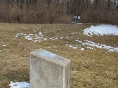
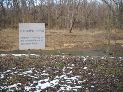
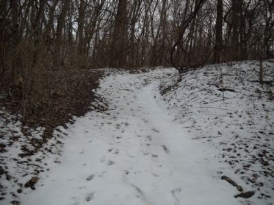
More about this marker. The marker is located at the western end of the trail that leads to Byram's Ford. Parking is nearby.
Also see . . .
1. Battle of Byram's Ford. Wikipedia entry of the Civil War Battle that took place here. (Submitted on March 14, 2010, by Thomas Onions of Olathe, Kansas.)
2. Battle of Byram's Ford. This is the Civil War Muse Commentary on this stop of a small tour of the area. (Submitted on March 14, 2010, by Thomas Onions of Olathe, Kansas.)
3. Byram Ford Historic District National Register Application.
Excerpt:(Submitted on November 29, 2021, by Thomas Onions of Olathe, Kansas.)
"The Byram's Ford site is a heavily wooded copse of about 12 acres bisected by the meandering course of the Big Blue River. The site contains Byram's Ford which in historic times afforded the traveler a good crossing point for mounted and wagon traffic and featured a traversable descending grade to the stream course and a firm rock-lined bottom through the Big Blue River. "
Credits. This page was last revised on February 10, 2023. It was originally submitted on March 14, 2010, by Thomas Onions of Olathe, Kansas. This page has been viewed 1,782 times since then and 47 times this year. Last updated on January 19, 2020, by Michael E Sanchez, Jr. of Kansas City, Missouri. Photos: 1, 2, 3, 4. submitted on March 14, 2010, by Thomas Onions of Olathe, Kansas. • Devry Becker Jones was the editor who published this page.


