
Kingston in Caldwell County, Missouri — The American Midwest (Upper Plains)
Kingston
Photographed by Michael E Sanchez, Jr., March 14, 2015
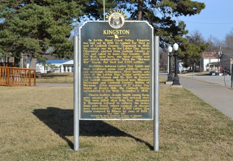
1. Kingston Marker front
Hostilities between Latter Day Saints and their neighbors arose over political, social and economic differences. First hostile acts were at the Latter Day Saints' settlements Adam-ondi-Ahman and De Witt in Daviess and Carroll counties. Involved were Missouri Militiamen and Caldwell County Militia of Mormons. After massacre of 17 Latter Day Saints at Haun's Mill, the Caldwell Militia surrendered at Far West, November 1, 1838.
Church leaders, Joseph Smith among them, were accused of treason and ordered shot. They were jailed when Brig. Gen. Alexander W. Doniphan refused to enforce the order. Some were freed, others escaped, as charges were unsustained. About 12,000 Latter Day Saints removed to Illinois by June of 1839.
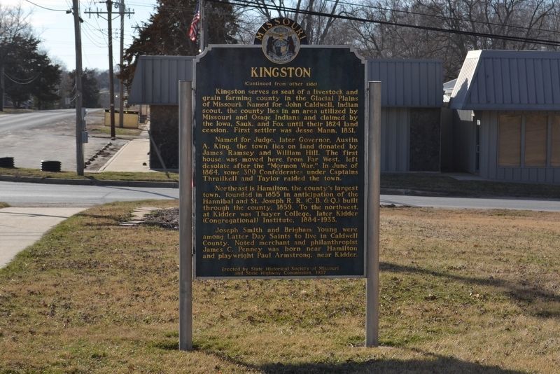
Kingston serves
this page online
Named for Judge, later Governor, Austin A. King, the town lies on land donated by James Ramsey and William Hill. The first house was moved here from Far West, left desolate after the "Mormon War." In June 1864, some 300 Confederates under Captains Thrailkell and Taylor raided the town.
Northeast is Hamilton, the county's largest town, founded in 1855 in anticipation of the Hannibal and St. Joseph R.R. (C.B.& Q.) built through the county, 1859. To the northwest, at Kidder was Thayer College, later Kidder (Congregational) Institute, 1884-1933.
Joseph Smith and Brigham Young were among Latter Day Saints to live in Caldwell County. Noted merchant and philanthropist James C. Penney was born near Hamilton and playwright Paul Armstrong, near Kidder.
Erected 1957 by State Historical Society of Missouri and State Highway Commission.
Topics and series.
Photographed by Michael E Sanchez, Jr., March 14, 2015
2. Kingston Marker back
Location. 39° 38.574′ N, 94° 2.315′ W. Marker is in Kingston, Missouri, in Caldwell County. It is on East Main Street just east of North Washington Street (Missouri Highway 13). Touch for map. Marker is at or near this postal address: 49 East Main Street, Kingston MO 64650, United States of America. Touch for directions.

Regionally, this marker is in North Missouri and in Greater Kansas City. It is also in the American Midwest, in the Lewis & Clark Corridor, and in the Corn Belt. Globally, it is in North America, the Western Hemisphere, the Western World, and the Anglosphere. Historically, it finds itself in what was once the territory of the Mississippian Culture, the Louisiana Purchase, and the Antebellum South.
Other nearby markers. At least 8 other markers are within 8 miles of this marker, measured as the crow flies: Veterans Memorial (within shouting distance of this marker); Caldwell County Sesquicentennial (within shouting distance of this marker); War Memorial (approx. 6.2 miles away); Zachariah (Zack) Davis Wheat (approx. 6.8 miles away); Hamilton (approx. 7.1 miles away); Hamilton Train Depot (approx. 7.3 miles away); James Cash Penney (approx. 7.3 miles away); Boyhood Home of J. C. Penney (approx. 7.3 miles away). Touch for a list and map of all markers in Kingston.
Additional keywords. acts of terrorism, Mormon War
Credits. This page was last revised on January 20, 2020. It was originally submitted on January 19, 2020, by Michael E Sanchez, Jr. of Kansas City, Missouri. This page has been viewed 823 times since then and 100 times this year. Photos: 1, 2. submitted on January 20, 2020, by Michael E Sanchez, Jr. of Kansas City, Missouri. • Devry Becker Jones was the editor who published this page.
