Front Royal in Warren County, Virginia — The American South (Mid-Atlantic)
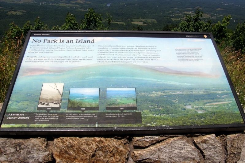
No Park is an Island
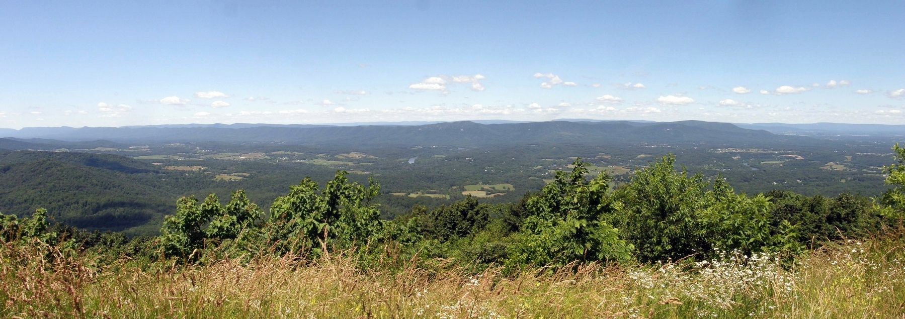
Skyline Drive was conceived and built so that people could enjoy views of the rural Shenandoah Valley and Virginia Piedmont. Indeed, the Valley looks like a folk art painting from up here – brush strokes of farms, homes, forests, and small businesses.
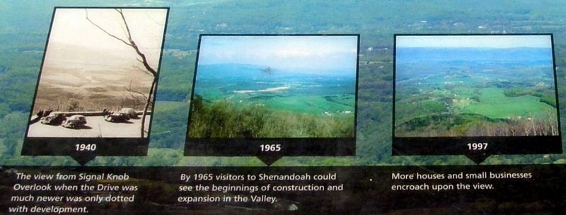
Though the landscape you see from the Signal Knob Overlook is mostly rural, it’s less rural than it was 23, 30, 50 years ago. More houses have been built, and more businesses. This view is losing its folk art character.
Shenandoah National Park is not as island. What happens outside its boundaries – expansion, industrialization, the building of cell phone towers – affects the park, and views from Skyline Drive. Park management can make decisions on how to best protect and preserve the resources inside Shenandoah. But because many of the views from our overlooks and peaks lie in towns and cities outside Park boundaries, surrounding communities also have a role in protecting the park’s views. There is a delicate balance between development and preservation.
From this overlook you can see Signal Knob, the northernmost peak of Massanutten Mountain. Much of the Massanutten remains undeveloped because it too is public land, protected as part of the George Washington National Forest. You can see the Shenandoah River flowing north to its confluence with the Potomac before emptying into the Chesapeake Bay.
Topics. This historical marker is listed in these topic lists: Parks & Recreational Areas • Roads & Vehicles.
Location. 38° 51.506′ N, 78° 12.567′ W. Marker is in Front Royal, Virginia, in Warren County. Marker is on Skyline Drive, on the right when traveling south. Touch for map. Marker is at or near this postal address: Signal Knob Overlook, Front Royal VA 22630, United States of America. Touch for directions.
Other nearby markers. At least 8 other markers are within 4 miles of this marker, measured as the crow flies. The Massanutten (a few steps from this marker); Indian Old Fields (approx. 1.1 miles away); Asbury Chapel (approx. 2˝ miles away); Belle Boyd and Jackson (approx. 2.9 miles away); Belle Boyd (approx. 3.1 miles away); William E. Carson (approx. 3.4 miles away); Prospect Hill Cemetery (approx. 3.9 miles away); Mosby's Men (approx. 3.9 miles away). Touch for a list and map of all markers in Front Royal.
Also see . . . Driving Skyline Drive. Official NPS site, with up-to-date information. (Submitted on January 31, 2020, by Larry Gertner of New York, New York.)
Credits. This page was last revised on April 13, 2020. It was originally submitted on January 31, 2020, by Larry Gertner of New York, New York. This page has been viewed 238 times since then and 26 times this year. Photos: 1, 2, 3. submitted on January 31, 2020, by Larry Gertner of New York, New York. • Bill Pfingsten was the editor who published this page.


