
Fort Lee in Prince George County, Virginia — The American South (Mid-Atlantic)
City Point and Hopewell
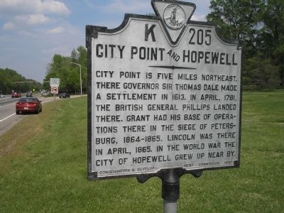
Photographed by Bill Coughlin, April 23, 2006
1. City Point and Hopewell Marker
Erected 1930 by Conservation & Development Commission. (Marker Number K-205.)
Topics and series. This historical marker is listed in these topic lists: Colonial Era • Settlements & Settlers • War, US Civil • War, US Revolutionary • War, World I. In addition, it is included in the Virginia Department of Historic Resources (DHR) series list. A significant historical month for this entry is April 1781.
Location. 37° 14.604′ N, 77° 21.122′ W. Marker is in Fort Lee, Virginia, in Prince George County. It is on Oaklawn Blvd (Virginia Route 36), on the right when traveling east. Marker is on Oaklawn Blvd, just west of Lee Avenue at the Ft. Lee entrance. Touch for map. Marker is in this post office area: Fort Lee VA 23801, United States of America. Touch for directions.

Regionally, this marker is in
this page online
Other nearby markers. At least 8 other markers are within walking distance of this marker: Women's Army Corps Training Center (here, next to this marker); Jordan Family Cemetery (approx. 0.2 miles away); Prelude to Petersburg (approx. ¼ mile away); a different marker also named The Siege of Petersburg (approx. ¼ mile away); Stephen Tyng Mather (approx. ¼ mile away); Battery 5 Trail (approx. ¼ mile away); Siege of Petersburg — Grant's First Offensive (approx. ¼ mile away); Artillery at Petersburg (approx. ¼ mile away).
Other markers no longer nearby. Confederate Battery 6 (was approx. 0.2 miles away but has been permanently removed); The Siege of Petersburg (was approx.
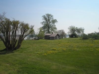
Photographed by Bill Coughlin, April 23, 2006
2. Grant's Cabin at City Point
During the siege of Petersburg, Lt. Gen. Ulysses S. Grant made his headquarters here at City Point.
Also see . . .
1. History and Hopewell Facts. City of Hopewell website. (Submitted on December 20, 2008, by Bill Coughlin of Woodland Park, New Jersey.)
2. Battle of Petersburg. City of Petersburg. (Submitted on December 20, 2008, by Bill Coughlin of Woodland Park, New Jersey.)
3. Grant's Headquarters. (Submitted on December 20, 2008, by Bill Coughlin of Woodland Park, New Jersey.)
Credits. This page was last revised on July 8, 2021. It was originally submitted on December 20, 2008, by Bill Coughlin of Woodland Park, New Jersey. This page has been viewed 1,244 times since then and 30 times this year. Photos: 1, 2. submitted on December 20, 2008, by Bill Coughlin of Woodland Park, New Jersey.
