Hot Springs in Garland County, Arkansas — The American South (West South Central)
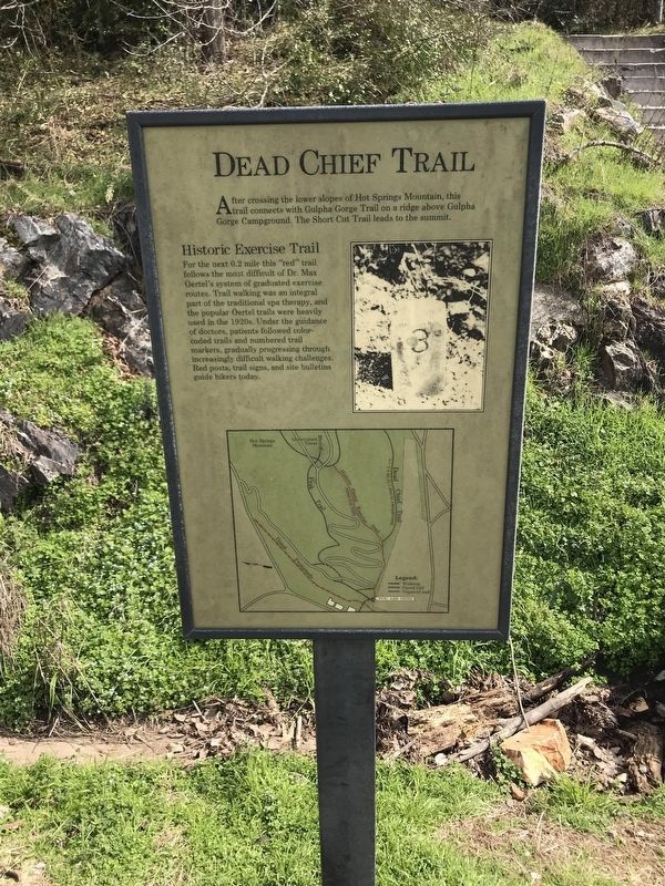
Dead Chief Trail
After crossing the lower slopes of Hot Springs Mountain, this "red" trail connects with Gulpha Gorge Trail on a ridge above Gulpha Gorge Campground. The Short Cut Trail leads to the summit.
Historic Exercise Trail
For the next 0.2 mile this "red” trail follows the most difficult of Dr. Max Oertel's system of graduated exercise routes. Trail walking was an integral part of the traditional spa therapy, and the popular Oertel trails were heavily used in the 1920s. Under the guidance of doctors, patients followed color-coded trails and numbered trail markers, gradually progressing through increasingly difficult walking challenges. Red posts, trail signs, and site bulletins guide hikers today.
Topics. This historical marker is listed in these topic lists: Parks & Recreational Areas • Roads & Vehicles • Science & Medicine.
Location. 34° 30.882′ N, 93° 3.173′ W. Marker is in Hot Springs, Arkansas, in Garland County. Marker is on Grand Promenade Trail, 0.2 miles south of Fountain Street, on the left when traveling south. Touch for map. Marker is at or near this postal address: 341 Central Avenue, Hot Springs National Park AR 71901, United States of America. Touch for directions.
Other nearby markers. At least 8 other markers are within walking distance of this marker. Ral Springs (a few steps from this marker); Peak Trail (within shouting distance of this marker); Superior Bathhouse (within shouting distance of this marker); Hale Bathhouse (within shouting distance of this marker); Site of the State Capitol of Arkansas (within shouting distance of this marker); Open Springs (within shouting distance of this marker); The Arlington Hotel (within shouting distance of this marker); Hot Springs' Building Boom (within shouting distance of this marker). Touch for a list and map of all markers in Hot Springs.
Also see . . . Oertel System of Graduated Exercise. National Park Service website entry (Submitted on February 22, 2020, by Steve Masler of Memphis, Tennessee.)
Credits. This page was last revised on September 15, 2021. It was originally submitted on February 22, 2020, by Steve Masler of Memphis, Tennessee. This page has been viewed 271 times since then and 30 times this year. Photo 1. submitted on February 22, 2020, by Steve Masler of Memphis, Tennessee. • Devry Becker Jones was the editor who published this page.
Editor’s want-list for this marker. A wide shot of the marker in context. • Can you help?
