Hagerstown in Washington County, Maryland — The American Northeast (Mid-Atlantic)
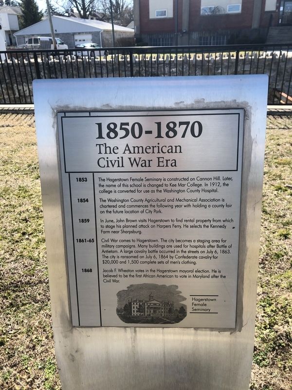
1850-1870
The American Civil War Era
1853
The Hagerstown Female Seminary is constructed on Cannon Hill. Later, the name of this school is changed to Kee Mar College. In 1912, the college is converted for use as the Washington County Hospital.
1854
The Washington County Agricultural and Mechanical Association is chartered and commences the following year with holding a county fair on the future location of City Park.
1859
In June, John Brown visits Hagerstown to find rental property from which to stage his planned attack on Harpers Ferry. He selects the Kennedy farm near Sharpsburg.
1861-65
Civil War comes to Hagerstown. The city becomes a staging area for military campaigns. Many buildings are used for hospitals after the Battle of Antietam. A large cavalry battle occurred in the streets on July 6, 1863. The city is ransomed on July 6, 1864 by Confederate cavalry for $20,000 and 1,500 complete sets of men's clothing.
1868
Jacob F. Wheaton votes in the Hagerstown mayoral election. He is believed to be the first African American to vote in Maryland after the Civil War.
Topics. This historical marker is listed in these topic lists: Civil Rights • Education • War, US Civil • Women. A significant historical date for this entry is July 6, 1863.
Location. 39° 37.935′ N, 77° 43.441′ W. Marker is in Hagerstown, Maryland, in Washington County. Marker is on West Memorial Boulevard, 0.1 miles west of South Potomac Street (Maryland Route 65), on the right when traveling west. Touch for map. Marker is at or near this postal address: 9 West Memorial Boulevard, Hagerstown MD 21740, United States of America. Touch for directions.
Other nearby markers. At least 8 other markers are within walking distance of this marker. 1870-1890 (a few steps from this marker); 1830-1850 (a few steps from this marker); 1910-1930 (a few steps from this marker); 1890-1910 (a few steps from this marker); 1810-1830 (within shouting distance of this marker); 1930-1950 (within shouting distance of this marker); 1790-1810 (within shouting distance of this marker); 1950-1970 (within shouting distance of this marker). Touch for a list and map of all markers in Hagerstown.
Credits. This page was last revised on July 18, 2020. It was originally submitted on March 1, 2020, by Devry Becker Jones of Washington, District of Columbia. This page has been viewed 291 times since then and 66 times this year. Photos: 1, 2. submitted on March 1, 2020, by Devry Becker Jones of Washington, District of Columbia.

