Hagerstown in Washington County, Maryland — The American Northeast (Mid-Atlantic)
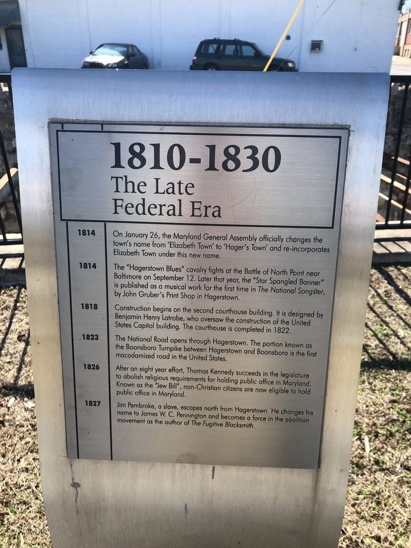
1810-1830
The Late Federal Era
1814
On January 26, the Maryland General Assembly officially changes the town's name from 'Elizabeth Town' to 'Hager's Town' and re-incorporates Elizabeth Town under this new name.
1814
The "Hagerstown Blues" cavalry fights at the Battle of North Point near Baltimore on September 12. Later that year, the "Star Spangled Banner" is published as a musical work for the first time in The National Songster, by John Gruber's Print Shop in Hagerstown.
1818
Construction begins on the second courthouse building. It is designed by Benjamin Henry Latrobe, who oversaw the construction of the United States Capitol building. The courthouse is completed in 1822.
1823
The National Road opens through Hagerstown. The portion known as the Boonsboro Turnpike between Hagerstown and Boonsboro is the first macadamized road in the United States.
1826
After an eight year effort, Thomas Kennedy succeeds in the legislature to abolish religious requirements for holding public office in Maryland. Known as the "Jew Bill", non-Christian citizens are now eligible to hold public office in Maryland.
1827
Jim Pembroke, a slave, escapes north from Hagerstown. He changes his name to James W. C. Pennington and becomes a force in the abolition movement as the author of The Fugitive Blacksmith.
Topics and series. This historical marker is listed in these topic lists: Abolition & Underground RR • African Americans • Arts, Letters, Music • Churches & Religion • Civil Rights • Industry & Commerce • Roads & Vehicles • Settlements & Settlers. In addition, it is included in the The Historic National Road series list. A significant historical date for this entry is January 26, 1814.
Location. 39° 37.929′ N, 77° 43.424′ W. Marker is in Hagerstown, Maryland, in Washington County. Marker is on West Memorial Boulevard just west of South Potomac Street (Maryland Route 65), on the right when traveling west. Touch for map. Marker is at or near this postal address: 9 West Memorial Boulevard, Hagerstown MD 21740, United States of America. Touch for directions.
Other nearby markers. At least 8 other markers are within walking distance of this marker. 1830-1850 (a few steps from this marker); 1790-1810 (a few steps from this marker); 1850-1870 (within shouting distance of this marker); 1770-1790 (within shouting distance of this marker); Before 1770 (within shouting distance of this marker); 1910-1930 (within shouting distance of this marker); Thomas Kennedy (within shouting distance of this marker); Matthias Peter Möller (within shouting distance of this marker). Touch for a list and map of all markers in Hagerstown.
Credits. This page was last revised on March 1, 2020. It was originally submitted on March 1, 2020, by Devry Becker Jones of Washington, District of Columbia. This page has been viewed 159 times since then and 18 times this year. Photos: 1, 2. submitted on March 1, 2020, by Devry Becker Jones of Washington, District of Columbia.

