Hagerstown in Washington County, Maryland — The American Northeast (Mid-Atlantic)
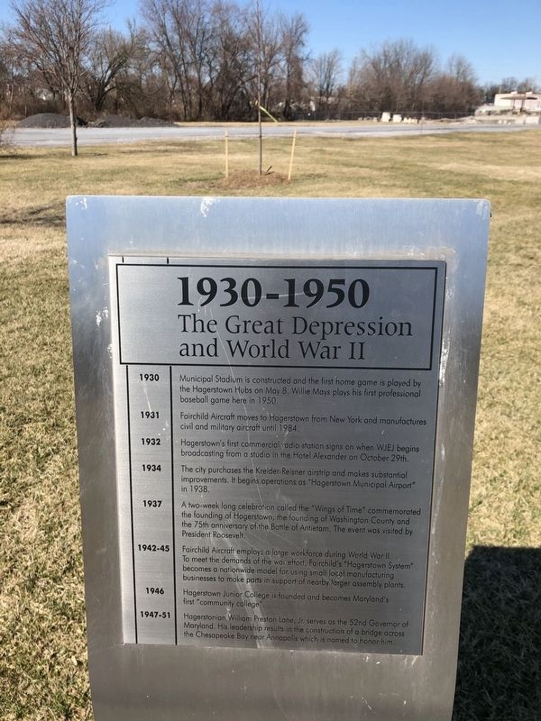
1930-1950
The Great Depression and World War II
1930
Municipal Stadium is constructed and the first home game is played by Hagerstown Hubs on May 8. Willie Mays plays his first professional baseball game here in 1950.
1931
Fairchild Aircraft moves to Hagerstown from New York and manufactures civil and military aircraft until 1984.
1932
Hagerstown's first commercial radio station signs on when WJEJ begins broadcasting from a studio in the Hotel Alexander on October 29th.
1934
The city purchases the Kreider-Reisner airstrip and makes substantial improvements. It begins operations as "Hagerstown Municipal Airport" in 1938.
1937
A two-week long celebration called the "Wings of Time" commemorated the founding of Hagerstown, the founding of Washington County, and the 75th anniversary of the Battle of Antietam. The event was visited by President Roosevelt.
1942-45
Fairchild Aircraft employs a large workforce during World War II. To meet the demands of the war effort, Fairchild's "Hagerstown System" becomes a nationwide model for using small local manufacturing businesses to make parts in support of nearby larger assembly plants.
1946
Hagerstown Junior College is founded and becomes Maryland's first "community college".
1947-51
Hagerstonian William Preston Lane, Jr. serves as the 52nd Governor of Maryland. His leadership results in the construction of a bridge across the Chesapeake Bay near Annapolis which is named to honor him.
Topics. This historical marker is listed in these topic lists: Air & Space • Bridges & Viaducts • Communications • Education • Industry & Commerce • Settlements & Settlers • Sports • War, US Civil • Waterways & Vessels. A significant historical date for this entry is May 8, 1930.
Location. 39° 37.95′ N, 77° 43.437′ W. Marker is in Hagerstown, Maryland, in Washington County. Marker is on West Memorial Boulevard, 0.1 miles west of South Potomac Street (Maryland Route 56), on the right when traveling west. Touch for map. Marker is at or near this postal address: 9 West Memorial Boulevard, Hagerstown MD 21740, United States of America. Touch for directions.
Other nearby markers. At least 8 other markers are within walking distance of this marker. 1910-1930 (a few steps from this marker); 1950-1970 (a few steps from this marker); 1890-1910 (within shouting distance of this marker); 1850-1870 (within shouting distance of this marker); 1830-1850 (within shouting distance of this marker); 1970-1990 (within shouting distance of this marker); 1870-1890 (within shouting distance of this marker); 1810-1830 (within shouting distance of this marker). Touch for a list and map of all markers in Hagerstown.
Credits. This page was last revised on March 2, 2020. It was originally submitted on March 2, 2020, by Devry Becker Jones of Washington, District of Columbia. This page has been viewed 139 times since then and 14 times this year. Photos: 1, 2. submitted on March 2, 2020, by Devry Becker Jones of Washington, District of Columbia.

