Austin in Lander County, Nevada — The American Mountains (Southwest)
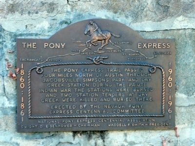
The Pony Express
Erected by the Nevada Pony Express Centennial Committee.
National Pony Express Centennial Association
Dwight D. Eisenhower--Chairman
Waddell F. Smith--President
Erected by Nevada Pony Express Centennial Committee.
Topics and series. This historical marker is listed in these topic lists: Communications • Native Americans • Roads & Vehicles. In addition, it is included in the Former U.S. Presidents: #34 Dwight D. Eisenhower, and the Pony Express National Historic Trail series lists.
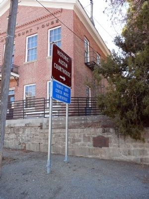
Location. 39° 29.533′ N, 117° 4.233′ W. Marker is in Austin, Nevada, in Lander County. Marker is on Highway 50, on the right when traveling east. Touch for map. Marker is in this post office area: Austin NV 89310, United States of America. Touch for directions.
Other nearby markers. At least 8 other markers are within walking distance of this marker. Lander County Courthouse (within shouting distance of this marker); Austin Masonic and Oddfellows Hall (1867) (within shouting distance of this marker); Austin Churches (within shouting distance of this marker); Votes for Women (about 400 feet away, measured in a direct line); Austin City Hall (about 400 feet away); St. Augustine (about 400 feet away); Austin Methodist Church (about 400 feet away); Austin City Railway (about 400 feet away). Touch for a list and map of all markers in Austin.
Also see . . . Pony Express National Historic Trail. (Submitted on December 22, 2008, by Karen Key of Sacramento, California.)
Credits. This page was last revised on June 16, 2016. It was originally submitted on December 22, 2008, by Karen Key of Sacramento, California. This page has been viewed 1,421 times since then and 27 times this year. Photos: 1, 2. submitted on December 22, 2008, by Karen Key of Sacramento, California.

