Near Tuxtla Chico, Chiapas, Mexico — The Southeast (North America)
Izapa Archaeological Zone
Zona Arqueológica
Patrimonio Cultural de Chiapas y de la Nación
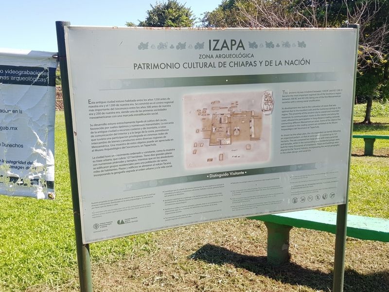
Esta antigua ciudad estuvo habitada entre los años 1250 antes de nuestra era y el 1200 de nuestra era. Se convirtió en el centro regional más importante del Soconusco entre los años 500 antes de nuestra era y 250 de nuestra era, siendo una de las primeras sociedades mesoamericanas con una marcada estratificación social.
Su desarrollo estuvo estrechamente ligado al cultivo del cacao, favorecido por suelos óptimos y numerosos manantiales. La cercanía de la antigua ciudad a recursos costeros y de montaña, a rutas de comunicación del interior y a lo largo de la costa, permitieron que tuviera una participación privilegiada en extensas redes de intercambio de bienes y productos entre diversas regiones de Mesoamérica. Una muestra de estos objetos puede ser apreciada en el Museo Arqueológico del Soconusco, en Tapachula.
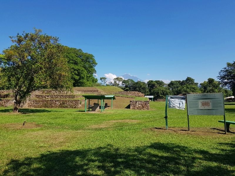
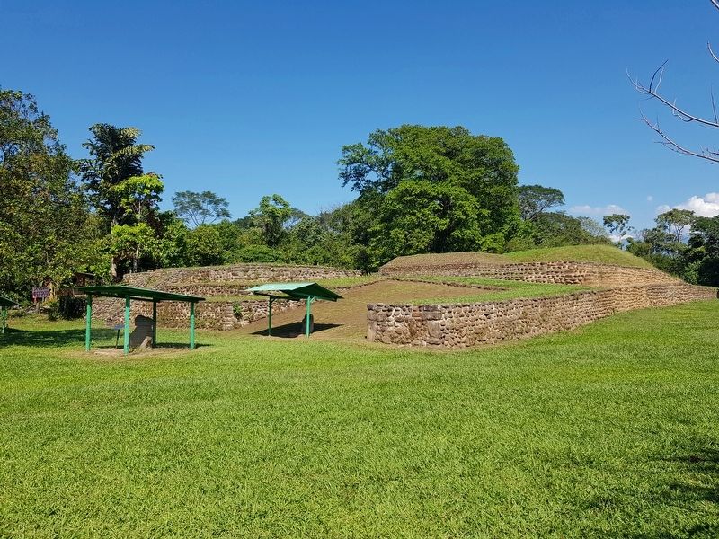
La ciudad tuvo un crecimiento ordenado y constante, como lo muestra su traza urbana, que cubría 127 hectáreas. Tiene diez grandes plazas con numerosas pirámides y templos, mientras que en los alrededores se edificaron grupos residenciales para una población de varios miles de habitantes. Plazas y edificios se alinearon al volcán Tacaná, incorporando la geografía sagrada al orden urbano y a la vida social.
Distinguido Visitante (Indicaciones para los visitantes, no transcritas)
Izapa
Archaeological Zone
Cultural Heritage of Chiapas and the Nation
This ancient city was inhabited between 1250 BC and AD 1200. It became the most important regional city of the Soconusco region between 500 BC and AD 250, being one of the first Mesoamerican societies with a strong social stratification.
Its development was tied to the cultivation of cacao that was optimal due to the excellent soils and the numerous springs in the region. The proximity of the ancient city to coastal and mountain resources, to communication routes to the interior and along the coast, allowed the participation in long distance trading networks connecting different Mesoamerican areas. Some of the objects that were involved in this trading system are exhibited at the Museo Arqueológico del Soconusco at Tapachula.
As shown by the urban plan, the city expanded constantly following an organized pattern, so that at some point covered up to 127 hectares. The site contained ten large plazas with many pyramids and temples, while in the surrounding area residential
groups were built for many thousands of inhabitants. Plazas and buildings were aligned to the Tacaná Volcano incorporating the sacred geography in the urban design and social life.
Distinguished visitor (Instructions for visitors, not transcribed)
Erected by Instituto Nacional de Antropología e Historia (INAH).
Topics. This historical marker is listed in these topic lists: Anthropology & Archaeology • Horticulture & Forestry • Native Americans. A significant historical year for this entry is 1250.
Location. 14° 55.37′ N, 92° 10.809′ W. Marker is near Tuxtla Chico, Chiapas. Marker is on Federal Route 200 just west of Avenida Obregón Sur, on the right when traveling west. Touch for map. Marker is in this post office area: Tuxtla Chico CHIS 30870, Mexico. Touch for directions.
Other nearby markers. At least 5 other markers are within 14 kilometers of this marker, measured as the crow flies. Group F at Izapa Archaeological Zone (within shouting distance of this marker); The End of Bʼakʼtun 13 (approx. 9.1 kilometers away); Tapachula and Chiapas (approx. 9.2 kilometers away); Benito Juárez (approx. 12.3 kilometers away in Guatemala); General Justo Rufino Barrios (approx. 13.6 kilometers away in Guatemala).
Also see . . . Izapa Archaeological Zone. (Submitted on March 7, 2020, by J. Makali Bruton of Accra, Ghana.)
Additional commentary.
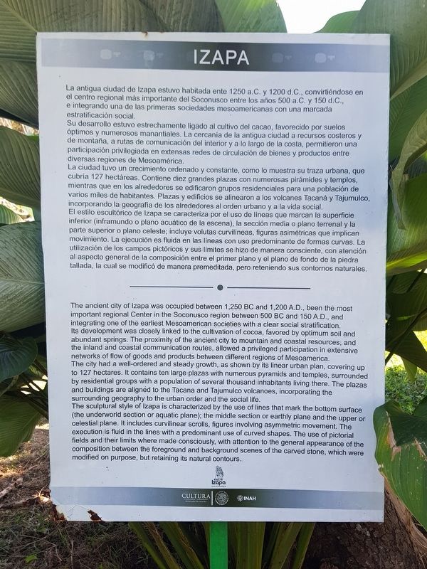
1. Text of additional, nearby Izapa Marker (see photo #2)
La antigua ciudad de Izapa estuvo habitada ente 1250 a.C. y 1200 d.C., convirtiéndose en el centro regional más importante del Soconusco entre los años 500 a.C. y 150 d.C., e integrando una de las primeras sociedades mesoamericanas con una marcada estratificación social. Su desarrollo estuvo estrechamente ligado al cultivo del cacao, favorecido por suelos óptimos y numerosos manantiales. La cercanía de la antigua ciudad a recursos costeros y de montaña, a rutas de comunicación del interior y a lo largo de la costa, permitieron una participación privilegiada en extensas redes de circulación de bienes y productos entre diversas regiones de Mesoamérica. La ciudad tuvo un crecimiento ordenado y constante, como lo muestra su traza urbana, que cubría 127 hectáreas. Contiene diez grandes plazas con numerosas pirámides y templos, mientras que en los alrededores se edificaron grupos residenciales para una población de varios miles de habitantes. Plazas y edificios se alinearon a los volcanes Tacaná y Tajumulco, incorporando la geografía de los alrededores al orden urbano y a la vida social. El estilo escultórico de Izapa se caracteriza por el uso de líneas que marcan la superficie inferior (inframundo
o plano acuático de la escena), la sección media o plano terrenal y la parte superior o plano celeste; incluye volutas curvilíneas, figuras asimétricas que implican movimiento. La ejecución es fluida en las líneas con uso predominante de formas curvas. La utilización de los campos pictóricos y sus límites se hizo de manera consciente, con atención al aspecto general de la composición entre el primer plano y el plano de fondo de la piedra tallada, la cual se modificó de manera premeditada, pero reteniendo sus contornos naturales.
Izapa
The ancient city of Izapa was occupied between 1,250 BC and 1,200 A.D., been the most
important regional Center in the Soconusco region between 500 BC and 150 A.D., and integrating one of the earliest Mesoamerican societies with a clear social stratification. Its development was closely linked to the cultivation of cocoa, favored by optimum soil and abundant springs. The proximity of the ancient city to mountain and coastal resources, and the inland and coastal communication routes, allowed a privileged participation in extensive networks of flow of goods and products between different regions of Mesoamerica.
The city had a well-ordered and steady growth, as shown by its linear urban plan, covering up to 127 hectares. It contains ten large plazas with numerous pyramids and temples, surrounded
Photographed By J. Makali Bruton, December 20, 2019
5. Stela 22 Marker
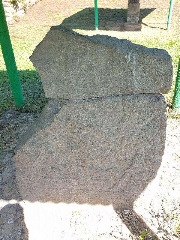
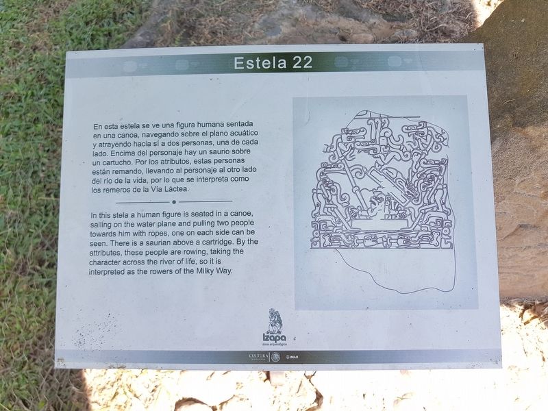
En esta estela se ve una figura humana sentada en una canoa, navegando sobre el plano acuático y atrayendo hacia sí a dos personas, una de cada lado. Encima del personaje hay un saurio sobre un cartucho. Por los atributos, estas personas están remando, llevando al personaje al otro lado del río de la vida, por lo que se interpreta como los remeros de la Vía Láctea.
Izapa
In this stela a human figure is seated in a canoe, sailing on the water plane and pulling two people towards him with ropes, one on each side can be seen. There is a saurian above a cartridge. By the attributes, these people are rowing, taking the character across the river of life, so it is interpreted as the rowers of the Milky Way.
The sculptural style of Izapa is characterized by the use of lines that mark the bottom surface (the underworld section or aquatic plane); the middle section or earthly plane and the upper or celestial plane. It includes curvilinear scrolls, figures involving asymmetric movement. The execution is fluid in the lines with a predominant use of curved shapes. The use of pictorial fields and their limits where made consciously, with attention to the general appearance of the composition between the foreground and background scenes of the carved stone, which were modified on purpose, but retaining its natural contours.
— Submitted March 7, 2020, by J. Makali Bruton of Accra, Ghana.
Credits. This page was last revised on March 7, 2020. It was originally submitted on March 7, 2020, by J. Makali Bruton of Accra, Ghana. This page has been viewed 119 times since then and 9 times this year. Photos: 1, 2, 3, 4, 5, 6. submitted on March 7, 2020, by J. Makali Bruton of Accra, Ghana.
