Newtown Township near Newtown Square in Delaware County, Pennsylvania — The American Northeast (Mid-Atlantic)
Paper Mill House & Museum / Mills Along Darby Creek
Newtown Square Historical Society

Photographed By Devry Becker Jones (CC0), March 7, 2020
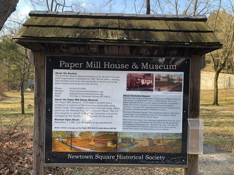
1. Paper Mill House & Museum side of the marker
About the Society
The Newtown Square Historical Society is an all-volunteer non-profit organization established in 1984. We are always seeking new members and those who would like to be involved in the goals, mission and projects of the Society.
Phone: (610) 975-0290
Website: www.historicnewtownsquare.org
Email: [email protected]
Mail: P.O. Box 3, Newtown Square, PA 19073
About the Paper Mill House Museum
The Paper Mill House (c. 1770-oldest section) was a residence to workers of the numerous local mills along Darby Creek. The building was restored in the early 1980's and is on the National Register of Historic Places. The 4.5 acre property is owned by Newtown Township and jointly managed by the Historical Society and the Township.
Museum Open Hours
Saturdays 1-4 PM, July & August or by appointment
About Newtown Square
Newtown Township was planned in England by William Penn in 1681 as the 1st inland town west of Philadelphia. This "New Town" was laid around a center square (originally at Newtown Street and Goshen Roads) or "townstead" surrounded by farmland. Newtown was originally part of Chester County and is the oldest township located in Delaware County.
The name "Newtown Square" was established about 1820 when a postal office was established near the intersection of West Chester Pike and Newtown Street Road.
While Newtown Square has developed significantly from its rural beginnings, while many old homes and structures dot the landscape reminding us of days gone by. Newtown has over 100 sites on our local inventory of historic resources, all of which can be viewed with photos and descriptions on our website.
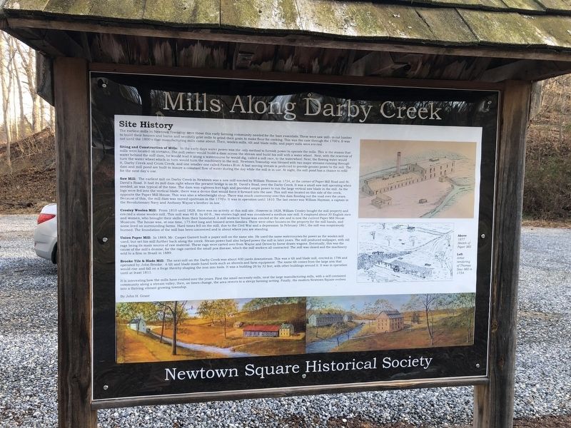
Site History
The earliest mills in Newtown Township were those this early farming community needed for the bare essentials. These were saw mills to cut lumber to build their houses and barns and secondly grist mills to grind their grain to make flour for cooking. This was the case through the 1700's. It was not until the 1800's that manufacturing mills came about. Then, woolen mills, tilt and blade mills, and paper mills were erected.
Siting and Construction of Mills: In the early days water power was the only method to furnish power to operate them ills. This is the reason that mills were located on streams. The mill owner would build a dam across the stream and build his mill with a water wheel. Next, with the reservoir of water behind the mill dam, he would lead it along a watercourse he would dig, called a mill race, to

Photographed By Devry Becker Jones (CC0), March 7, 2020
2. Mills Along Darby Creek side of the marker
Saw Mill: The earliest mill on Darby Creek in Newtown was a saw mill erected by William Thomas in 1754, at the corner of Paper Mill Road and St. David's Road. It had its mill dam right where the present bridge is on St. David's Road, over the Darby Creek. IT was a small saw mill operating when needed, and was typical of the time. The dam was eighteen feet high and provided ample power to run the large vertical saw blade in the mill. As the logs were fed into the vertical blade, there was a device that would force it forward into the saw. This mill was located on this side of the creek, opposite the Paper Mill House. This was also a waterwheel shop. There was much controversy over this dam flooding out the road over the years. Because of this, the dam was moved upstream in the 1770's. It was in operation until 1810. The last owner was William Hayman, a captain in

Photographed By Devry Becker Jones (CC0), March 7, 2020
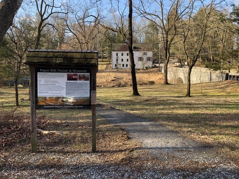
3. Paper Mill House & Museum / Mills Along Darby Creek Marker
Crosley Woolen Mill: From 1810 until 1828, there was no activity at this mill site. However in 1828, William Crosley bought the mill property and erected a stone woolen mill. This mill was 40 ft. by 60 ft., two stories high and was considered a medium size mill. It employed about 30 English men and women, who brought their skills from their homeland. A mill workers' house was erected at the site and is now the current Paper Mill House Museum. The house was, at one time, 175 feet long and housed seven families. There were other houses on the property for the mill hands, and some lived on surrounding farms. Hard times fell on the mill, due to the Civil War and a depression. In February 1861, the mill was suspiciously burned. The foundation of the mill has been uncovered and is about where you are standing.
Union Paper Mill: In 1869, Mr. Casper Garrett built a paper mill on the same site. He used the same watercourses for power as the woolen mill used, but set his mill further back along the creek. Steam power had also helped power the mill in later years. The mill produced wallpaper, with old rags being its main source of raw material. These rags were carted over from Wayne and Devon by horse drawn wagons. Eventually, this was the cause of the mill's demise, for the rags carried the small pox disease, which the ill workers all contracted. The mill was closed and the machinery sold to a firm in Brazil in 1889.
Brooke Tile & Blade Mill: The next mill on the Darby Creek was about 400 yards downstream. This was a tilt and blade mill, erected in 1796 and operated by John Brooke. A tilt and blade made hand tools such as shovels and farm equipment. The name tilt comes from the large arm that would rise and fall on a forge thereby shaping the iron into tools. It was a building 26 by 32 feet, with other buildings around it. It was in operation until at least 1811.
It is interesting how the mills have evolved over the years. First the small necessity mills, next the large manufacturing mills, with a self-contained community along a stream valley, then, as times change, the area reverts to a sleepy farming setting. Finally, the modern Newtown Square evolves into a thriving vibrant growing township.
By John H. Grant
Erected by Newtown Square Historical Society.
Topics and series. This historical marker is listed in these topic lists: Agriculture • Colonial Era • Industry & Commerce • Settlements & Settlers • Waterways & Vessels. In addition, it is included in the Pennsylvania, Newtown Square Historical Preservation Society series list. A significant historical month for this entry is February 1861.
Location. 40° 1.056′ N, 75° 24.288′ W. Marker is near Newtown Square, Pennsylvania, in Delaware County. It is in Newtown Township. Marker is on St. Davids Road, 0.1 miles north of Paper Mill Road, on the left when traveling south. Touch for map. Marker is at or near this postal address: 19 Dunminning Road, Newtown Square PA 19073, United States of America. Touch for directions.
Other nearby markers. At least 8 other markers are within 2 miles of this marker, measured as the crow flies. Paper Mill House (about 300 feet away, measured in a direct line); Harrison House (about 300 feet away); St. David's Church (approx. 0.4 miles away); Nathan Matlack House (approx. half a mile away); Thomas Moore House (approx. half a mile away); George H. Earle III (approx. one mile away); 7th Day Baptist Cemetery (approx. 1.4 miles away); Square Inn (approx. 1˝ miles away). Touch for a list and map of all markers in Newtown Square.
Credits. This page was last revised on February 7, 2023. It was originally submitted on March 8, 2020, by Devry Becker Jones of Washington, District of Columbia. This page has been viewed 302 times since then and 22 times this year. Photos: 1, 2, 3. submitted on March 8, 2020, by Devry Becker Jones of Washington, District of Columbia.