Near Escalante in Garfield County, Utah — The American Mountains (Southwest)
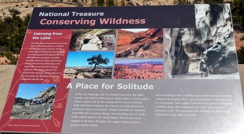
Conserving Wildness
National Treasure
A Place for Solitude
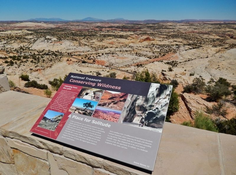
In this vast landscape, you can immerse yourself in the sights, sounds, and textures of the natural world. Listen to a penetrating silence, broken only by the rasping call of a raven overhead. Walk amid rock formations that conceal yet-to-be-discovered prehistoric plants and animals. Glimpse the birth of a hundred waterfalls after a summer deluge. You're looking out over some of the wildest lands in the United States. The last area to be mapped in the lower 48 states, this rugged region remains a sparsely roaded frontier.
You're standing in the 1.9-million-acre Grand Staircase-Escalante National Monument, where conserving the land's wild character is a top priority. These public lands don't just protect astounding scientific values. They safeguard one of the rarest natural resources of all — the opportunity for solitude — in a landscape sculpted by wind, water, and time.
Learning from the Land
The public lands of Grand Staircase-Escalante National Monument conserve a wealth of scientific and cultural resources. On the remote Kaiparowits Plateau, paleontologists are unearthing prehistoric species, like duck-billed dinosaurs and gigantic crocodiles, that help explain the origins of present-day life on earth. Massive petrified logs in the Circle Cliffs reveal clues about long-ago ecosystems. The winding canyons of the Escalante River drainage conceal artifacts of ancient peoples that illuminate an enduring relationship with this land.
Topics. This historical marker is listed in these topic lists: Animals • Anthropology & Archaeology • Native Americans • Paleontology.
Location. 37° 44.788′ N, 111° 27.229′ W. Marker is near Escalante, Utah, in Garfield County. Marker is on Utah Route 12 at milepost 69, on the left when traveling east. Marker is located at the Head of the Rocks Overlook on Utah Scenic Byway 12, about 10 miles east of Escalante. Touch for map. Marker is in this post office area: Escalante UT 84726, United States of America. Touch for directions.
Other nearby markers. At least 7 other markers are within 9 miles of this marker, measured as the crow flies. Building the Million-dollar Road (a few steps from this marker); View from Head of the Rocks (within shouting distance of this marker); Old Boulder Mail Trail (approx. 7.1 miles away); Old White Church (approx. 8.2 miles away); L.D.S. Tithing Office (approx. 8.2 miles away); First Public Building (approx. 8.2 miles away); Escalante (approx. 8.3 miles away).
Credits. This page was last revised on March 16, 2020. It was originally submitted on March 14, 2020, by Cosmos Mariner of Cape Canaveral, Florida. This page has been viewed 117 times since then and 14 times this year. Photos: 1. submitted on March 15, 2020, by Cosmos Mariner of Cape Canaveral, Florida. 2. submitted on March 16, 2020, by Cosmos Mariner of Cape Canaveral, Florida.

