Near Collinsville in St. Clair County, Illinois — The American Midwest (Great Lakes)
Grand Plaza
Heart of the City
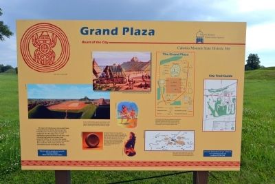
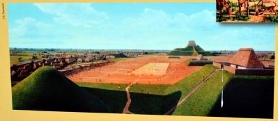
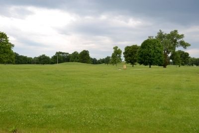
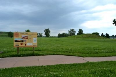
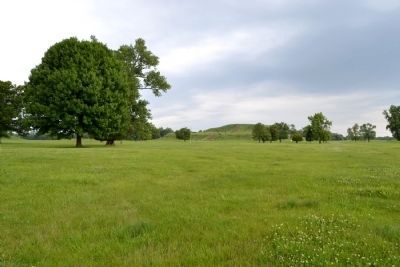
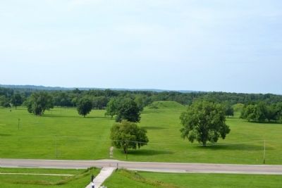
The heart of Cahokia was the Grand Plaza situated between Monks Mound and the Twin Mounds. Archaeological testing has confirmed that the plaza was, in part, artificially created by filling in low areas and reducing high points to create a flat, prepared surface. It was here that public gatherings, markets and festivals would take place and the chief could address the assembled masses from Monks Mound.
(Upper Left Illustration Caption)
Spider motif on a shell gorget
(Middle Left Illustration Caption)
A view of central Cahokia, looking north between the Twin Mounds, across the Grand Plaza to Monks Mound. In the plaza is a chunkey field and traders’ shelters can be seen along the plaza’s edge, in front of the homes of the elite.
(Upper Central Illustration Caption)
View of daily life and activities in and around the Grand Plaza
(Lower Central Images and Illustration Caption)
The Game of chunkey, as it was called by Southeastern Indians, was apparently popular at Cahokia. Many chunkey stones, or discoidals, have been found here, such as this one from Mound 72 (left). The game was played by two men; one would roll the stone then both would throw lances or markers to where they thought the chunkey would stop rolling (above). A stone effigy pipe (right) from Oklahoma depicts a player preparing to roll a chunkey stone.
(Upper Central Map Caption(
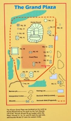
The 40-acre Grand Plaza was bordered on the north by Monks Mound and on the south by the Twin Mounds (59 & 60). Mounds 49 and 56 are located within the Plaza, mounds 51, 50, 54, and 55 mark the east side, and mounds 48 and 57 mark the western limits.
(Lower Central Map Caption)
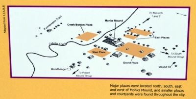
Major plazas were located north, south, east and west of Monks Mound, and smaller plazas and courtyards were found throughout the city.
Erected by Cahokia Mounds State Historic Site.
Topics. This historical marker is listed in these topic lists: Anthropology & Archaeology • Native Americans • Settlements & Settlers.
Location. 38° 39.331′ N, 90° 3.636′ W. Marker is near Collinsville, Illinois, in St. Clair County. Marker can be reached from Ramey Street, 0.2 miles south of Collinsville Road. Marker is located in Cahokia Mounds State Historic Site west of the Interpretive Center; the above directions are to the Interpretive Center. Touch for map. Marker is at or near this postal address: 30 Ramey St, Collinsville IL 62234, United States of America. Touch for directions.
Other nearby markers. At least 8 other markers are within walking distance of this marker. Interpretive Center Tract (within shouting distance of this marker); Mound 55 (about
400 feet away, measured in a direct line); You Are Walking Where a Cahokia Neighborhood Once Stood (about 600 feet away); Cahokia Mounds (about 600 feet away); Cahokia (about 600 feet away); The South Stockade (approx. 0.2 miles away); Mound 50 (approx. 0.2 miles away); Mound 51 (approx. 0.2 miles away). Touch for a list and map of all markers in Collinsville.
Also see . . . Cahokia Mounds State Historic Site. Official website of the Cahokia Mounds State Historic Site. (Submitted on June 28, 2014.)
Credits. This page was last revised on March 22, 2022. It was originally submitted on June 28, 2014, by Duane Hall of Abilene, Texas. This page has been viewed 892 times since then and 100 times this year. Last updated on March 26, 2020, by Jason Voigt of Glen Carbon, Illinois. Photos: 1, 2, 3, 4, 5, 6, 7, 8. submitted on June 28, 2014, by Duane Hall of Abilene, Texas. • Devry Becker Jones was the editor who published this page.
