Emmitsburg in Frederick County, Maryland — The American Northeast (Mid-Atlantic)
Town Square
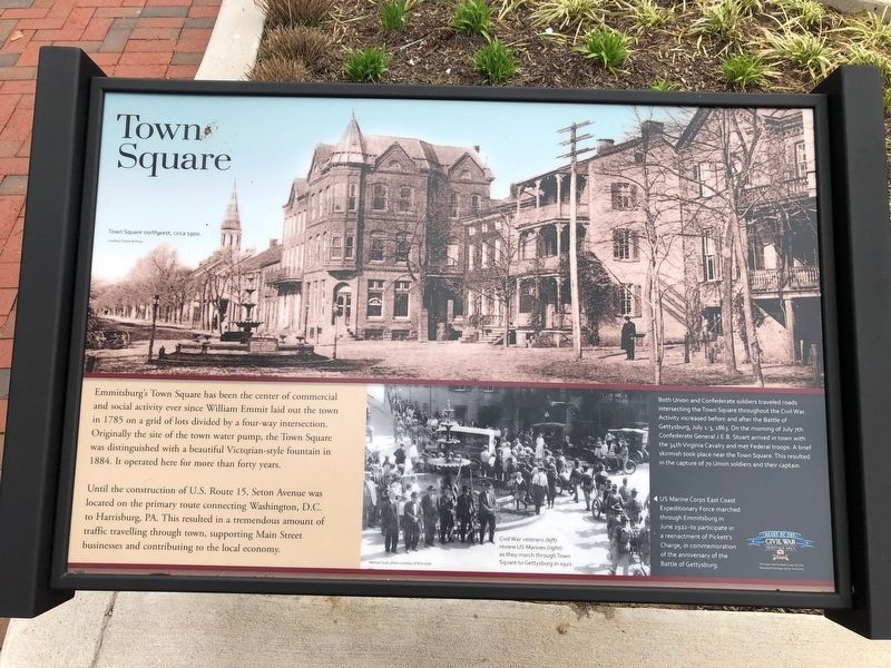
Emmitsburg's Town Square has been the center of commercial and social activity since William Emmit laid out the town in 1785 on a grid of lots and divided by a four-way intersection. Originally the site of the town water pump, the Town Square was distinguished with a beautiful Victorian-style fountain in 1884. It operated here for more than forty years.
Until the construction of U.S. Route 15, Seton Avenue was located on the primary route connecting Washington, D.C. to Harrisburg, PA. This resulted in a tremendous amount of traffic travelling through town, supporting Main Street businesses and contributing to the local economy.
[Captions:]
Both Union and Confederate soldiers traveled roads intersecting the Town Square throughout the Civil War. Activity increased before and after the Battle of Gettysburg, July 1-3, 1863. On the morning of July 7th Confederate General J.E.B. Stuart arrived in town with the 34th Virginia Cavalry and met Federal troops. A brief skirmish took place near the Town Square. This resulted in the capture of 70 Union soldiers and their captain.
US Marine Corps East Coast Expeditionary Force marched through Emmitsburg in June 1922—to participate in a reenactment of Pickett's Charge, in commemoration of the anniversary of the Battle of Gettysburg.
Erected by Maryland Heritage Area Authority.
Topics. This historical marker is listed in these topic lists: Industry & Commerce • Roads & Vehicles • Settlements & Settlers • War, US Civil. A significant historical month for this entry is June 1922.
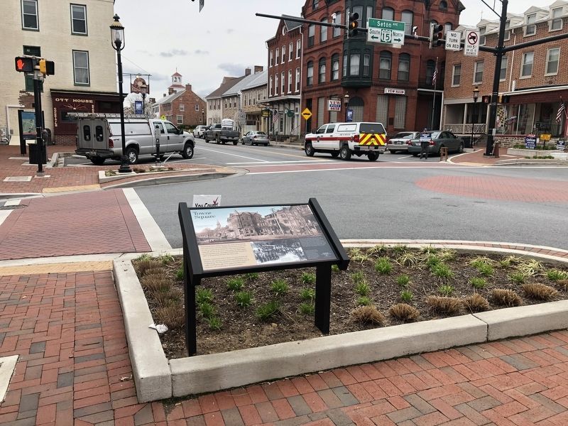
Location. 39° 42.275′ N, 77° 19.61′ W. Marker is in Emmitsburg, Maryland, in Frederick County. Marker is at the intersection of South Seton Avenue (Business U.S. 15) and East Main Street (Maryland Route 140), on the right when traveling north on South Seton Avenue. Touch for map. Marker is at or near this postal address: 22 S Seton Ave, Emmitsburg MD 21727, United States of America. Touch for directions.
Other nearby markers. At least 8 other markers are within walking distance of this marker. The Town of Emmitsburg, Maryland (a few steps from this marker); Emmitsburg (within shouting distance of this marker); Emmitsburg Memorial Post (within shouting distance of this marker); Francis Xavier Elder (within shouting distance of this marker); Emmitsburg Maryland Roll of Honor World War II (within shouting distance of this marker); Viet Nam Conflict Memorial (within shouting distance of this marker); Korean War Memorial (about 300 feet away, measured in a direct line); Operation Urgent Fury and Lebanese Civil War Memorial (about 300 feet away). Touch for a list and map of all markers in Emmitsburg.
Credits. This page was last revised on March 27, 2020. It was originally submitted on March 27, 2020, by Devry Becker Jones of Washington, District of Columbia. This page has been viewed 154 times since then and 7 times this year. Photos: 1, 2. submitted on March 27, 2020, by Devry Becker Jones of Washington, District of Columbia.

