Near Pasadena in Anne Arundel County, Maryland — The American Northeast (Mid-Atlantic)
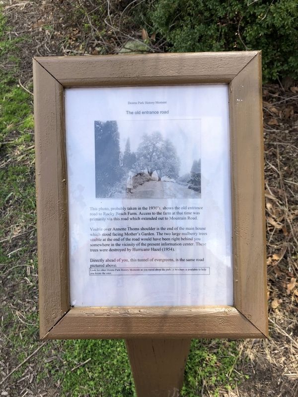
The old entrance road
Downs Park History Moment
This photo, probably taken in the 1930's, shows the old entrance road to Rocky Beach Farm. Access to the farm at that time was primarily via this road which extended out to Mountain Road.
Visible over Annette Thoms shoulder is the end of the main house which stood facing Mother's Garden. The two large mulberry trees visible at the end of the road would have been right behind you somewhere in the vicinity of the present information center. These trees were destroyed by Hurricane Hazel (1954).
Directly ahead of you, this tunnel of evergreens, is the same road pictured above.
Look for other Downs Park History Moments as you travel about the park. A brochure is available to help you locate the sites.
Topics. This historical marker is listed in these topic lists: Agriculture • Horticulture & Forestry • Roads & Vehicles.
Location. 39° 6.617′ N, 76° 26.043′ W. Marker is near Pasadena, Maryland, in Anne Arundel County. Marker is on Chesapeake Bay Drive, 0.2 miles north of John Downs Loop, on the left when traveling north. Touch for map. Marker is in this post office area: Pasadena MD 21122, United States of America. Touch for directions.
Other nearby markers. At least 8 other markers are within walking distance of this marker. Mother's Garden (within shouting distance of this marker); Summer House on the Bay (within shouting distance of this marker); The Wishing Bench (within shouting distance of this marker); Garden Gazebo (within shouting distance of this marker); The Rocky Beach Oyster Farm (within shouting distance of this marker); The Chesapeake Bay (about 300 feet away, measured in a direct line); Improvements on the Bayfront (about 500 feet away); Kids on the Farm (approx. 0.2 miles away). Touch for a list and map of all markers in Pasadena.
Credits. This page was last revised on April 5, 2020. It was originally submitted on April 5, 2020, by Devry Becker Jones of Washington, District of Columbia. This page has been viewed 149 times since then and 12 times this year. Photos: 1, 2. submitted on April 5, 2020, by Devry Becker Jones of Washington, District of Columbia.

