Saint John in Saint John County, New Brunswick — The Atlantic Provinces (North America)
Navy Island (Ouigoudy Island)
— Harbour Passage Trail —
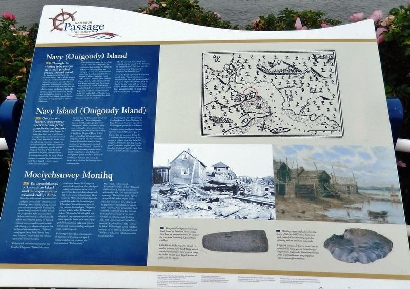
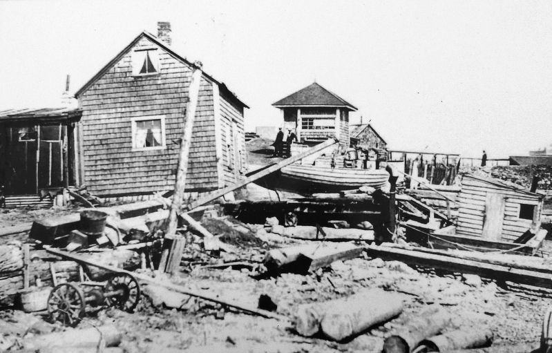
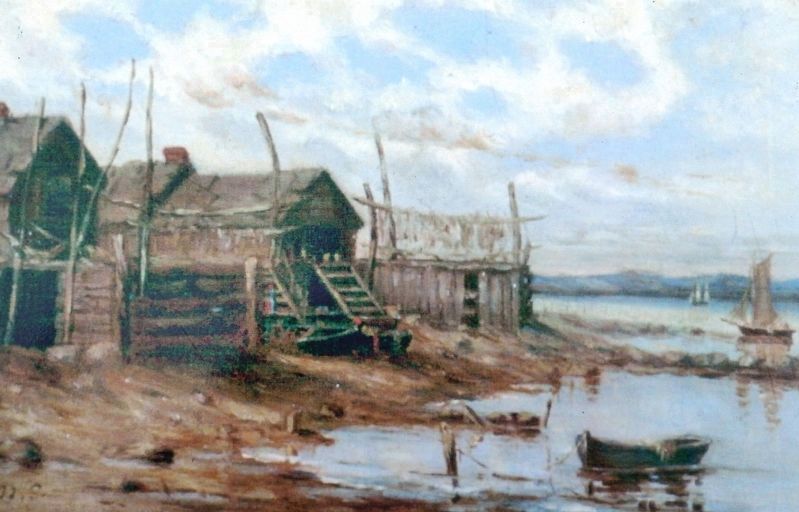
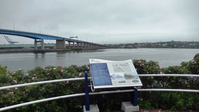
Through this viewing tube you can see a small patch of ground around one of the abutments of the Saint John Harbour Bridge. This is all that remains visible of a small island known as Navy Island. For centuries this island was an important Wolastoqiyik (Maliseet) First Nation summer village site, and later, for about 150 years, the home of Saint John families engaged in commercial fishing and shipbuilding. In 1979 it was developed as the Navy Island Forest Products Terminal, covering any sign of human habitation.
The Wolastoqiyik name for the village and the island was “Ouigoudy.” Its appearance was recorded by Samuel de Champlain, the geographer and cartographer on a 1604 reconnaissance expedition from France, led by Pierre Dugua de Mons. Champlain noted "The town of Ouigoudi (thus I call the place where the said Chkoudun lived) was a large enclosure on a flat-topped hill, surrounded by tall, slender trees attached together, and inside were several large and small huts, one of which was as big as a market hall and housed many families. As for the one where they held feasts, it was a little smaller."
The Wolastoqiyik were clearly well established at the mouth of the Wolastoq or “beautiful river,” their own name for themselves being Wolastoqiyik or “people of the beautiful river.”
It was the French expedition that decided to call it the "Fleuve Saint-Jean," as their arrival on June 24th, 1604 coincided with their religious feast for St. John the Baptist. In later years, with the influx of English speaking people, “Fleuve Saint-Jean” was anglicized to “St. John River” and the city became “Saint John.”
Grâce à cette lunette, vous pouvez apercevoir une petite parcelle de terrain près d'une des culées du pont du port de Saint John. Voici tout ce qu'il reste d'une petite île connue sous le nom de Navy Island. Pendant des siècles, cette île a abrité un important campement d'été wolastoqiyik (malécite). Plus tard, pendant quelque 150 ans, elle a été le refuge de familles de Saint John qui pratiquaient la pêche commerciale et la construction navale. En 1979, elle est devenue le terminal de produits forestiers de Navy Island, et toutes traces d'habitation ont disparu.
Le nom que les Wolastoqiyik ont donné au village et à l'île est «Ouigoudy». Samuel de Champlain, géographe et cartographe officiel, remarque sa présence en 1604 lors d'une mission de reconnaissance au nom de la France dirigée par Pierre Dugua de Mons. Il écrit alors : «Le village d'Ouigoudi (ainsi j'appelle l'endroit où vivait vraisemblablement Chkoudun) était une vaste enceinte sur un plateau, entourée de massifs d'arbres élancés, à l'intérieur de laquelle se trouvaient plusieurs huttes, grandes et petites. L'une d'elles était aussi grande qu'un marché et abritait de nombreuses familles. Par contre, les huttes où se tenaient les festivités étaient moins grandes.»
Les Wolastoqiyik, alors bien établis à l'embouchure du fleuve Wolastoq (le beau fleuve), se nomment eux-mêmes Wolastoqiyik (peuple du beau fleuve).
C'est cette même expédition française, ignorant vraisemblablement que ce fleuve a déjà un nom, qui décide de le nommer «fleuve Saint-Jean», à son arrivée le 24 juin 1604, jour de la fête religieuse de la Saint-Jean-Baptiste. Les gens d'expression anglaise qui s'installent dans la région l'appellent «St. John River», et la ville devient «Saint John».
Topics. This historical marker is listed in these topic lists: Colonial Era • Exploration • Industry & Commerce • Native Americans. A significant historical date for this entry is June 24, 1604.
Location. 45° 16.195′ N, 66° 4.625′ W. Marker is in Saint John, New Brunswick, in Saint John County. Marker can be reached from the intersection of Chesley Drive (New Brunswick Route 100) and Bentley Street, on the right when traveling north. Marker is located along the Harbour Passage Trail, about 2.5 km north of the Bentley Street trailhead. Touch for map. Marker is in this post office area: Saint John NB E2K 1B2, Canada. Touch for directions.
Other nearby markers. At least 8 other markers are within walking distance of this marker. Fishing the Harbour (here, next to this marker); The Saint John Harbour Bridge | Le pont du port de Saint John (about 210 meters away, measured in a direct line); The Tides of Fundy (about 210 meters away); Ancient Life (about 240 meters away); Fossil Hunters (about 240 meters away); The Shards of Time (approx. 0.4 kilometers away); Fort La Tour (approx. half a kilometer away); a different marker also named Fort La Tour (approx. half a kilometer away). Touch for a list and map of all markers in Saint John.
Also see . . . Navy Island (Wikipedia). For centuries, Navy Island existed as a narrow, oval shaped hunk of rock sitting roughly at the turning point of the harbour where the deep open water ends and the harbour approaches the Reversing Falls. However, the island ceased to exist in its traditional form when the construction of the Saint John Harbour Bridge linked the island to the mainland in the 1970s. The island now sits under the western footing of the bridge, and is survived in name by the Navy Island Forest Products Terminal,
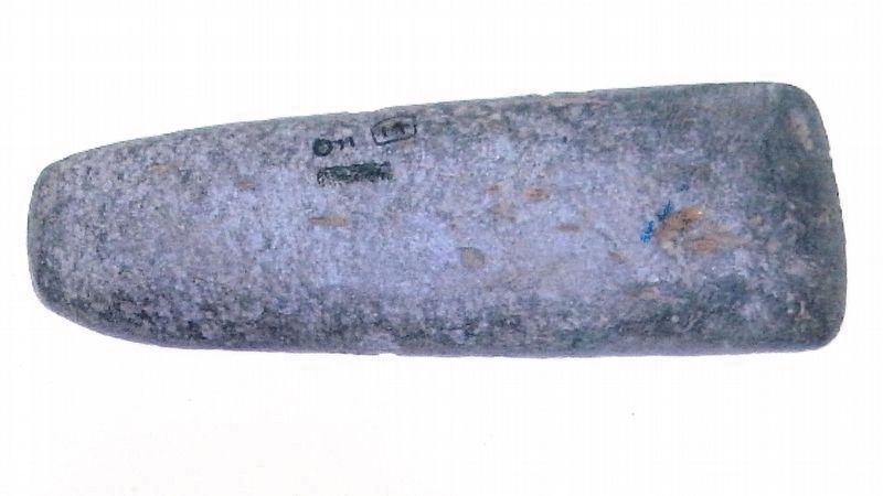
Courtesy Leo Doucet • Archaeological Services, Heritage Branch, New Brunswick Culture & Sport
4. Marker detail: Stone Axe Head
This pecked and ground stone axe head, found on Portland Point, would have been an appropriate tool for cutting the trees used in making a palisade for a village.
Cette tète de hache en pierre picotée et meulée, trouvée à Portland Point, aurait constitué un excellent outil pour la coupe des arbres utilisés dans la fabrication de palissades de villages.
Cette tète de hache en pierre picotée et meulée, trouvée à Portland Point, aurait constitué un excellent outil pour la coupe des arbres utilisés dans la fabrication de palissades de villages.
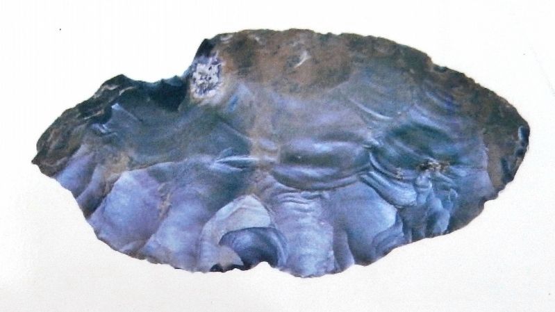
Courtesy Leo Doucet • Archaeological Services, Heritage Branch, New Brunswick Culture and Sport
5. Marker detail: Stone Knife
This large stone knife, found on the shores of Navy Island, would have been used by early First Nations peoples for skinning seals or other sea mammals.
Ce grand couteau de pierre, trouvé sur les rives de l'île Navy, aurait été utilisé par les premiers peuples des Premières Nations pour le dépouillement des phoques et autres mammifères marins.
Ce grand couteau de pierre, trouvé sur les rives de l'île Navy, aurait été utilisé par les premiers peuples des Premières Nations pour le dépouillement des phoques et autres mammifères marins.
Credits. This page was last revised on April 9, 2020. It was originally submitted on April 9, 2020, by Cosmos Mariner of Cape Canaveral, Florida. This page has been viewed 450 times since then and 55 times this year. Photos: 1, 2, 3, 4, 5, 6. submitted on April 9, 2020, by Cosmos Mariner of Cape Canaveral, Florida.
