Colonie in Albany County, New York — The American Northeast (Mid-Atlantic)
Fox Preserve
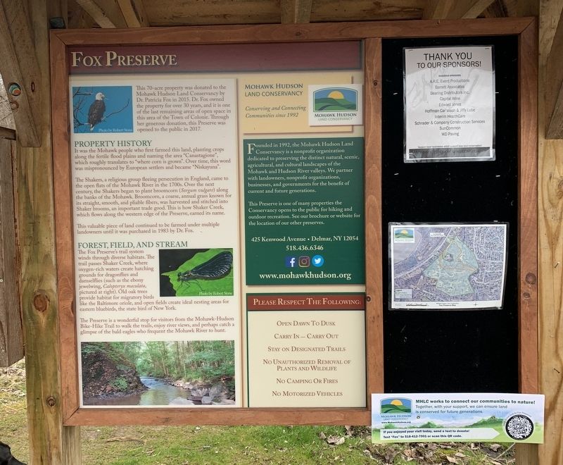
This 70-acre property was donated to the Mohawk Hudson Land Conservancy by Dr. Patricia Fox in 2015. Dr. Fox owned the property for over 30 years, and it is one of the last remaining areas of open space in this area of the Town of Colonie. Through her generous donation, this Preserve was opened to the public in 2017.
Property History
It was the Mohawk people who first farmed this land, planting crops along the fertile flood plains and naming the area "Canastagione", which roughly translates to "where corn is grown". Over time, this word was mispronounced by European settlers and became “Niskayuna".
The Shakers, a religious group fleeing persecution in England, came to the open flats of the Mohawk River in the 1700s. Over the next century, the Shakers began to plant broomcorn (Sorgum vulgare) along the banks of the Mohawk. Broomcorn, a coarse, annual grass known for its straight, smooth, and pliable fibers, was harvested and stitched into Shaker brooms, an important trade good. This is how Shaker Creek, which flows along the western edge of the Preserve, earned its name.
This valuable piece of land continued to be farmed under multiple landowners until it was purchased in 1983 by Dr. Fox.
Forest, Field, And Stream
The Fox Preserve's trail system winds through diverse habitats. The trail passes Shaker Creek, where oxygen-rich waters create hatching grounds for dragonflies and damselflies (such as the ebony jewelwing, Calopteryx maculate, pictured at right). Old oak trees provide habitat for migratory birds like the Baltimore oriole, and open fields create ideal nesting areas for eastern bluebirds, the state bird of New York.
The Preserve is a wonderful stop for visitors from the Mohawk-Hudson Bike-Hike Trail to walk the trails, enjoy river views, and perhaps catch a glimpse of the bald eagles who frequent the Mohawk River to hunt.
Mohawk Hudson Land Conservancy
Conserving and Connecting Communities since 1992
Founded in 1992, the Mohawk Hudson Land Conservancy is a nonprofit organization dedicated to preserving the distinct natural, scenic, agricultural, and cultural landscapes of the Mohawk and Hudson River valleys. We partner with landowners, nonprofit organizations, businesses, and governments for the benefit of current and future generations.
This Preserve is one of many properties the Conservancy opens to the public for hiking and outdoor recreation. See our brochure or website for the location of our other preserves.
425 Kenwood Avenue • Delmar, NY 12054
518.436.6346
www.mohawkhudson.org
Topics and series. This historical marker is listed in these topic lists: Charity & Public Work • Environment • Parks & Recreational Areas. In addition, it is included in the Communal and Utopian Societies series list. A significant historical year for this entry is 2015.
Location. 42° 46.51′ N, 73° 47.629′ W. Marker is in Colonie, New York, in Albany County. Marker is on River Road, 0.2 miles west of Forts Ferry Road, on the right when traveling east. Touch for map. Marker is in this post office area: Albany NY 12205, United States of America. Touch for directions.
Other nearby markers. At least 8 other markers are within 2 miles of this marker, measured as the crow flies. Fort's Ferry (approx. 0.9 miles away); Welcome to the Colonie Mohawk-Hudson Bike-Hike Path (approx. 1.1 miles away); Erie Canal (approx. 1.2 miles away); Whipple Iron Truss Bridge (approx. 1.2 miles away); Vischer Ferry Nature and Historic Preserve (approx. 1.2 miles away); Cast Iron Whipple Truss Bridge, 1869 (approx. 1.2 miles away); Van Vranken Home, 1847 (approx. 1.4 miles away); Matthew Winne Jr. (approx. 1˝ miles away).
Also see . . . Mohawk Hudson Land Conservancy. (Submitted on April 11, 2020, by Michael Herrick of Southbury, Connecticut.)
Credits. This page was last revised on April 11, 2020. It was originally submitted on April 10, 2020, by Steve Stoessel of Niskayuna, New York. This page has been viewed 211 times since then and 21 times this year. Photo 1. submitted on April 10, 2020, by Steve Stoessel of Niskayuna, New York. • Michael Herrick was the editor who published this page.
Editor’s want-list for this marker. A wide angle photo of the marker and its surroundings. • Can you help?
