Gallatin in Sumner County, Tennessee — The American South (East South Central)
Big South Tunnel
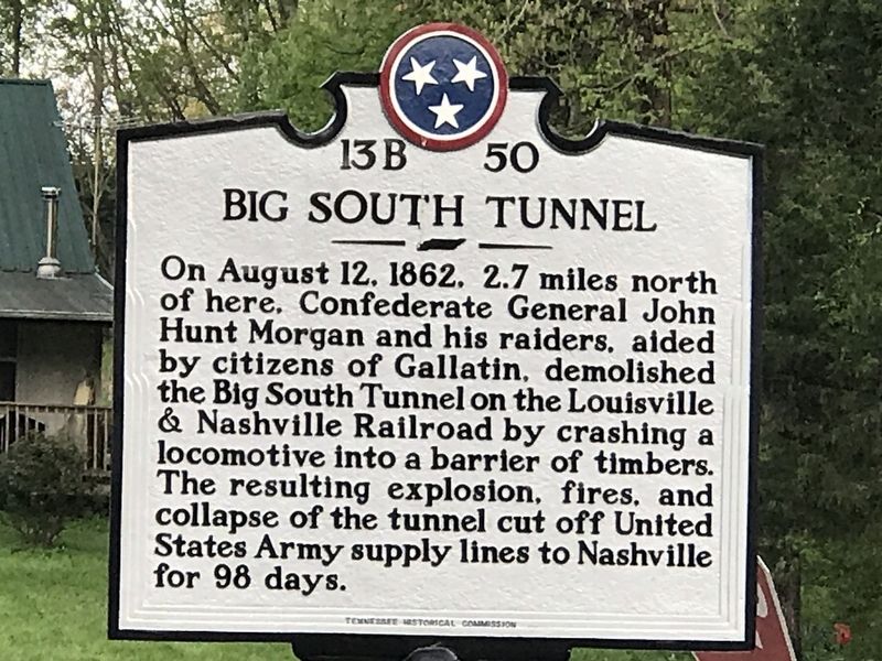
Photographed by Duane and Tracy Marsteller, April 11, 2020
1. Big South Tunnel Marker
Erected by Tennessee Historical Commission. (Marker Number 13B 50.)
Topics and series. This historical marker is listed in these topic lists: Railroads & Streetcars • War, US Civil. In addition, it is included in the Tennessee Historical Commission series list. A significant historical date for this entry is August 12, 1862.
Location. 36° 28.237′ N, 86° 28.473′ W. Marker is in Gallatin, Tennessee, in Sumner County. It is at the intersection of South Tunnel Road and Scotty Parker Road, on the right when traveling west on South Tunnel Road. Touch for map. Marker is in this post office area: Gallatin TN 37066, United States of America. Touch for directions.

Regionally, this marker is in Middle Tennessee and in Greater Nashville. It is also in the American
this page online
Other nearby markers. At least 8 other markers are within 6 miles of this marker, measured as the crow flies: History of the Highland Community (approx. 3.7 miles away); Bridal House (approx. 3.8 miles away); In Memory of Revolutionary War Soldier Thomas Cotton (approx. 3.8 miles away); Highland Community (approx. 3.8 miles away); The Colored Fair (approx. 4.7 miles away); Original Church of God / L.M. Swanson's Nursing Home (approx. 5.1 miles away); Union High School (approx. 5.2 miles away); Fountain Head (approx. 5.7 miles away). Touch for a list and map of all markers in Gallatin.
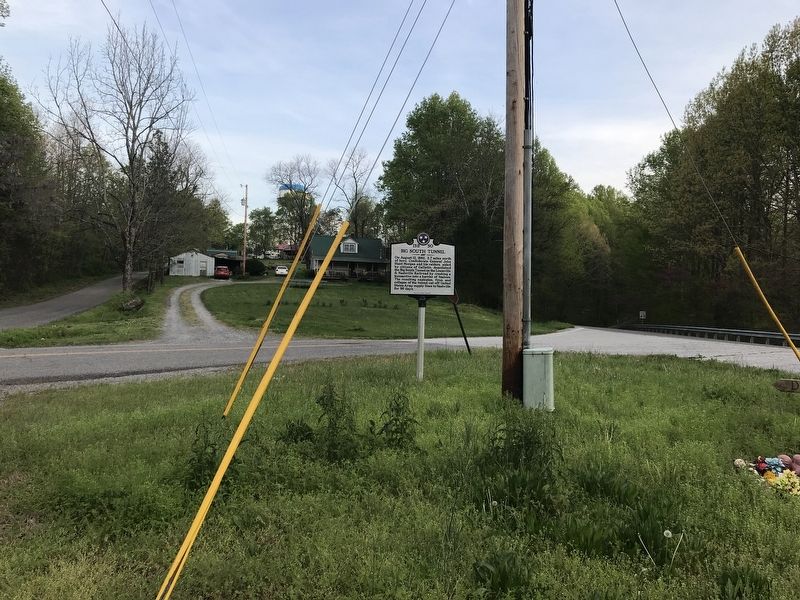
Photographed by Duane and Tracy Marsteller, April 11, 2020
2. Big South Tunnel Marker
![From Mitchelsville [sic] to Gallatin--Sumner Co., Tenn., 1862 image. Click for full size.](Photos5/516/Photo516961.jpg?413202052100PM "From Mitchelsville [sic] to Gallatin--Sumner Co., Tenn., 1862. Click for full size.")
Photographed by Blakeslee, G. H., 1862
3. From Mitchelsville [sic] to Gallatin--Sumner Co., Tenn., 1862
This image, courtesy of the Library of Congress, includes a small image of the South Tunnel as well as other local sites of interest in 1862.
Credits. This page was last revised on April 13, 2020. It was originally submitted on April 12, 2020, by Duane and Tracy Marsteller of Murfreesboro, Tennessee. This page has been viewed 3,257 times since then and 187 times this year. Photos: 1, 2. submitted on April 12, 2020, by Duane and Tracy Marsteller of Murfreesboro, Tennessee. 3. submitted on April 13, 2020, by J. Makali Bruton of Washington, District of Columbia. • Bernard Fisher was the editor who published this page.
