Near Norvell in Lassen County, California — The American West (Pacific Coastal)
Nancy Ann Allen Grave
Nobles' Emigrant Trail
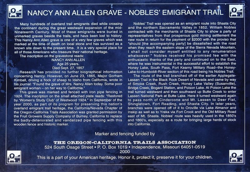
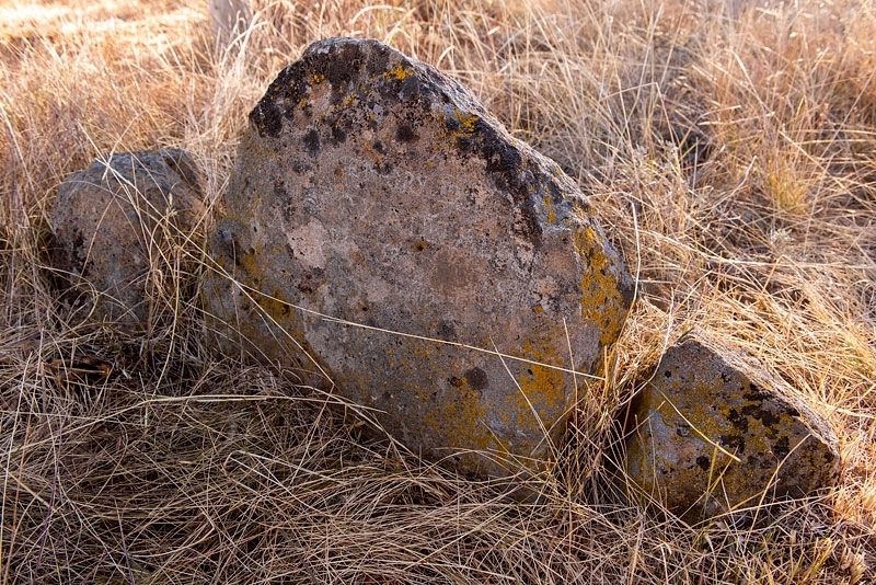
Many hundreds of Overland Trail emigrants died while crossing the continent during the great westward expansion of the mid-Nineteenth Century. Most of these emigrants were buried in unmarked graves beside the trails, and have been lost to history. This Nancy Ann Allen grave is one of the very few graves which was marked at the time of death on local stone and has survived as a known site down to the present time. It is a very special place for all of those Americans who treasure their national heritage.
The inscription on the gravestone reads:
Age 25 years
Died Sept. 27, 1857
Research has provided no further biographical information concerning Nancy. However, on June 23, 1865, Major Gorham Kimball, driving a flock of sheep to Idaho from California, wrote in his journal: "Found the grave of Mrs. Nancy Allen today. Some poor emigrant woman - on her way to California."
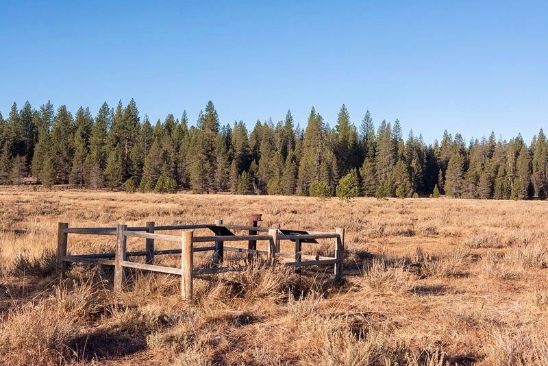
This grave was marked and fenced with iron pipe fencing in 1924. The inscription on the small attached plate reads: "Restored by 'Women’s Study Club' of Westwood 1924." In September of the year 2000, as part of its program for preserving this nation's overland emigrant trail heritage, the California/Nevada Chapter of the Oregon-California Trails Associations was granted permission by the Fruit Growers Supply Company of Burney, California, to replace the badly-deteriorated and vandalized pipe fencing with this wooden fence and historic marker.
Nobles' Trail was opened as an emigrant route into Shasta city and the northern Sacramento Valley in 1852. William Nobles contracted with the merchants of Shasta City to show a party of representatives from that prosperous gold mining settlement the new route in return for the payment of $2000 with the proviso that "should [the accompanying party] be dissatisfied with the road when they reach the eastern slope of the Sierra Nevada Mountain, I shall not consider myself entitled to any renumeration whatsoever." Nobles received his promised fee with the enthusiastic thanks of the party and continued on to the East where he was instrumental in the successful effort to establish the Honey Lake, South Pass, Fort Kearny Military Road -- the Honey-Lake-to-Humboldt-River section of this road being the Nobles Trail.
The route of the trail branched off of the earlier Applegate-Lassen Trail in the Black Rock Desert of Nevada and came by way of Smoke Creek, Rush Creek, Honey Lake Valley Ridge (Susanville), Bridge Creek, Bogard Station, and Poison Lake. At Poison Lake the trail turned westward and then southward up Butte Creek to enter Lassen National Park at Butte Lake. Here it turned westward again to pass north of Cindercone and Mt. Lassen to Deer Flat, Shingletown, Fort Reading, and Shasta City. In later years, branches were opened of it to Oroville via Lake Almanor and Inskip via Fort Crook and the Old Military Road east of Mt. Shasta. Nobles' route was heavily used in the 1850's and 1860's, especially as a route for bringing large herds of stock in to California.
This is a part of your American heritage. Honor it, protect it, preserve it for your children.
Erected 2000 by Oregon-California Trails Association.
Topics. This historical marker is listed in these topic lists: Roads & Vehicles • Settlements & Settlers • Women. A significant historical date for this entry is September 27, 1857.
Location. 40° 30.561′ N, 120° 56.82′ W. Marker is near Norvell, California, in Lassen County. Marker can be reached from Bridge Creek Springs Road, one mile Merrill Flat Road, on the left when traveling north. On Bridge Creek Springs Road, about one mile north of Merrill Flat Road, there is a dirt road on the left. Drive about five hundred feet on the dirt road to a parking area. Park and walk about 400 feet to the marker. Touch for map. Marker is in this post office area: Bieber CA 96009, United States of America. Touch for directions.
Other nearby markers. At least 7 other markers are within 15 miles of this marker, measured as the crow flies. Nancy Ann Allen (here, next to this marker); Nobles Trail - Bridge Creek (here, next to this marker); Nobles Trail - First Nobles Pass (approx. 2 miles away); Nobles Trail - Big Spring (approx. 7.8 miles away); The Chimney (approx. 12.8 miles away); Nobles Trail - Dry Valley (approx. 12.8 miles away); Lassen Emigrant Trail (approx. 14.6 miles away).
Additional commentary.
1. Nancy Ann Allen (nee Ready)
Nancy Ann Allen was born in Missouri in 1832. She traveled with her husband, Joel Allen and family; her sister Elenor Jane, her sister's husband William Allen (Joel's brother) and their family; the Henry Parman's family and several other families on a large wagon train from Missouri to California/Oregon. Unfortunately, the travelers were hit with what was most likely cholera, and several perished including William Allen, who died in Wyoming, Henry Parman's wife Martha and Nancy who perished a week or so later in California. These were difficult times, marked with tragedy but also filled with perseverance and hope. May their memories always be a blessing.
— Submitted September 29, 2022, by Laurie Allen of Fair Oaks, California.
Credits. This page was last revised on October 6, 2022. It was originally submitted on April 14, 2020, by Alvis Hendley of San Francisco, California. This page has been viewed 221 times since then and 36 times this year. Photos: 1, 2, 3. submitted on April 14, 2020, by Alvis Hendley of San Francisco, California. • Devry Becker Jones was the editor who published this page.


