Gallup in McKinley County, New Mexico — The American Mountains (Southwest)
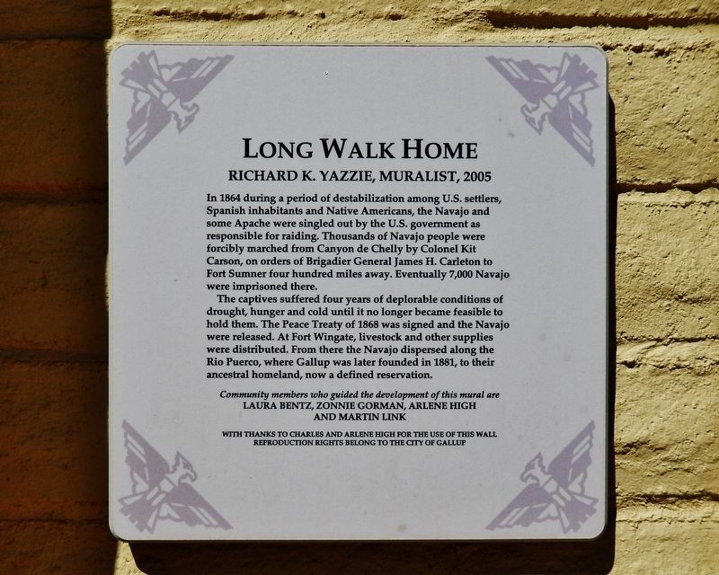
Long Walk Home
Richard K. Yazzie, Muralist, 2005
Photographed by Cosmos Mariner, May 22, 2016
1. Long Walk Home Marker
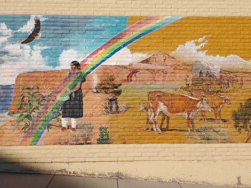
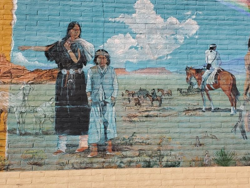
The captives suffered four years of deplorable conditions of drought, hunger and cold until it no longer became feasible to hold them. The Peace Treaty of 1868 was signed and the Navajo were released. At Fort Wingate, livestock and other supplies were distributed. From there the Navajo dispersed along the Rio Puerco, where Gallup was later founded in 1881, to their ancestral homeland, now a defined reservation.
Laura Bentz, Zonnie Gorman, Arlene High and Martin Link
With thanks to Charles and Arlene High for the use of this wall
Reproduction rights belong to the City of Gallup
Topics. This historical marker is listed in these topic
this page online
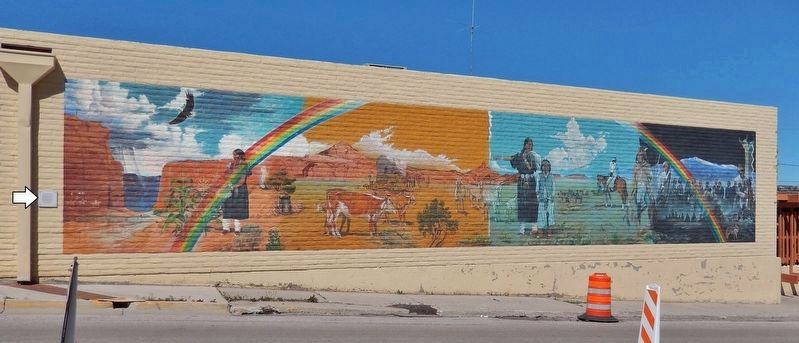
Location. 35° 31.5′ N, 108° 44.596′ W. Marker is in Gallup, New Mexico, in McKinley County. It is at the intersection of South 3rd Street (New Mexico Route 610) and West Hill Avenue, on the right when traveling south on South 3rd Street. Marker is mounted at eye-level on the southeast corner of the building here, facing South 3rd Street. The subject mural, which covers most of the east side of the building, is just to the right of this marker. Touch for map. Marker is in this post office area: Gallup NM 87301, United States of America. Touch for directions.

Regionally, this marker is in the San Juan Basin. It is also in the American Southwest, on the Colorado Plateau, and at the Four Corners. Globally, it is in North America, the Western Hemisphere, the Western World, and the Anglosphere. Historically, it finds itself in what was once New Spain and also the territory of the Ancestral Puebloans.
Other nearby markers. At least 8 other markers are within walking distance of this marker:
Photographed by Cosmos Mariner, May 22, 2016
2. Long Walk Home Marker
Also see . . . The Navajo Nation Treaty of 1868 Lives On at the American Indian Museum. The Dine had long dealt with Mexican and Spanish incursions, and had navigated their way through the troubled waters of attempted colonization. But the 1848 Treaty of Guadalupe Hidalgo, which ended the Mexican War, gave rise to a new threat—American invaders, who claimed the southwest as theirs. Indian tribes were seen as an obstacle to manifest destiny-driven land grabs. By 1851, the Americans had established Fort Defiance smack in the middle of Navajo country. Not surprisingly, conflicts frequently arose. Major General James H. Carleton, who at the time was the commander of the department

Photographed by Richard K. Yazzie, Muralist
3. Long Walk Home Mural
Photographed by Mark Parker, October 8, 2023
4. Long Walk Home Mural (left panel)
Photographed by Mark Parker, October 8, 2023
5. Long Walk Home Mural (center panel)
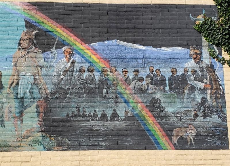
Photographed by Mark Parker, October 8, 2023
6. Long Walk Home Mural (right panel)
Credits. This page was last revised on September 20, 2024. It was originally submitted on April 22, 2020, by Cosmos Mariner of Cape Canaveral, Florida. This page has been viewed 1,005 times since then and 64 times this year. Photos: 1, 2, 3. submitted on April 24, 2020, by Cosmos Mariner of Cape Canaveral, Florida. 4, 5, 6. submitted on September 2, 2024, by Mark Parker of Hickory, North Carolina. • J. Makali Bruton was the editor who published this page.
