Near Quincy in Adams County, Illinois — The American Midwest (Great Lakes)
Welcome to Illinois
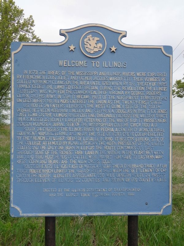
In 1673 the areas of the Mississippi and Illinois Rivers were explored by Frenchmen Louis Joliet and Father Jacques Marquette. Their voyages resulted in French claims on the area until 1763 when, by the Treaty of Paris, France ceded the land to Great Britain. During the American Revolution the Illinois Territory was won for the Commonwealth of Virginia by George Rogers Clark and his army. In 1784 it became part of the Northwest Territory and on December 3, 1818 Illinois entered the Union as the twenty-first state.
U.S. Route 24 enters Illinois on the west at Quincy, site of the sixth debate between Abraham Lincoln and Stephen A. Douglas in 1858. It extends east towards the Illinois River cutting diagonally across the Military Tract, an area used as bounty land for veterans of the war of 1812. It passes near Dickson Mounds, a burial site of the Mississippian culture circa 1100 A.D.
Route 24 crosses the Illinois River at Peoria, a center of agricultural equipment manufacturing, and near the site of Fort Creve Coeur erected by the French explorer Sieur de LaSalle in 1680. It bisects Eureka, site of the college attended by Ronald Reagan the 40th President of the United States and the only one born in Illinois. The route continues due east through some of the richest farm land in the nation. In the years between 1840 and 1890 huge herds of cattle were raised for sale to eastern markets. Corn and beans are the main crops today.
Route 24 exits Illinois east of Watseka near the Old Hubbard Trace: a fur trade route which linked the Wabash River area with the settlement of Chicago in the north. Along its approximate 260 mile length Route 24 passes through eleven of Illinois' 102 counties and seven of its county seats.
Erected 1989 by Illinois Department of Transportation and the Illinois State Historical Society.
Topics and series. This historical marker is listed in these topic lists: Agriculture • Colonial Era • Exploration • Roads & Vehicles • Settlements & Settlers. In addition, it is included in the Former U.S. Presidents: #40 Ronald Reagan, and the Illinois State Historical Society series lists. A significant historical year for this entry is 1673.
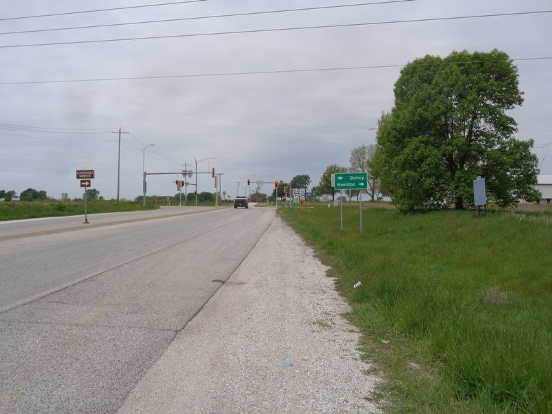
Location. 40° 0.502′ N, 91° 22.028′ W. Marker is near Quincy, Illinois, in Adams County. Marker is at the intersection of U.S. 24 and State Route 96, on the right when traveling west on U.S. 24. Touch for map. Marker is in this post office area: Quincy IL 62305, United States of America. Touch for directions.
Other nearby markers. At least 8 other markers are within 6 miles of this marker, measured as the crow flies. In Honor of Those Who Gave the Ultimate Sacrifice (approx. 5.3 miles away); Quincy National Cemetery (approx. 5.3
miles away); A National Cemetery System (approx. 5.3 miles away); Thomas Scott Baldwin 1858-1923 (approx. 5.3 miles away); Madison Park (approx. 5.3 miles away); Dr. Thomas Edgar Musselman (approx. 5.4 miles away); Indian Removals - A Memorial (approx. 5.4 miles away); R. F. Newcomb House (approx. 5.4 miles away). Touch for a list and map of all markers in Quincy.
Also see . . . U.S. Route 24 in Illinois on Wikipedia. Throughout the 1980's, the ISHS put up some "Welcome to Illinois" markers at various places near the border at certain points along U.S. highways. U.S. 24 enters Illinois through downtown Quincy, which is about six miles from this marker. The highway's entire length, from Colorado to Michigan, is estimated at 1,540 miles. (Submitted on May 14, 2020, by Jason Voigt of Glen Carbon, Illinois.)
Credits. This page was last revised on May 15, 2020. It was originally submitted on May 14, 2020, by Jason Voigt of Glen Carbon, Illinois. This page has been viewed 531 times since then and 37 times this year. Photos: 1, 2. submitted on May 14, 2020, by Jason Voigt of Glen Carbon, Illinois. • Devry Becker Jones was the editor who published this page.

