Near Kearneysville in Berkeley County, West Virginia — The American South (Appalachia)
Shaw Run Wetland Complex
West Virginia 9
— Charles Town to Martinsburg —
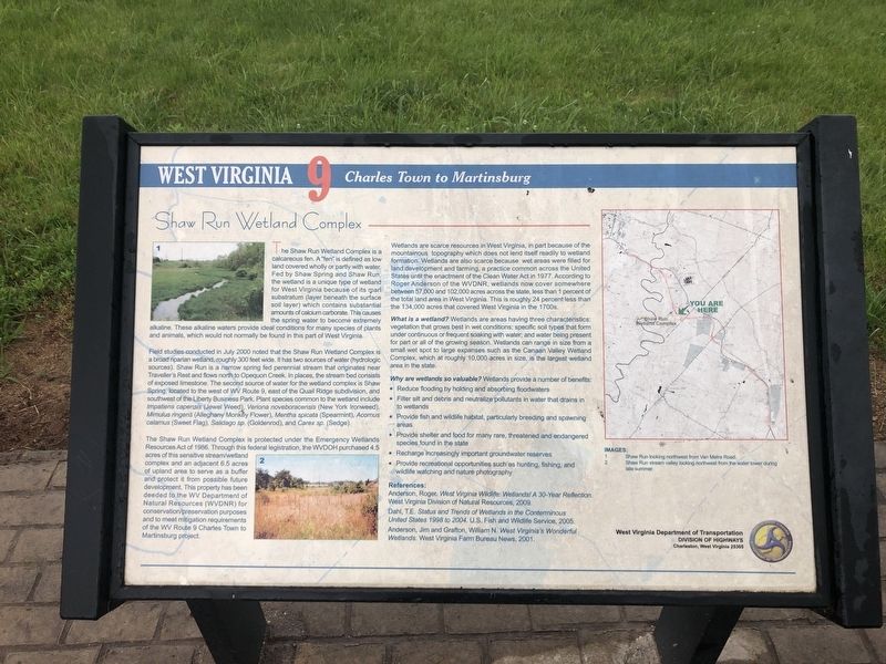
The Shaw Run Wetland Complex is a calcareous fen. A "fen" is defined as low land covered wholly or partly with water. fed by Shaw Spring and Shaw Run, the wetland is a unique type of wetland for West Virginia because of its marl substratum (layer beneath the surface soil layer) which contains substantial amounts of calcium carbonate. This causes the spring water to become extremely alkaline. These alkaline waters provide ideal conditions for many species of plants and animals, which would not normally be found in this part of West Virginia.
Field studies conducted in July 2000 noted that the Shaw Run Wetland Complex is a broad riparian wetland, roughly 300 feet wide. It has two sources of water (hydrologic sources). Shaw Run is a narrow spring fed perennial stream that originates near Traveller's Rest and flows north to Opequon Creek. In places, the stream bed consists of exposed limestone. The second source of water for the wetland complex is the Shaw Spring, located to the west of WV Route 9, east of the Quail Ridge subdivision, and southwest of the Liberty Business Park. Plant species common to the wetland include Impatiens capensis (Jewel Weed), Veriona noveboracensis (New York Ironweed), Mimulus rigens (Alleghany Monkey Flower), Mentha spicata (Spearmint), Acomus calamus (Sweet Flag), Salidago sp. (Goldenrod), and Carex sp. (Sledge).
The Shaw Run Wetland Complex is protected under the Emergency Wetlands Resources Act of 1986. Through this federal legislation, the WVDOH purchased 4.5 acres of this sensitive stream/wetland complex and an adjacent 6.5 acres of upland area to serve as a buffer to protect it from possible future development. This property has been deeded to the WV Department of Natural Resources (WVDNR) for conservation/preservation purposes and to meet mitigation requirements of the WV Route 9 Charles Town to Martinsburg project.
Wetlands are scarce resources in West Virginia, in part because of the mountainous topography which does not lend itself readily to wetland formation. Wetlands are also scarce because wet areas were filled for land development and farming, a practice common across the United States until the enactment of the Clean Water Act in 1977. According to Roger Anderson of the WVDNR, wetlands now cover somewhere between 57,000 and 102,000 acres across the state, less than 1 percent of the total land area in West Virginia. This is roughly 24 percent than the 134,000 acres that covered West Virginia in the 1700s.
What is a wetland? Wetlands are areas having three characteristics: vegetation that grows best in wet conditions; specific soil types that form under continuous
Why are wetlands so valuable? Wetlands provide a number of benefits:
• Reduce flooding by holding and absorbing floodwaters
• Filter silt and debris and neutralize pollutants in water that drains in to wetland
• Provide fish and wildlife habitat, particularly breeding and spawning areas
• Provide shelter and food for many rare, threatened and endangered species found in the state
• Recharge increasingly important groundwater reserves
• Provide recreational opportunities such as hunting, fishing, and wildlife watching and nature photography.
Erected by West Virginia Department of Transportation, Division of Highways.
Topics and series. This historical marker is listed in these topic lists: Environment • Government & Politics • Waterways & Vessels. In addition, it is included in the West Virginia 9 series list. A significant historical month for this entry is July 2000.
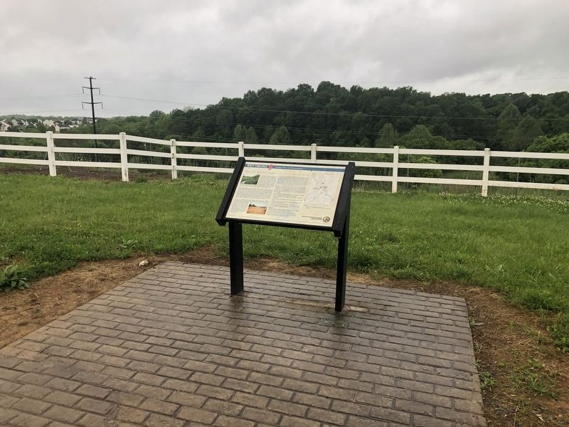
Location. 39° 23.747′ N, 77° 55.131′ W. Marker is near Kearneysville, West Virginia, in Berkeley County. Marker is on Route 9 Bike Path, 0.2 miles south of Short Road (County Road 36/1), on the right when traveling south. Touch for map. Marker is at or near this postal address: 1496 Short Rd, Kearneysville WV 25430, United States of America. Touch for directions.
Other nearby markers. At least 8 other markers are within 4 miles of this marker, measured as the crow flies. Stone House Mansion (approx. ¼ mile away); Veterans Administration Center (approx. 1.2 miles away); Kearneysville Area Historic Properties (approx. 1.4 miles away); a different marker also named Kearneysville Area Historic Properties (approx. 1½ miles away); "Travelers' Rest" (approx. 1.9 miles away); John C. Heinz House (approx. 2.2 miles away); “The Bower” (approx. 2.7 miles away); Continental Clay Brick Works (approx. 3.2 miles away). Touch for a list and map of all markers in Kearneysville.
More about this marker. References:
Anderson, Roger. West Virginia Wildlife: Wetlands! A 30-Year Reflection. West Virginia Division of Natural Resources, 2009.
Dahl, T.E. Status and Trends of Wetlands in the Conterminous United States 1998 to 2004, U.S. Fish and Wildlife Service, 2005.
Anderson, Jim and Grafton, William N. West Virginia's Wonderful Wetlands. West Virginia Farm Bureau News, 2001.
Images:
1. Shaw Run looking northwest from Van Metre Road.
2. Shaw Run stream valley looking northwest from the water tower during late summer.
Credits. This page was last revised on May 28, 2020. It was originally submitted on May 28, 2020, by Devry Becker Jones of Washington, District of Columbia. This page has been viewed 279 times since then and 31 times this year. Photos: 1, 2. submitted on May 28, 2020, by Devry Becker Jones of Washington, District of Columbia.

