Marker Logo HMdb.org THE HISTORICAL
MARKER DATABASE
“Bite-Size Bits of Local, National, and Global History”
Taylor Run in Alexandria, Virginia — The American South (Mid-Atlantic)
 

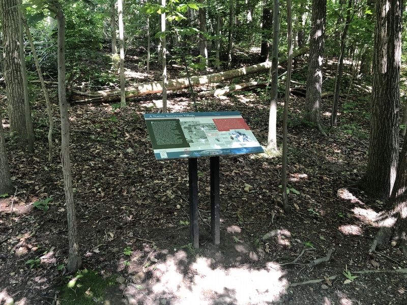
A Native American Village

Alexandria Heritage Trail


A Native American Village Marker image. Click for full size.
Photographed By Devry Becker Jones (CC0), May 31, 2020
1. A Native American Village Marker
Inscription.
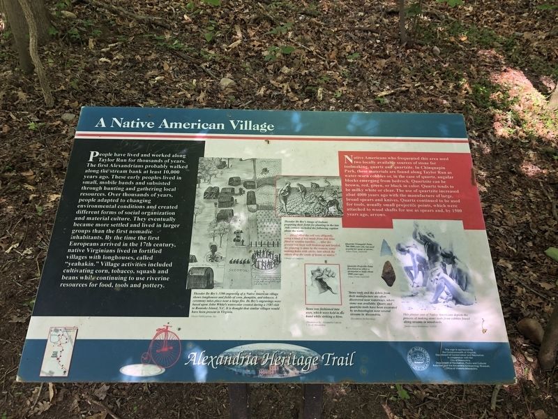
People have lived and worked along Taylor Run for thousands of years. The first Alexandrians probably walked along the stream bank at least 10,000 years ago. These early peoples lived in small, mobile bands and subsisted through hunting and gathering local resources. Over thousands of years, people adapted to changing environmental conditions and created different forms of social organization and material culture. They eventually became more settled and lived in larger groups than the first nomadic inhabitants. By the time the first Europeans arrived in the 17th century, native Virginians lived in fortified villages with longhouses, called "yeahakin." Village activities included cultivating corn, tobacco, squash and beans while continuing to use riverine resources for food, tools and pottery.

Native Americans who frequented this area used two locally available sources of stone for toolmaking, quartz and quartzite. In Chinquapin Park, these materials are found along Taylor Run as water-worn cobbles or, in the case of quartz, angular blocks emerging from bedrock. Quartzite can be brown, red, green, or black in color. Quartz tends to be milky white or clear. The use of quartzite increased abut 4000 years ago with the manufacture of large, broad spears and knives. Quartz continued to be used for tools, usually small projectile
Paid Advertisement
Click on the ad for more information.
Please report objectionable advertising to the Editor.
Click or scan to see
this page online
points, which were attached to wood shafts for use as spears and, by 1500 years ago, arrows.
 
Erected by City of Alexandria, Virginia.
 
Topics and series. This historical marker is listed in these topic lists: Anthropology & ArchaeologyColonial EraNative AmericansSettlements & Settlers. In addition, it is included in the Virginia, The City of Alexandria series list.
 
Location. 38° 49.038′ N, 77° 4.883′ W. Marker is in Alexandria, Virginia. It is in Taylor Run. Marker can be reached from Francis Hammond Parkway, 0.2 miles east of Key Drive, on the right when traveling east. Touch for map. Marker is at or near this postal address: 1099 Francis Hammond Pkwy, Alexandria VA 22302, United States of America. Touch for directions.
 
Other nearby markers. At least 8 other markers are within walking distance of this marker. Life of a Forest (within shouting distance of this marker); Listen for Chipmunks (about 600 feet away, measured in a direct line); Life of a Creek (approx. ¼ mile away); Original Federal Boundary Stone, District of Columbia, Southwest 3 (approx. ¼ mile away); Mills and Molassas (approx. ¼ mile away); President Gerald R. Ford, Jr. Residence (approx. 0.3 miles away); A Chinquapin House (approx. 0.3 miles away); Fun in the Forest (approx. 0.4 miles away). Touch for a list and map of all markers in Alexandria.
 
A Native American Village Marker image. Click for full size.
Photographed By Devry Becker Jones (CC0), May 31, 2020
2. A Native American Village Marker
sectionhead>More about this marker.
[Captions:]
Theodore De Bry's 1590 engraving of a Native American village shows longhouse and fields of corn, pumpkin, and tobacco. A ceremony takes place near a large fire. De Bry's engravings were based upon John White's watercolor created during a 1585 visit to Roanoke Island, N.C. It is thought that similar villages could have been present in Virginia.
Dover Publication, Inc.

Theodore De Bry's image of Indians preparing their fields for planting in the late 16th century included the following caption about the work:
"...[they] tilled the soil very diligently, using a kind of hoe made from fish bone fitted to wood handles... After the ground has been well broken up and leveled, the planting is done by the women, some making holes with sticks, into which the others drop the seeds of beans or maize."
Library of Congress

Stone was fashioned into axes, which were held in the hand while striking a blow.
Illustration by Alexandra Garcia.
City of Alexandria


Quartzite Triangular Point, 500-1000 years old, was used as point for spear or arrow;
Jones Point 44AX185

Quartzite Projectile Point functioned as either a spearpoint or knife about 4000 years ago;
Jones Point 44AX185

Stone
Paid Advertisement
Click on the ad for more information.
Please report objectionable advertising to the Editor.
tools and the debris from their manufacture are often discovered near waterways, where stone was available. Quartz and quartzite tools have been excavated by archaeologists near several streams in Alexandria.
Alexandria Archaeology

This plaster cast of Native Americans depicts the process of making stone tools from cobbles found along streams in woodlands.
Smithsonian Institution, NMNH
 
 
Credits. This page was last revised on January 27, 2023. It was originally submitted on May 31, 2020, by Devry Becker Jones of Washington, District of Columbia. This page has been viewed 465 times since then and 58 times this year. Photos:   1, 2. submitted on May 31, 2020, by Devry Becker Jones of Washington, District of Columbia.

Share this page.  
Share on Tumblr
m=150807

CeraNet Cloud Computing sponsors the Historical Marker Database.
This website earns income from purchases you make after using our links to Amazon.com. We appreciate your support.
Paid Advertisement
May. 9, 2024