St. Charles in St. Charles County, Missouri — The American Midwest (Upper Plains)
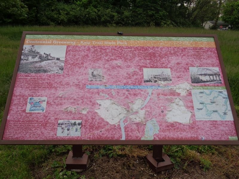
Centennial Greenway - Katy Trail State Park
Rolling Along the Katy Trail
The Missouri-Kansas-Texas (MKT) railroad rolled along this route from 1870 to 1988. Locomotives of every era traveled here, tracing the path of the Missouri River, from the early, wood-burning steam engines, to the coal-burning steam locomotives to the brightly painted and battleship-grey diesel engines.
St. Louis emerged as a major railroad gateway in the 1890s when the rail line from New Franklin to Machens was built. This important link in the MKT became the first rail line to enter Texas from the north. It was listed on the stock exchange as KT, and became affectionately dubbed "the Katy."
Completed in 1893, the Katy transported both passengers and freight all the way from St. Louis to Galveston, Texas. In the early twentieth century, a luxury rail liner named the Texas Special took passengers from St. Louis to Dallas, Fort Worth and San Antonio via the Katy. Passengers rode in stylish rail cars named after such luminaries as Sam Houston, Stephen F. Austin, David Crockett and James Bowie. Passenger service began to decline after World War II.
The dark days for the Katy began in 1957, after the Korean War truce, as freight revenues began to falter. Between 1965 and 1970 passenger service was discontinued. In 1967, the line reported a net loss of $10 million. In 1976, the line procured a $19 million government-guaranteed loan to repair existing track, but its finances continued to dwindle. In 1988, the Interstate Commerce Commission gave Union Pacific and its subsidiary, the Missouri Pacific, permission to purchase the Katy line. On December 1, 1989, the companies were merged and the Katy was no more.
Forces of nature wreaked havoc with the rail lines that ran along the Missouri River flood plain. Every time the river spilled its banks, the Katy was plagued by rail washouts. The Katy rail line finally surrendered to the river in 1986, when severed flooding washed out several miles of track. The train discontinued its runs between St. Charles and Sedalia.
Visionaries saw the Katy railroad corridor as a way to link communities via a scenic biking/hiking trail. The Missouri Department of Natural Resources found an opportunity to acquire the railroad's abandoned right-of-way with the passing of the National Trail System Act by Congress. The Act permitted railroad corridors to be set aside for future transportation use and to be utilized in the interim for recreation. A generous donation by the late Edward D. (Ted) Jones enabled the Department to procure the right of way and build the trail.
In 1991, Union Pacific Railroad donated another 33 miles of corridor, from Sedalia to just
east of Clinton, Missouri. Thus, Katy Trail State Park was created. It is currently the nation's longest rails-to-trails corridor in the United States and is part of the American Discovery Trail. A portion of the limestone gravel-covered trail has also been designated as the official part of the Lewis & Clark Heritage Trail.
Two pilot sections of the trail suffered extensive damage in the Flood of 1993. Katy Trail State Park was officially dedicated in 1996. Today, the Katy Trail State Park is a 225-mile bike path/pedestrian walking trail that stretches from St. Charles to Clinton, Missouri. When completed, the trail will extend an additional 11 miles from St. Charles to Machens in eastern St. Charles County.
Almost one entire half of the trail follows Lewis and Clark's path up the Missouri River, and the remainder rolls through picturesque pastures and small towns.
The Katy Trail starts at mile 39 rather than mile 0 because it uses the old railroad's mileage system, which showed St. Charles at mile 39. The trail is flat, rarely exceeding a 5% grade, and lends itself perfectly to hiking, running and cycling.
Hikers and bicyclists along the trail will pass through many scenic landscapes, including woodland wetlands, prairies and pasturelands.
Wetlands
Wetlands once made up one-tenth of the Missouri
landscape. They provide great beauty and assist in flood control. Composed primarily of organic matter and plants, wetlands reduce erosion, stabilize soil, filter and purify groundwater and act like giant sponges. In heavy rain or snow melt, they can absorb up to 18 times their weight in water. As river levels drop, they release moisture slowly back into the groundwater.
Birds, mammals, reptiles and amphibians call the wetlands home. Canada Geese, shorebirds, wading birds, raptors, mallard ducks, white-tailed deer, opossum, raccoon, muskrat, squirrels, moles, voles, rabbits, box turtles, frogs, toads, garter and black rat snakes are all typical to this wetland habitat.
Wetland plants provide food and habitat for smaller organism that in turn serve as food for migratory waterfowl and other animals. Weedy wetland plant species can include the amaranth, curly leaved dock, panic grass and foxtail. Bulrushes, cattail, false nettle and sedge may also be present.
Steamboat History
Steamboat commerce began on the Missouri River in 1819, when Captain John Nelson piloted the Independence from St. Louis to Franklin, Missouri in 13 days. Most river travel took place between 1846 and 1866. In 1857, 46 steamboats were listed as traveling the Missouri. Another 12 were under construction for launch into service.
The Missouri River was every steamboat pilot's nightmare with its regular depth and shifting channel, jutting sandbars and snags. As many as 400 steamboat wrecks have been located along the Missouri River.
For almost a century, traveling up and down the Missouri River was how most people journeyed from Montana to Louisiana and all points between.
Early steamboats on the muddy waters of the Missouri were mainly "sidewheelers." Captain Joseph Kinney influenced a shift to sternwheelers, and after 1850, the sternwheeler was the predominant style of craft traveling up and down the river's scenic byways.
Missouri steamboats had little decoration as light weight was important on the river. Boats were 170 to 140 feet long and 30 feet wide, with spoonbill-shaped bows and broad beams. They could navigate over sandbars through waist-deep water, carrying up to 200 tons of cargo.
Steamboat crews consisted of mates, firemen and roustabouts. The firemen watched for fires caused by boiler blow-ups. Roustabouts put sweat and muscle into pushing boats over sandbars and through ice. Mates supervised the roustabouts' efforts.
Skilled steamboat captains could earn $1200 a month. They needed to be good navigators and great dealmakers, winning the confidence of merchants who took great risks shipping product on unpredictable waters in order to realize huge profits. A steamboat could carry cargo worth a $40,000 profit.
Passenger fare from St. Louis to Fort Benton, Montana (a two to three month trip) cost $300.
A Bridge Over Turbulent Waters
The Creve Coeur Park Connector is a 3.6 mile long bike lane that enables cyclists and pedestrians to cross the Missouri River using the Page Avenue / 364 bridge. This dedicated bicycle and pedestrian path is separated from vehicular traffic so cyclists and walkers can feel safe and protected. The connecting trail runs most parallel with Hwy 364 and increases opportunities for recreation. It connects to the Katy Trail State Park on the west end at mile 42.8, just south of the Family Arena. On the east end, it connects so the southwest corner of Creve Coeur Park, giving recreation enthusiasts opportunity to explore the Creve Coeur Lake Memorial Park Trail.
Erected by Great Rivers Greenway and St. Charles County Department of Parks & Recreation.
Topics. This historical marker is listed in these topic lists: Animals • Railroads & Streetcars • Roads & Vehicles • Waterways & Vessels.
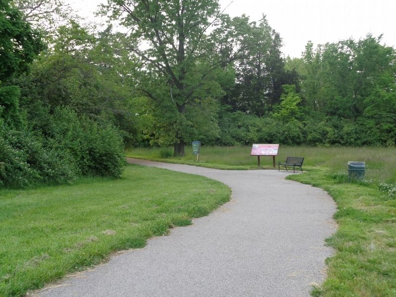
Location. 38° 44.462′ N, 90° 31.489′ W. Marker has been reported unreadable. Marker is in St. Charles, Missouri, in St. Charles County. Marker can be reached from South River Road east of Hemsath Road. Marker is off the trail, just a short walking distance from the Katy Trail/Page Avenue Bridge bike trail parking lot. Touch for map. Marker is at or near this postal address: 2884 S River Rd, Saint Charles MO 63303, United States of America. Touch for directions.
Other nearby markers. At least 8 other markers are within 3 miles of this location, measured as the crow flies. P.O.W. - M.I.A. Memorial (approx. 1½ miles away); Centennial Greenway - Heritage Crossing (approx. 1.6 miles away); Veterans Memorial (approx. 1.7 miles away); In Memory of All American Veterans (approx. 1.7 miles away); M60A3 "Patton" Tank (approx. 1.7 miles away); Greens Bottom to St. Charles (approx. 2.9 miles away); Greens Bottom to Weldon Spring (approx. 2.9 miles away); Boone's Lick Trail (approx. 3 miles away). Touch for a list and map of all markers in St. Charles.
More about this marker. Marker has portions that have suffered through weather conditions, leaving some parts not readable.
Regarding Centennial Greenway - Katy Trail State Park. In 2011 (after this marker was placed), the expansion between St. Charles and Machens was complete and opened.
Credits. This page was last revised on June 2, 2020. It was originally submitted on June 1, 2020, by Jason Voigt of Glen Carbon, Illinois. This page has been viewed 155 times since then and 9 times this year. Photos: 1, 2, 3. submitted on June 2, 2020, by Jason Voigt of Glen Carbon, Illinois. • Devry Becker Jones was the editor who published this page.


