Moncton in Westmorland County, New Brunswick — The Atlantic Provinces (North America)
The Tidal Bore / le mascaret
Riviére Petitcodiac River
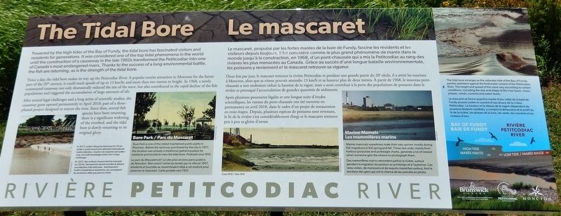
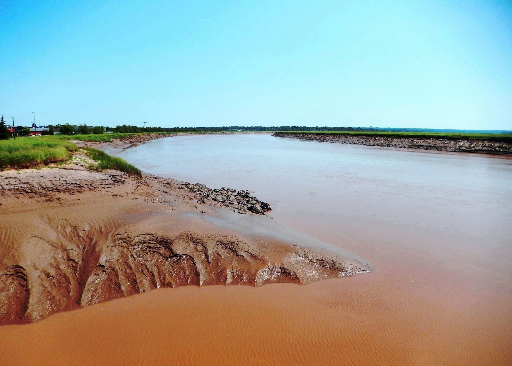
Powered by the high tides of the Bay of Fundy, the tidal bore has fascinated visitors and residents for generations. It was considered one of the top tidal phenomena in the world until the construction of a causeway in the late 1960s transformed the Petitcodiac into one of Canada's most endangered rivers. Thanks to the success of a long environmental battle, the fish are returning, as is the strength of the tidal bore.
Twice a day, the tidal bore makes its way up the Petitcodiac River. A popular tourist attraction in Moncton for the better part of the 20th century, it could reach speeds of up to 13 km/hr and more than two metres in height. In 1968, a newly constructed causeway not only dramatically reduced the size of the wave, but also contributed to the rapid decline of the fish populations and triggered the accumulation of large amounts of silt.
After several legal challenges and a long series of scientific studies, the causeway gates opened permanently in April 2010; part of a three-phased project designed to restore the river. Since then, several fish species have been returning, there is a significant widening of the riverbed, and the tidal bore is slowly returning to its original glory.
Le mascaret, propulsé par les fortes marées de la baie de Fundy, fascine les résidents et les visiteurs depuis toujours. Il fut considéré comme le plus grand phénomène de marée dans le monde jusqu'à la construction, en 1968, d'un pont-chaussée qui a mis la Petitcodiac au rang des rivières les plus menacées au Canada. Grâce au succès d'une longue bataille environnementale, les poissons y reviennent et le mascaret retrouve sa vigueur.
Deux fois par jour, le mascaret remonte la rivière Petitcodiac et pendant une grande partie du 20e siècle, il a attiré les touristes à Moncton, alors que sa vitesse pouvait atteindre 13 km/h et sa hauteur plus de deux mètres. À partir de 1968, le nouveau pont-chaussée a non seulement réduit la hauteur de la vague, mais a aussi contribué à la perte des populations de poissons dans la rivière et provoqué l'accumulation de grandes quantités de sédiments.
Après plusieurs poursuites légales et une longue suite d'études scientifiques, les vannes du pont-chaussée ont été ouvertes en permanence en avril 2010, dans le cadre d'un projet de restauration en trois étapes. Depuis, plusieurs espèces de poissons sont revenues, le lit de la rivière s'est considérablement élargi et le mascaret retrouve peu à peu sa gloire d'antan.
Photographed By Charles Legresley
2. Marker detail: Surfers riding the tidal bore /
surfeurs chevauchent le mascaret
surfeurs chevauchent le mascaret
• • •
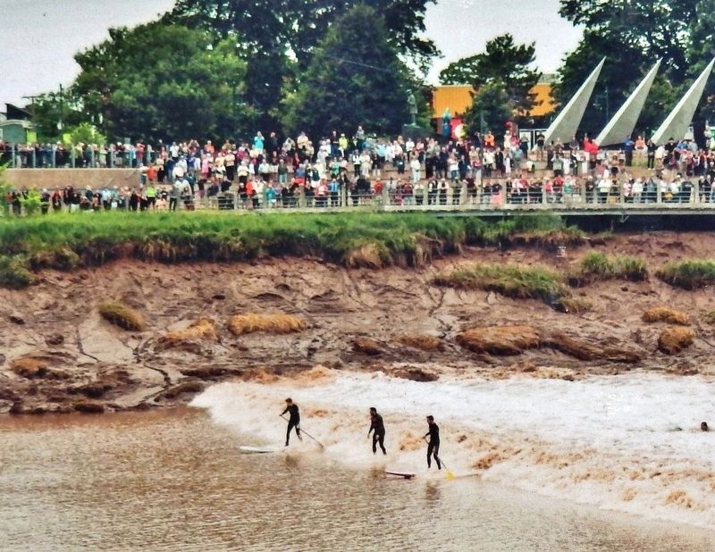
En 2013, des surfeurs chevauchent le mascaret sur 29 km, fracassant le record mondial et attirant une attention internationale. Avertissement : Surfers d'expérience seulement, qui connaissent les nombreux défis que pose la rivière.
Topics. This historical marker is listed in these topic lists: Animals • Environment • Parks & Recreational Areas • Waterways & Vessels. A significant historical year for this entry is 1968.
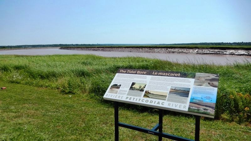
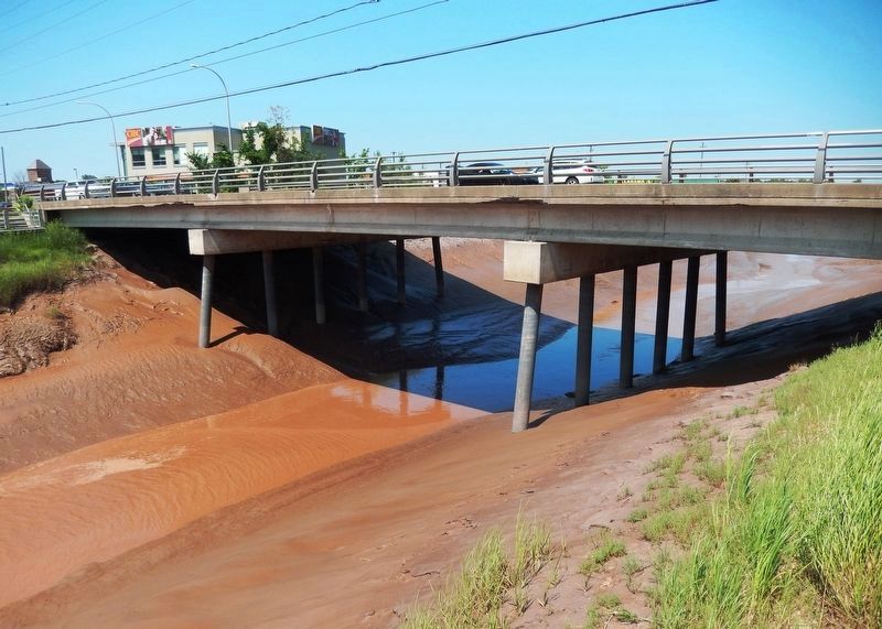
Location. 46° 5.553′ N, 64° 45.829′ W. Marker is in Moncton, New Brunswick, in Westmorland County. Marker can be reached from Main Street (New Brunswick Route 106) just west of Wheeler Boulevard, on the right when traveling east. Marker is located along the riverfront walkway just south of Main Street and just east of the Petitcodiac River channel bridge. Touch for map. Marker is in this post office area: Moncton NB E1C 1B8, Canada. Touch for directions.
Other nearby markers. At least 8 other markers are within walking distance of this marker. Arrival and Survival (within shouting distance of this marker); Journey to a New Country (within shouting distance of this marker); Settlers Landing (within shouting distance of this marker); The Moncton Settlement (within shouting distance of this marker); Les Acadiens / The Acadians (about 180 meters away, measured in a direct line); The Grand Dérangement (about 180 meters away); First Settlers / Premiers Colons (approx. 0.6 kilometers away); Joseph Salter Moncton 100 Monument (approx. 0.6 kilometers away). Touch for a list and map of all markers in Moncton.
Related markers. Click here for a list of markers that are related to this marker. Riviére Petitcodiac
Courtesy Resurgo Place
3. Marker detail: Bore Park / Le parc du Mascaret
• • •
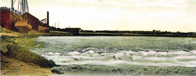
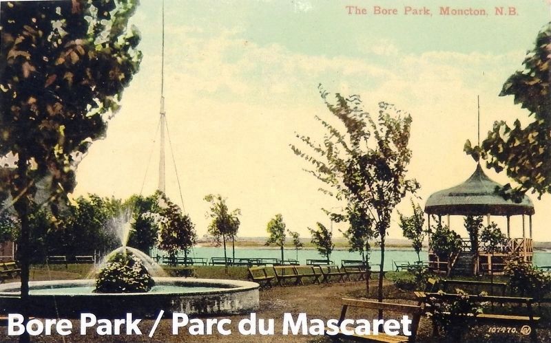
Le parc du Mascaret est l'un des plus anciens parcs publics de Moncton. Bien avant l'achat du terrain par la ville en 1907, résidents et touristes se rassemblaient déjà à cet endroit pour observer le mascaret. Carte postale vers 1910.
Also see . . .
1. Bay of Fundy Tides, Mudflats and Estuaries. Twice daily, one hundred billion tons of water from the Atlantic Ocean swirl their way up the shores of the Bay of Fundy. This water volume is estimated to nearly equal the 24-hour flow of all the rivers in the world. The tides reach upwards of 9 m in height on the Petitcodiac River, uncovering kilometers of mudflats at low tide, and nourishing some of the world’s greatest estuaries. (Submitted on June 7, 2020, by Cosmos Mariner of Cape Canaveral, Florida.)
2. Surfers set record after 29 km ride on Moncton tidal bore. (CBC News · Posted: Jul 25, 2013 • link includes event video) A pair of Californian surfers set a North American record on Wednesday after riding the Petitcodiac River's tidal bore for 29 kilometres. (Submitted on June 7, 2020, by Cosmos Mariner of Cape Canaveral, Florida.)
Photographed By Brian Branch
5. Marker detail: Marine Mammals / Les mammifères marins
• • •
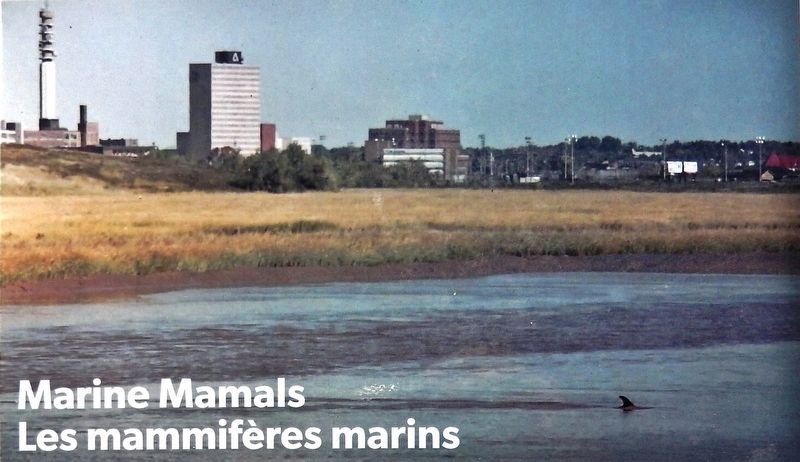
Des mammifères marins remontent parfois la rivière, surtout pendant la migration du poisson au printemps et à l'automne. Ces rares visites, de marsouins et de requins maraîches surtout, font le bonheur des gens qui ont la chance de les prendre en photo.
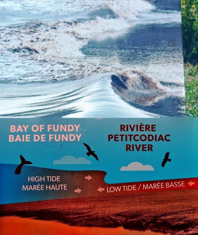
6. The Tidal Bore / le mascaret
• • •
Le mascaret se forme quand la marée d'eau salée de la baie de Fundy pousse contre le courant d'eau douce de la rivière Petitcodiac. La hauteur et la vitesse de la vague dépendent de plusieurs facteurs variables, y compris la dimension et le profil du lit de la rivière, les phases de la lune, les vents, les courants et les niveaux d'eau.
Credits. This page was last revised on June 8, 2020. It was originally submitted on June 6, 2020, by Cosmos Mariner of Cape Canaveral, Florida. This page has been viewed 450 times since then and 19 times this year. Photos: 1, 2, 3, 4, 5, 6, 7, 8. submitted on June 7, 2020, by Cosmos Mariner of Cape Canaveral, Florida. 9. submitted on June 8, 2020, by Cosmos Mariner of Cape Canaveral, Florida.
