Moncton in Westmorland County, New Brunswick — The Atlantic Provinces (North America)
The Shipbuilding Era / La construction navale
Riviére Petitcodiac River
Inscription.
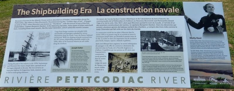
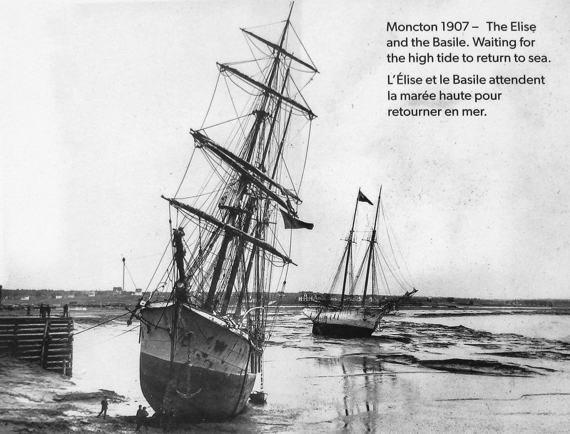
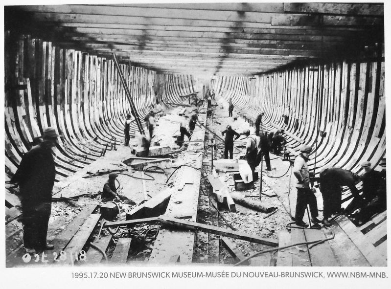
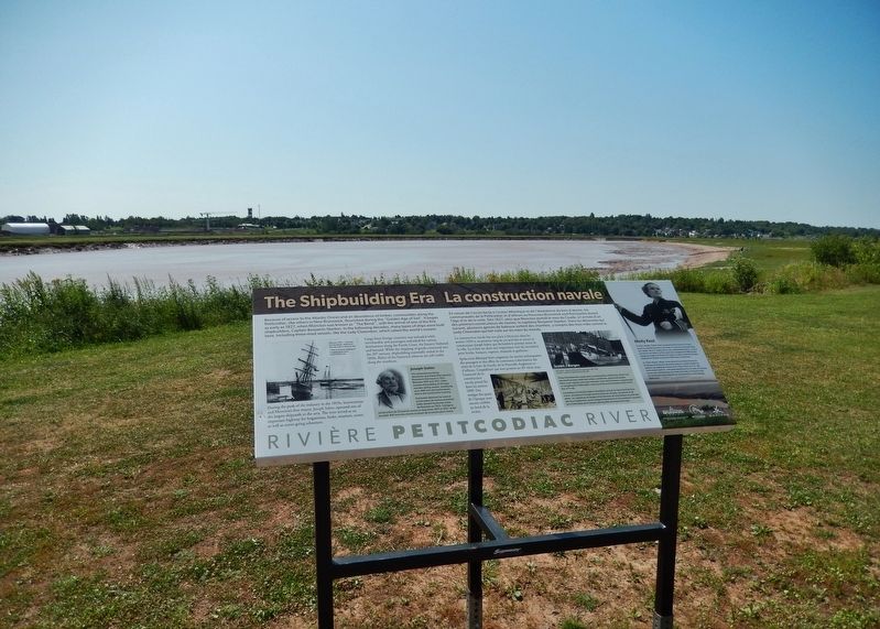
Because of access to the Atlantic Ocean and an abundance of timber, communities along the Petitcodiac, like others in New Brunswick, flourished during the "Golden Age of Sail". It began as early as 1827, when Moncton was known as "The Bend", with the arrival of one of the first shipbuilders, Captain Benjamin Stanton. In the following decades, many types of ships were built here, including three-mast vessels, like the Lady Clarendon, which sailed the world's oceans.
During the peak of the industry in the 1850s, businessman and Moncton's first mayor, Joseph Salter, operated one of the largest shipyards in the area. The river served as an important highway for brigantines, barks, steamers, scows, as well as ocean-going schooners.
Cargo from foreign countries was unloaded while merchandise and passengers embarked for various destinations along the Fundy Coast, the Eastern Seaboard and beyond. While the shipping of goods continued into the 20th century, shipbuilding essentially ended in the 1890s. Relics of the historical wharves are still visible along the riverfront.
En raison de l'accès facile à l'océan Atlantique et de l'abondance du bois d'œuvre, les in communautés de la Petitcodiac et d'ailleurs au Nouveau-Brunswick sont florissantes durant l'âge d'or de la voile. Dès 1827, alors que Moncton portait le nom du Coude, à l'arrivée d'un des premiers constructeurs de navires, le capitaine Benjamin Stanton. Dans les décennies qui suivent, plusieurs genres de bateaux sortent des chantiers, y compris des trois-mâts comme le Lady Clarendon qui fait voile sur les mers du monde.
La construction navale bat son plein à Moncton dans les années 1850 et au premier rang de ces activités se trouve le commerçant Joseph Salter, qui deviendra le premier maire de la ville. La rivière est alors une importante voie de circulation pour bricks, barques, vapeurs, chalands et goélettes.
Après avoir débarqué leurs cargaisons, les navires embarquaient des passagers et des effets de commerce à destination des côtes de la baie de Fundy, de la Nouvelle-Angleterre et d'ailleurs. L'expédition par mer persiste au 20e siècle mais l'essentiel de la construction navale prend fin dans les années 1890. Des vestiges des quais de l'époque sont encore visibles au bord de la rivière.
Topics. This historical marker is listed in these topic lists: Industry & Commerce • Waterways & Vessels • Women. A significant historical year for this entry is 1827.
Location.
46° 5.222′ N, 64° 46.394′ W. Marker is in Moncton, New Brunswick, in Westmorland County. Marker can be reached from Assomption Boulevard, 0.2 kilometers east of Westmorland Street, on the right when traveling east. Marker is located along the riverfront walkway just south of Assomption Boulevard. Touch for map. Marker is at or near this postal address: 80 Assomption Boulevard, Moncton NB E1C 1A1, Canada. Touch for directions.
Other nearby markers. At least 8 other markers are within walking distance of this marker. Aquatic Species / Les espèces aquatiques (within shouting distance of this marker); Downing Place (about 120 meters away, measured in a direct line); Over the Years / Au fil des ans (about 120 meters away); From River to Firm Land / De la rivière à la terre ferme (about 150 meters away); An Economic Engine / Un moteur économique (about 210 meters away); The Art of Advertising / L’art de la publicité (about 210 meters away); Bilingual Banking / Une Banque Bilingue (about 210 meters away); Armenian Genocide Centennial Memorial (approx. 0.3 kilometers away). Touch for a list and map of all markers in Moncton.
Related markers. Click here for a list of markers that are related to this marker. Riviére Petitcodiac River
Also see . . . "The Bend". The portion of the Petitcodiac River known as “The Bend” is designated a Local Historic Place for its significance in the settlement of the City of
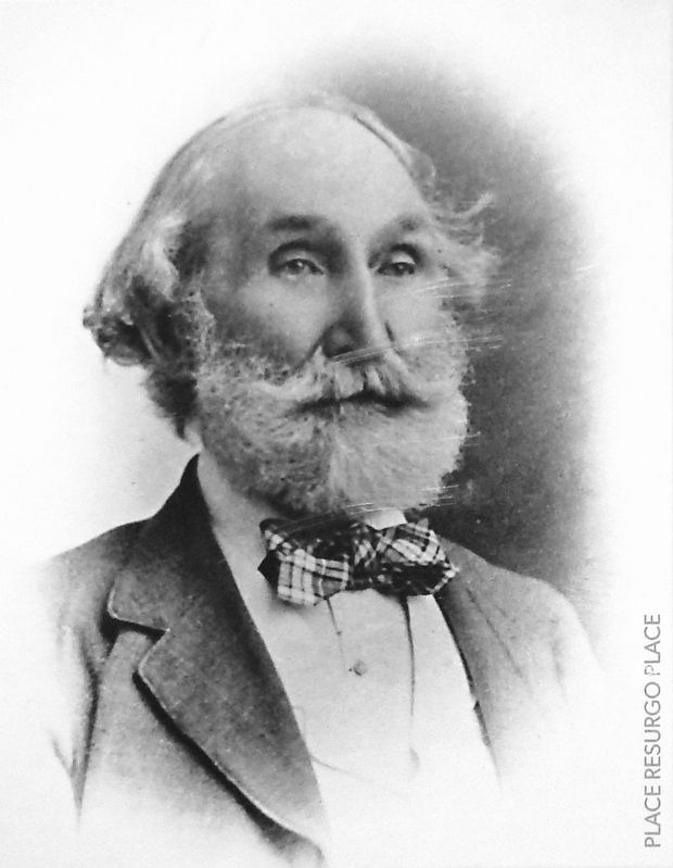
Courtesy Resurgo Place
3. Marker detail: Joseph Salter
• • •
Aventurier sillonnant les mers et constructeur de navires renommé, Salter devient le premier maire de Moncton en 1855. Il dirige la construction de 20 grands navires en bois entre 1847 et 1857, et fait travailler 400 hommes durant ce boom de la construction navale.
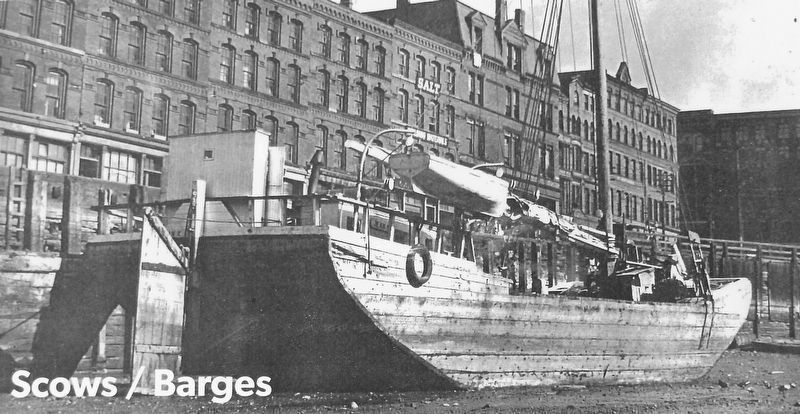
Courtesy Molly Kool Centre, Alma, NB
5. Marker detail: Jean K., Saint John, NB., 1940
These flat-bottomed vessels were considered the workhorses of the river, transporting heavy loads like lumber, sandstones, gravel and plaster. Many scow captains and crew members were also fishermen, experienced in navigating the Petitcodiac's many currents and the extreme tides of the Bay of Fundy.
• • •
Le Jean K. amarré au quai de Saint John, NB., 1940.
Ces bateaux à fond plat étaient considérés comme le cheval de trait de la rivière, lourdement chargés de bois d'œuvre, de grès, de gravier et de plâtre. Les capitaines de barges et les hommes de bord étaient souvent des pêcheurs également, ayant navigué longuement sur les nombreux courants de la Petitcodiac et les marées démesurées de la baie de Fundy.
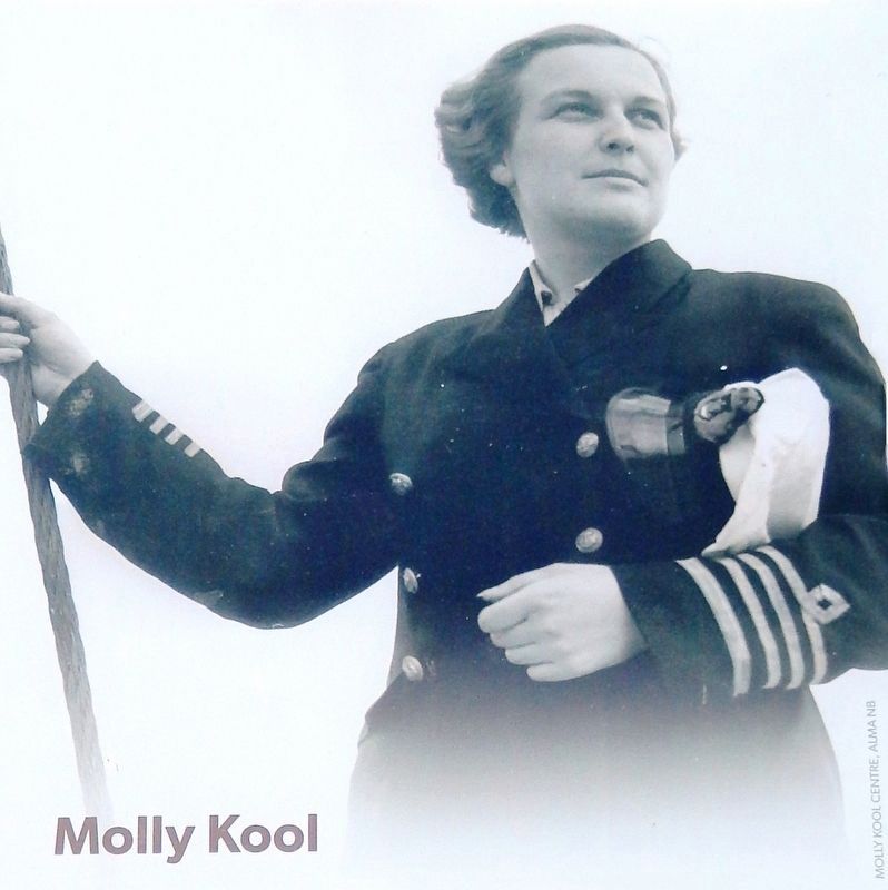
Courtesy Molly Kool Centre, Alma, NB
6. Marker detail: Molly Kool
• • •
En 1939, Myrtle « Molly » Kool devient la première femme en Amérique du Nord et la deuxième dans le monde à obtenir le diplôme de capitaine au long cours. Née à Alma au N.-B., elle commande le Jean K., une barge appartenant à son père, et navigue sur les eaux dangereuses de la baie de Fundy, le long de la côte est américaine jusqu'à Boston et vers Moncton en remontant la Petitcodiac.
Credits. This page was last revised on January 23, 2023. It was originally submitted on June 6, 2020, by Cosmos Mariner of Cape Canaveral, Florida. This page has been viewed 402 times since then and 37 times this year. Photos: 1, 2, 3, 4, 5, 6, 7. submitted on June 7, 2020, by Cosmos Mariner of Cape Canaveral, Florida.
