
Hanging Rock in Roanoke County, Virginia — The American South (Mid-Atlantic)
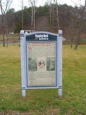
United Daughters of the Confederacy Monuments
Hanging Rock Battlefield Trail
Photographed by Kevin W., December 28, 2008
1. United Daughters of the Confederacy Monuments Marker
On June 3, 1932, the Southern Cross Chapter No. 746 U.D.C. erected a monument on Route 311, memorializing the battle and the Confederate soldiers who died here. On June 21, 1964, the William Watts Chapter No. 809 dedicated a monument at the intersection of I-81 and Route 419 to commemorate the One Hundredth Anniversary of the Battle of Hanging Rock.
Erected 1999 by County of Roanoke, the City of Salem, and the Hanging Rock Battlefield and Railway Preservation Foundation.
Topics and series. This historical marker is listed in these topic lists: Charity & Public Work • Fraternal or Sororal Organizations • War, US Civil • Women. In addition,
this page online
Location. 37° 19.677′ N, 80° 2.419′ W. Marker is in Hanging Rock, Virginia, in Roanoke County. It can be reached from the intersection of Thompson Memorial Drive (Virginia Route 311) and Kessler Mill Drive. Touch for map. Marker is in this post office area: Salem VA 24153, United States of America. Touch for directions.

Regionally, this marker is in the Mountain Region and in Southwest Virginia. It is also in the American South and specifically in the Upper South. Globally, it is in North America, the Western Hemisphere, the Western World, and the Anglosphere. Historically, it finds itself in what was once the territory of the Mississippian Culture, one of the original Thirteen Colonies, one of the Confederate States of America, and the Antebellum South.
Other nearby markers. At least 8 other markers are within walking distance of this marker: Hanging Rock Battlefield Trail (here, next to this marker); The Battle of Hanging Rock (here, next to this marker); George Morgan Jones (a few steps from this marker);
Photographed by Kevin W., December 28, 2008
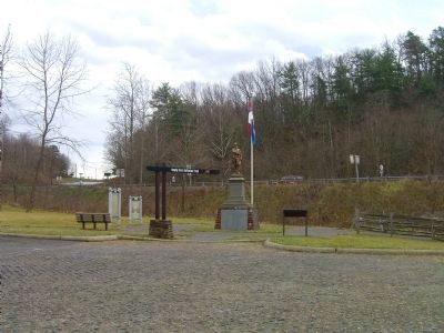
2. United Daughters of the Confederacy Monuments Marker
More about this marker. Marker is one of several interpretive signs along the cinder-surfaced, 1.7-mile long Hanging Rock Battlefield Trail that winds along Mason Creek and Kessler Mill Road in Salem, Virginia.
Related markers. Click here for a list of markers that are related to this marker. As mentioned, markers placed in 1932 by the Southern Cross Chapter No. 746 U.D.C. and in 1964 by the William Watts Chapter No. 809.
Credits. This page was last revised on April 21, 2026. It was originally submitted on January 7, 2009, by Kevin W. of Stafford, Virginia. This page has been viewed 2,488 times since then and 55 times this year. Photos: 1, 2. submitted on January 7, 2009, by Kevin W. of Stafford, Virginia. • Craig Swain was the editor who published this page.
