Port Charlotte in Charlotte County, Florida — The American South (South Atlantic)
Southland Trail Cemetery
Photographed by Tim Fillmon, June 21, 2016
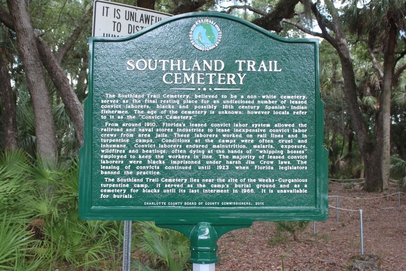
1. Southland Trail Cemetery Marker
From around 1910, Florida’s leased convict labor system allowed the railroad and naval stores industries to lease inexpensive convict labor crews from area jails. These laborers worked on rail lines and in turpentine camps. Conditions at the camps were often cruel and inhumane. Convict laborers endured malnutrition, malaria, exposure, wildfires and beatings, often dying at the hands of “whipping bosses” employed to keep the workers in line. The majority of leased convict laborers were blacks imprisoned under harsh Jim Crow laws. The leasing of convicts continued until 1923 when Florida legislators banned the practice.
The Southland Trail Cemetery lies near the site of the Weeks-Gurganious turpentine camp. It served as the camp’s burial ground and as a cemetery for blacks until its last interment
this page online
Erected 2015 by Charlotte County Board of County Commissioners.
Topics. This historical marker is listed in these topic lists: African Americans • Cemeteries & Burial Sites • Law Enforcement. A significant historical year for this entry is 1910.
Location. 27° 0.085′ N, 82° 12.405′ W. Marker is in Port Charlotte, Florida, in Charlotte County. It is on McClellan Avenue 0.1 miles north of Black Avenue, on the right when traveling north. Touch for map. Marker is at or near this postal address: 14516 McClellan Avenue, Port Charlotte FL 33953, United States of America. Touch for directions.

Regionally, this marker is on Florida’s Gulf Coast. It is also in the American South and on the Gulf Coast. Globally, it is in the North Atlantic Region, North America, a Gulf of Mexico state, the Western Hemisphere, the Western World, and the Anglosphere. Historically, it finds itself in what was once New Spain, the territory of the Mississippian Culture, one of the Confederate States of America, and the Antebellum South.
Other nearby markers. At least 8 other markers are within
Photographed by Tim Fillmon, June 21, 2016
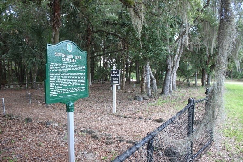
2. Southland Trail Cemetery Marker looking south
Credits. This page was last revised on June 8, 2020. It was originally submitted on June 7, 2020, by Tim Fillmon of Webster, Florida. This page has been viewed 2,187 times since then and 148 times this year. Photos: 1, 2. submitted on June 7, 2020, by Tim Fillmon of Webster, Florida. • Bernard Fisher was the editor who published this page.
