Richmond in Chesterfield County, Virginia — The American South (Mid-Atlantic)
Drewry’s Bluff Trail
Richmond National Battlefield Park
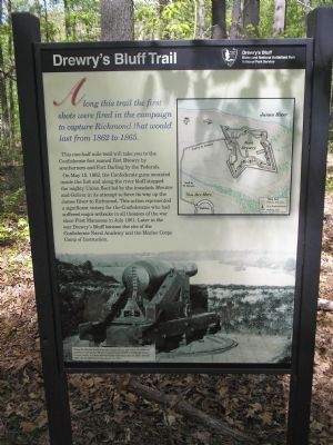
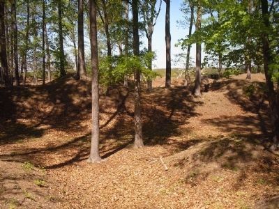
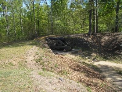
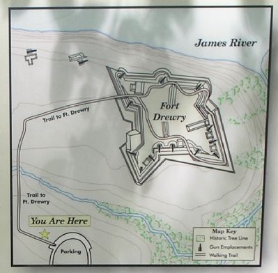
This one-half mile trail will take you to the Confederate fort named Fort Drewry by southerners and Fort Darling by the Federals. On May 15, 1862, the Confederate guns mounted inside the fort and along the river bluff stopped the mighty Union fleet led by the ironclads Monitor and Galena in its attempt to force its way up the James River to Richmond. This action represented a significant victory for the Confederates who had suffered major setbacks in all theaters of the war since First Manassas in July 1861. Later in the war Drewry’s Bluff became the site of the Confederate Naval Academy and the Marine Corps Camp of Instruction.
Erected by Richmond National Battlefield Park – National Park Service.
Topics. This historical marker is listed in these topic lists: Forts and Castles • War, US Civil. A significant historical month for this entry is May 1883.
Location. This marker has been replaced by another marker nearby. 37° 25.273′ N, 77° 25.471′ W. Marker is in Richmond, Virginia, in Chesterfield County. Marker can be reached from Fort Darling Road, on the left when traveling east. Marker is located in the Drewry’s Bluff/Fort Darling unit of Richmond National Battlefield Park. Touch for map. Marker is in this post office area: Richmond VA 23237, United States of America. Touch for directions.
Other nearby markers. At least 8 other markers are within walking distance of this location. Drewry’s Bluff (here, next to this marker); Covered Way (about 600 feet away, measured in a direct line); A Permanent Post (about 600 feet away); Fort Darling (about 600 feet away); Camp Beall (about 600 feet away); "A Very Neat Chapel" (about 700 feet away); a different marker also named Drewry's Bluff (about 700 feet away); The First Marine Medal of Honor (about 700 feet away). Touch for a list and map of all markers in Richmond.
More about this marker. The bottom left of the marker contains a photograph of one of the Confederate cannon overlooking the James River. It has a caption of “From the 90-foot bluff above the James River, the heavy Confederate artillery at Drewry’s Bluff presented a formidable challenge to any Union vessel. A Union photographer took this view in 1865, shortly after the Confederates abandoned the fort." The right of the marker contains a map of Fort Drewry and the trail from the parking lot. The site of the marker is indicated on the map.
Regarding Drewry’s Bluff Trail. This marker was replaced by a new one named Drewry's Bluff (see nearby markers).
Also see . . .
1. Battle of Drewry’s Bluff, 15 May 1862. American Civil War website. (Submitted on January 10, 2009, by Bill Coughlin of Woodland Park, New Jersey.)
2. Drewry’s Bluff. Richmond National Battlefield Park website. (Submitted on January 10, 2009, by Bill Coughlin of Woodland Park, New Jersey.)
Credits. This page was last revised on June 16, 2016. It was originally submitted on January 10, 2009, by Bill Coughlin of Woodland Park, New Jersey. This page has been viewed 1,306 times since then and 32 times this year. Photos: 1, 2, 3, 4, 5. submitted on January 10, 2009, by Bill Coughlin of Woodland Park, New Jersey.
