Downtown Providence in Providence County, Rhode Island — The American Northeast (New England)
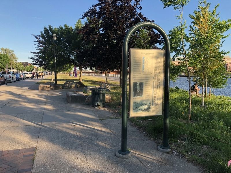
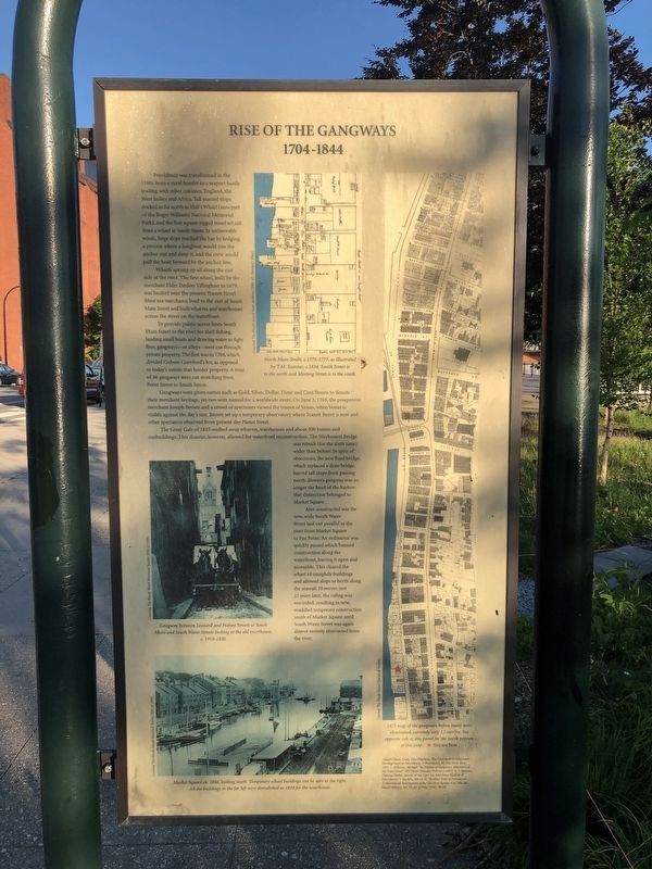
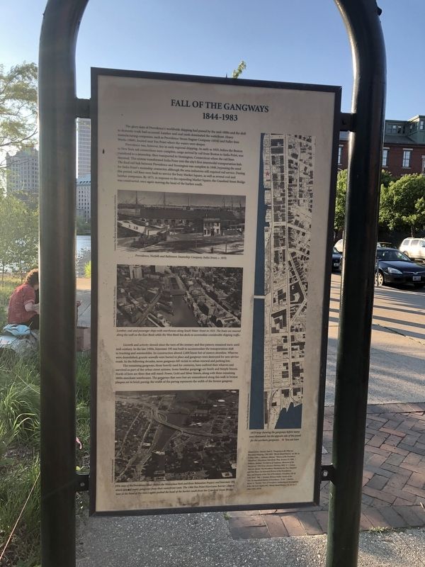
Rise of the Gangways (1704-1844) / Fall of the Gangways (1844-1983)
1704-1844
Providence was transformed in the 1700s from a rural hamlet to a seaport busily trading with other colonies, England, the West Indies and Africa. Tall masted ships docked as far north as Hall's Wharf (now part of the Roger Williams National Memorial Park), and the first square rigged vessel set sail from a wharf at Smith Street. In unfavorable winds, large ships reached the bay by kedging, a process where a longboat would row the anchor out and drop it, and the crew would pull the boat forward by the anchor line.
Wharfs sprung up all along the east side of the river. The first wharf, built by the merchant Elder Pardon Tillinghast in 1679, was located near the present Transit Street. Most sea merchants lived to the east of South Main Street and built wharves and warehouses across the street on the waterfront.
To provide public access from South Main Street to the river for shell fishing, landing small boats and drawing water to fight fires, gangways — or alleys — were cut through private property. The first was in 1704, which divided Gideon Crawford's lot, as opposed to today's streets that border property. A total of 46 gangways were cut stretching from Point Street to Smith Street.
Gangways were given names such as Gold, Silver, Dollar, Dime and Cent Streets to denote their merchant heritage, yet two were named for a worldwide event. On June 3, 1769, the prosperous merchant Joseph Brown and a crowd of spectators viewed the transit of Venus, when Venus is visible against the day's sun. Brown set up a temporary observatory where Transit Street is now and other spectators observed from present day Planet Street.
The Great Gale of 1815 washed away wharves, warehouses and about 500 homes and outbuildings. This disaster, however, allowed for waterfront reconstruction. The Weybossett Bridge was rebuilt (for the sixth time) wider than before. In spite of objections, the new fixed bridge, which replaced a draw bridge, barred tall ships from passing north. Bowen's gangway was no longer the head of the harbor: that distinction belonged to Market Square.
Also constructed was the new, wide South Water Street laid out parallel to the river from Market Square to Fox Point. An ordinance was quickly passed which banned construction along the waterfront, leaving it open and accessible. This cleared the wharf of unsightly buildings and allowed ships to berth along the seawall. However, just 27 years later, the ruling was rescinded, resulting in new, muddled temporary construction south of Market Square until South Water Street was again almost entirely obstructed from the river.
1844-1983
The glory days of Providence's worldwide shipping had passed by the mid-1800s and the shift to domestic trade had occurred. Lumber and coal yards dominated the waterfront. Heavy manufacturing companies, such as Providence Steam Engine Company (1834) and Fuller Iron Works (1869), located near Fox Point where the water were deeper.
Providence was, however, key in early regional shipping. As early as 1835, before the Boston to New York rail connections were complete, cargo arrived by rail from Boston to India Point, was transferred to a steamship, then transported to Stonington, Connecticut where the rail lines resumed. This system transformed India Point into the city's first intermodal transportation hub. The final rail link between Providence and Stonington was complete in 1848, bypassing the need for India Point's steamship connector, although the area industries still required rail service. During this period, rail lines were built to service the busy Market Square, as well as several coal and lumber companies. By 1875, in response to the expanding Market Square, the Crawford Street Bridge was constructed, once again moving the head of the harbor south.
Growth and activity slowed since the turn of the century and that pattern remained static until mid-century. In the late 1950s, Interstate 195 was built

Photographed By Devry Becker Jones (CC0), June 19, 2020
3. Rise of the Gangways (1704-1844) / Fall of the Gangways (1844-1983) Marker
The remaining gangways, those heavily used for centuries, have outlived their wharves and survived as part of the urban street systems. Some familiar gangways are Smith and Steeple Streets. North of here are three that still stand: Power, Gold and Silver Streets, along with three remaining 1800s merchant warehouses. The gangways that were lost are remembered along this walk in bronze plaques set in brick paving: the width of the paving represents the width of the former gangway.
Topics. This historical marker is listed in these topic lists: Colonial Era • Industry & Commerce • Railroads & Streetcars • Roads & Vehicles • Waterways & Vessels. A significant historical date for this entry is June 3, 1769.
Location. 41° 49.311′ N, 71° 24.34′ W. Marker is in Providence, Rhode Island, in Providence County. It is in Downtown Providence. Marker is on South Water Street (U.S. 44) 0.1 miles south of Power Street, on the right when traveling south. Touch for map. Marker is at or near this postal address: 243 S Water St, Providence RI 02903, United States of America. Touch for directions.
Other nearby markers. At least 8 other markers are within walking distance of this marker. Providence (here, next to this marker); HMS Gaspee (about 500 feet away, measured in a direct line); Sons of Liberty (about 500 feet away); Revolutions: American and Industrial (about 600 feet away); Crawford Street Bridge Without Crawford Street (about 600 feet away); The Changing Face of the West Bank / The West Bank (about 600 feet away); Central Wharf Shipping, Whaling, and Other Industries (about 700 feet away); Early History and Archaeology of Central Wharf (about 700 feet away). Touch for a list and map of all markers in Providence.
Credits. This page was last revised on February 8, 2023. It was originally submitted on June 22, 2020, by Devry Becker Jones of Washington, District of Columbia. This page has been viewed 248 times since then and 29 times this year. Photos: 1, 2, 3. submitted on June 22, 2020, by Devry Becker Jones of Washington, District of Columbia.

